|
|
Post by jasoninsd on Nov 30, 2022 11:54:06 GMT -5
jasoninsd You mentioned San Jacinto River cobbles. Is that correct or did you mean to say Rio Grande river cobbles. Both Texas rivers produce Agate, with the Rio Grande Agate being much more prolific. Or is there another non-Texas Rio Grande river of which I am not familiar. Henry I tumbled a batch of San Jacinto pebbles for Jeremy in the past Henry. I could probably tell you where to go. It is odd that the Rio Grande type materials are way over there northeast of Houston. You got to go there, it is safe and close to Houston. No explanation for that one...how those materials are so far from the Rio drainage is just a mystery. Jeremy used to find some serious wood/palm/plume/moss/banded materials along that stretch of the San Jacinto. Most of them had that same 'bleached' out white patina like many Rio cobbles have. He sent me some to tumble, I took some quicky photos. I wish you would collect there. I'll look on GE to see if I can find the section of the river, it still seems to be in my memory. There is some gravel pits along the river - it sure would be nice to have access to that gravel perhaps at a landscape store close by. Jeremy sent me these, they were some of his early findings and not his best. jasoninsd - you should look up some of Jeremy's older threads. He found some of the finest agates and palms ever posted here. They were just 1 to 2 inch pebbles but amazing material. www.flickr.com/photos/67205364@N06/23367342951/in/album-72157661762016831/I just looked through the flickr album...and looked up some of Jeremy's threads. Holy smokes, talk about a TON of eye candy! I even looked some of his other threads. I wish I had the equipment to take pictures like him! Most of his pictures look like they should be in a coffee table book! I know we have some amazing hounding grounds out here in SD...but it just floors me to see such a variety of amazing material come from a stretch of river in TX!  |
|
jamesp
Cave Dweller 
Member since October 2012
Posts: 36,607
|
Post by jamesp on Nov 30, 2022 12:24:18 GMT -5
Yes Jeremy went on to get into photography jasoninsd. He mastered the San Jacinto gravels and built a home made tumbler to tumble them with. He travelled Texas/west doing outside contract work. His Texas storm photography was over the top. They can be seen on his flickr albums. Maybe I can find them, we are friends on flickr and I am not in his photography league !. Just a taste of Jeremy Willetts photography HankRocks check out the San Jacinto's Link showing some San Jacinto pebbles wow www.flickr.com/photos/134088743@N05/page4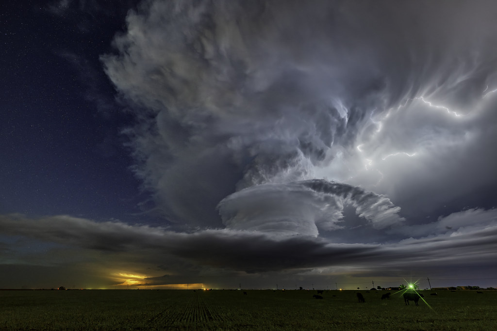   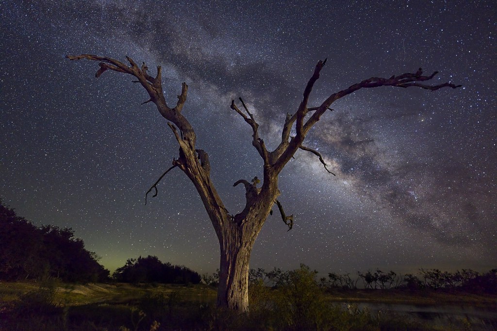 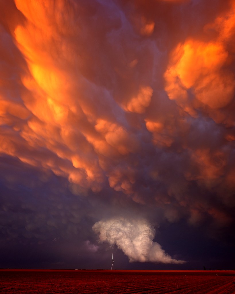 |
|
|
|
Post by HankRocks on Nov 30, 2022 13:46:59 GMT -5
I went through his album, outstanding pictures. When I see the images of the Singleton Ranch material I get the same sinking feeling knowing that the area is now closed to collecting now.  |
|
|
|
Post by jasoninsd on Nov 30, 2022 16:57:04 GMT -5
jamesp - Thanks for that link! Those pictures are beyond professional level! What an amazing artistic eye!!
|
|
jamesp
Cave Dweller 
Member since October 2012
Posts: 36,607
|
Post by jamesp on Dec 1, 2022 11:12:59 GMT -5
Yea, it is a shame those agate ranches in Texas are shutting their doors HankRocks. Granted Jeremy has nice camera equipment but those scenes are just breathtaking jasoninsd. Very few times have I seen such weather related formations as he found. Texas noted for superstorm activity. Talk about being at the right place at the right time ! And seeing those in person had to be stunning views. Florida has similar but without the color contrasts. It is a mystery how those agates and woods were transported 300 miles north of the Rio Grande drainage. HankRocks lives a short distance from the San Jacinto but is too lazy   to drag his butt over there and collect. I will begin a harassment program targeted at him till he gets off his duff and makes a trip over there  . |
|
|
|
Post by jasoninsd on Dec 1, 2022 17:38:54 GMT -5
Yea, it is a shame those agate ranches in Texas are shutting their doors HankRocks . Granted Jeremy has nice camera equipment but those scenes are just breathtaking jasoninsd . Very few times have I seen such weather related formations as he found. Texas noted for superstorm activity. Talk about being at the right place at the right time ! And seeing those in person had to be stunning views. Florida has similar but without the color contrasts. It is a mystery how those agates and woods were transported 300 miles north of the Rio Grande drainage. HankRocks lives a short distance from the San Jacinto but is too lazy   to drag his butt over there and collect. I will begin a harassment program targeted at him till he gets off his duff and makes a trip over there  . I'm always in awe of amazing weather related photographs. Sometimes I have to wonder if a picture is photoshopped due to some of the brilliant colors that show. (Not saying that's what Jeremy did...) Teepee Canyon is located on the West edge of The Black Hills. I have floated the Cheyenne River...okay...dragged my raft on the low river...and have found river tumbled Teepee Canyon Agate Nodules. So...either the nodules were more widespread over this entire area (which is possible)...or the nodules made their way 100+ miles away from the area they're located through the Cheyenne River Valley. I'm hoping when the time comes to meet "the Big Guy" face to face, I'll be able to have the answers to questions like this... Keep needling Henry...I'm betting sometimes he needs and appreciates the "encouragement"! LOL |
|
|
|
Post by HankRocks on Dec 1, 2022 18:06:35 GMT -5
Yea, it is a shame those agate ranches in Texas are shutting their doors HankRocks . Granted Jeremy has nice camera equipment but those scenes are just breathtaking jasoninsd . Very few times have I seen such weather related formations as he found. Texas noted for superstorm activity. Talk about being at the right place at the right time ! And seeing those in person had to be stunning views. Florida has similar but without the color contrasts. It is a mystery how those agates and woods were transported 300 miles north of the Rio Grande drainage. HankRocks lives a short distance from the San Jacinto but is too lazy   to drag his butt over there and collect. I will begin a harassment program targeted at him till he gets off his duff and makes a trip over there  . I'm always in awe of amazing weather related photographs. Sometimes I have to wonder if a picture is photoshopped due to some of the brilliant colors that show. (Not saying that's what Jeremy did...) Teepee Canyon is located on the West edge of The Black Hills. I have floated the Cheyenne River...okay...dragged my raft on the low river...and have found river tumbled Teepee Canyon Agate Nodules. So...either the nodules were more widespread over this entire area (which is possible)...or the nodules made their way 100+ miles away from the area they're located through the Cheyenne River Valley. I'm hoping when the time comes to meet "the Big Guy" face to face, I'll be able to have the answers to questions like this... Keep needling Henry...I'm betting sometimes he needs and appreciates the "encouragement"! LOL Ok you guys keep needling and pressuring me about this!! Just wait until I finally do go and stumble upon a location loaded with a previously unknown material, Royal Rainbow Palm Wood with chalcedony veins loaded with Texas plumes!!! Then after a year of frenzied sales I take the proceeds and buy 4 sections of a certain ranch in West Texas!!!  It could happen!!  |
|
|
|
Post by jasoninsd on Dec 1, 2022 18:34:34 GMT -5
I'm always in awe of amazing weather related photographs. Sometimes I have to wonder if a picture is photoshopped due to some of the brilliant colors that show. (Not saying that's what Jeremy did...) Teepee Canyon is located on the West edge of The Black Hills. I have floated the Cheyenne River...okay...dragged my raft on the low river...and have found river tumbled Teepee Canyon Agate Nodules. So...either the nodules were more widespread over this entire area (which is possible)...or the nodules made their way 100+ miles away from the area they're located through the Cheyenne River Valley. I'm hoping when the time comes to meet "the Big Guy" face to face, I'll be able to have the answers to questions like this... Keep needling Henry...I'm betting sometimes he needs and appreciates the "encouragement"! LOL Ok you guys keep needling and pressuring me about this!! Just wait until I finally do go and stumble upon a location loaded with a previously unknown material, Royal Rainbow Palm Wood with chalcedony veins loaded with Texas plumes!!! Then after a year of frenzied sales I take the proceeds and buy 4 sections of a certain ranch in West Texas!!!  It could happen!! 
 |
|
jamesp
Cave Dweller 
Member since October 2012
Posts: 36,607
|
Post by jamesp on Dec 2, 2022 8:39:53 GMT -5
Oh HankRocks Sir can I visit your agate viens ? Pleeaase. Meantime I will post Jeremy's photos of the San Jacinto gravel bars to tease you Henry into making a trip. These bars and landscape is a mirror image of the geo topography of south Alabama, sand, quartzite, pet wood, chert pebbles. Looks like a consistent Fall Line shore consistency as the 400 mile stretch of the east/west Fall Line in Bama and west Georgia. Same 200' elevation, same ~20 mile distance from the Fall Line at 346' elevation, same size pebbles, same brisk flowing stream, same water color, same everything. Except Texas has way more volcanic ash residue in their clays for wood petrification. San Jacinto:   Mirror image at south Alabama at exact same elevation and distance from Fall line: 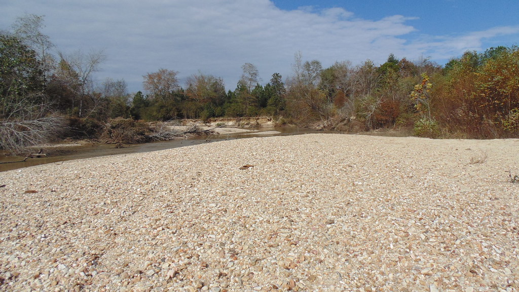 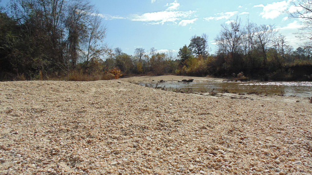 Fall Line across SE US and Texas is just north/above the purple to violet intersection. Fine rock and fossil collecting along there.  |
|
|
|
Post by jasoninsd on Dec 2, 2022 9:19:45 GMT -5
jamesp - That's a hounder's dream spot!! I don't know what else to call it, other than the "ancient river rock" layer that we have throughout the region is similar to that...when it gets exposed through erosion. Two of the main hounding spots out here, Fairburn and Railroad Buttes, are both a part of the Buffalo National Grasslands. There are "agate beds" which are just spewing forth rocks out of the eroding hills like the pictures of the San Jacinto. The main difference is what someone's looking for when hounding out here versus down there. Out here, it's mainly scanning the ground for anything showing a fortification pattern...basically a Fairburn Agate. Whereas if I were hounding down on the San Jacinto, I'd be overwhelmed inspecting EVERY rock and I'd probably have my pack full after the first 10' square area I looked at! LOL
|
|
jamesp
Cave Dweller 
Member since October 2012
Posts: 36,607
|
Post by jamesp on Dec 2, 2022 9:50:16 GMT -5
jamesp - That's a hounder's dream spot!! I don't know what else to call it, other than the "ancient river rock" layer that we have throughout the region is similar to that...when it gets exposed through erosion. Two of the main hounding spots out here, Fairburn and Railroad Buttes, are both a part of the Buffalo National Grasslands. There are "agate beds" which are just spewing forth rocks out of the eroding hills like the pictures of the San Jacinto. The main difference is what someone's looking for when hounding out here versus down there. Out here, it's mainly scanning the ground for anything showing a fortification pattern...basically a Fairburn Agate. Whereas if I were hounding down on the San Jacinto, I'd be overwhelmed inspecting EVERY rock and I'd probably have my pack full after the first 10' square area I looked at! LOL So how on earth did these hard quartzite pebbles get rounded so nice when they seem to have come from closeby quartzite veins only 20 to 50 miles away over flat land ? It seems impossible that they were river rounded. Either a glacier or heavy grinding land movement had to ground them round. Same game up your way Jason, so many pebbles on high ground. It doesn't make sense. What rounded those rocks ? I'm sure the geologists will tell you they came from way far away, displaced and rounded by glaciers, water and/or landslides. Mysteries abound... Same deal with Rio cobbles, many types of the source rocks are well known to come from a short distance away but they look like they heavily tumbled in step 1 grind for a year using SiC 30. Especially pet wood and chert cobbles, they were born squarish and somehow managed to round to oval/round cobbles over short distances. Agates are often born as round nodules or amygdules, makes sense that they would be round/oval. Quartzite is born squarish, yet these southern rivers are loaded with round/oval pebbles from 20 miles away ? Good sunlight or a drizzle of rain helps separate the desirable rocks on these rivers. Probably the same when collecting up your way. Now after a heavy flooding rain these river bars are completely reorganized exposing a whole new crop of pebbles. And artifacts. Both the Alabama rivers and the San Jacinto have heavy 4wd traffic in the river bed also exposing new rocks. Some of the big creeks in Bama say 20 to 30 feet wide are driven for 20 to 30 miles right in the river bed. This behavior is not exactly favored by environmentalists lol. It is fun running 30 mph criss-crossing the 1 to 3 foot water and over the river bars ! Apparently there is little law enforcement down here ! Something tells me vehicles are not allowed in western US waterways. We must be heathens... |
|
|
|
Post by HankRocks on Dec 2, 2022 11:00:50 GMT -5
jamesp - That's a hounder's dream spot!! I don't know what else to call it, other than the "ancient river rock" layer that we have throughout the region is similar to that...when it gets exposed through erosion. Two of the main hounding spots out here, Fairburn and Railroad Buttes, are both a part of the Buffalo National Grasslands. There are "agate beds" which are just spewing forth rocks out of the eroding hills like the pictures of the San Jacinto. The main difference is what someone's looking for when hounding out here versus down there. Out here, it's mainly scanning the ground for anything showing a fortification pattern...basically a Fairburn Agate. Whereas if I were hounding down on the San Jacinto, I'd be overwhelmed inspecting EVERY rock and I'd probably have my pack full after the first 10' square area I looked at! LOL So how on earth did these hard quartzite pebbles get rounded so nice when they seem to have come from closeby quartzite veins only 20 to 50 miles away over flat land ? It seems impossible that they were river rounded. Either a glacier or heavy grinding land movement had to ground them round. Same game up your way Jason, so many pebbles on high ground. It doesn't make sense. What rounded those rocks ? I'm sure the geologists will tell you they came from way far away, displaced and rounded by glaciers, water and/or landslides. Mysteries abound... Same deal with Rio cobbles, many types of the source rocks are well known to come from a short distance away but they look like they heavily tumbled in step 1 grind for a year using SiC 30. Especially pet wood and chert cobbles, they were born squarish and somehow managed to round to oval/round cobbles over short distances. Agates are often born as round nodules or amygdules, makes sense that they would be round/oval. Quartzite is born squarish, yet these southern rivers are loaded with round/oval pebbles from 20 miles away ? Good sunlight or a drizzle of rain helps separate the desirable rocks on these rivers. Probably the same when collecting up your way. Now after a heavy flooding rain these river bars are completely reorganized exposing a whole new crop of pebbles. And artifacts. Both the Alabama rivers and the San Jacinto have heavy 4wd traffic in the river bed also exposing new rocks. Some of the big creeks in Bama say 20 to 30 feet wide are driven for 20 to 30 miles right in the river bed. This behavior is not exactly favored by environmentalists lol. It is fun running 30 mph criss-crossing the 1 to 3 foot water and over the river bars ! Apparently there is little law enforcement down here ! Something tells me vehicles are not allowed in western US waterways. We must be heathens... My guess is that a lot of these rocks were shoreline rocks, either Gulf of Mexico or Inland Sea. Either way the combination of wave action and sand can do a lot of grinding over the years. Water line moves over the years and the rounded rocks get eventually covered by normal soil formation. Several of the agate fields in Big Bend area are right next to water deposited fossils. In the Needle Peak area, there is a spot we used to park that within several hundred yards of the vehicle; Sharks Teeth, Fossil Bone, Petrified Wood, Agate and Geodes, Palm Wood. The agate was both seam and nodules. A lot of the fossils are in Volcanic Ash seeming to indicate they died and were buried in the Ash. The Shark's teeth indicate that the area was covered in water from the Inland Sea. A good portion of Santa Elena Canyon walls are made of Limestone. Mixed in with the lower level of limestone is well cemented Conglomerate. The Indians in the area had the story that when the Creator Spirit finished building the land he took all of the leftover material and dumped it in the Big Bend of Texas. Can't disprove their story by the local Geology. Jason, you do not have to worry looking down as you will be carrying 2 buckets for my collected rocks. Maybe look down a bit as I would not want you to spill the buckets!!! |
|
jamesp
Cave Dweller 
Member since October 2012
Posts: 36,607
|
Post by jamesp on Dec 3, 2022 12:35:54 GMT -5
So how on earth did these hard quartzite pebbles get rounded so nice when they seem to have come from closeby quartzite veins only 20 to 50 miles away over flat land ? It seems impossible that they were river rounded. Either a glacier or heavy grinding land movement had to ground them round. Same game up your way Jason, so many pebbles on high ground. It doesn't make sense. What rounded those rocks ? I'm sure the geologists will tell you they came from way far away, displaced and rounded by glaciers, water and/or landslides. Mysteries abound... Same deal with Rio cobbles, many types of the source rocks are well known to come from a short distance away but they look like they heavily tumbled in step 1 grind for a year using SiC 30. Especially pet wood and chert cobbles, they were born squarish and somehow managed to round to oval/round cobbles over short distances. Agates are often born as round nodules or amygdules, makes sense that they would be round/oval. Quartzite is born squarish, yet these southern rivers are loaded with round/oval pebbles from 20 miles away ? Good sunlight or a drizzle of rain helps separate the desirable rocks on these rivers. Probably the same when collecting up your way. Now after a heavy flooding rain these river bars are completely reorganized exposing a whole new crop of pebbles. And artifacts. Both the Alabama rivers and the San Jacinto have heavy 4wd traffic in the river bed also exposing new rocks. Some of the big creeks in Bama say 20 to 30 feet wide are driven for 20 to 30 miles right in the river bed. This behavior is not exactly favored by environmentalists lol. It is fun running 30 mph criss-crossing the 1 to 3 foot water and over the river bars ! Apparently there is little law enforcement down here ! Something tells me vehicles are not allowed in western US waterways. We must be heathens... My guess is that a lot of these rocks were shoreline rocks, either Gulf of Mexico or Inland Sea. Either way the combination of wave action and sand can do a lot of grinding over the years. Water line moves over the years and the rounded rocks get eventually covered by normal soil formation. Several of the agate fields in Big Bend area are right next to water deposited fossils. In the Needle Peak area, there is a spot we used to park that within several hundred yards of the vehicle; Sharks Teeth, Fossil Bone, Petrified Wood, Agate and Geodes, Palm Wood. The agate was both seam and nodules. A lot of the fossils are in Volcanic Ash seeming to indicate they died and were buried in the Ash. The Shark's teeth indicate that the area was covered in water from the Inland Sea. A good portion of Santa Elena Canyon walls are made of Limestone. Mixed in with the lower level of limestone is well cemented Conglomerate. The Indians in the area had the story that when the Creator Spirit finished building the land he took all of the leftover material and dumped it in the Big Bend of Texas. Can't disprove their story by the local Geology. Jason, you do not have to worry looking down as you will be carrying 2 buckets for my collected rocks. Maybe look down a bit as I would not want you to spill the buckets!!! Texas is without a doubt sophisticated and diverse in it's geology Henry. Add the Big Bend in the mix and it has about everything. It doesn't hurt that it is as big as a whole nation. Maybe the 320 to 346 foot elevation my serve you well as a rock collecting zone since it is close to home. That state not only has a wide variety but each category of rocks/minerals/fossils are such fine specimens. That creator spirit darn sure dumped a wide variety along the Rio including that hodge podge carried down from the Big Bend. Then he guarded those rocks with the border bunch. The 'cove' pointing to the east is where I discovered the petrified wood in Alabama. Theory was that floating logs are going to pile up at the back of a cove as they do in a lake. You might find similar deposits in terminus of those 3 coves near Houston. 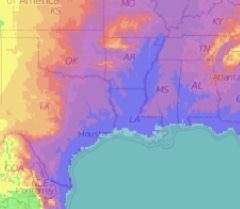 |
|
oldschoolrocker
fully equipped rock polisher
  
Member since January 2019
Posts: 1,578
|
Post by oldschoolrocker on Dec 3, 2022 19:05:27 GMT -5
Oh HankRocks Sir can I visit your agate viens ? Pleeaase. Meantime I will post Jeremy's photos of the San Jacinto gravel bars to tease you Henry into making a trip. These bars and landscape is a mirror image of the geo topography of south Alabama, sand, quartzite, pet wood, chert pebbles. Looks like a consistent Fall Line shore consistency as the 400 mile stretch of the east/west Fall Line in Bama and west Georgia. Same 200' elevation, same ~20 mile distance from the Fall Line at 346' elevation, same size pebbles, same brisk flowing stream, same water color, same everything. Except Texas has way more volcanic ash residue in their clays for wood petrification. San Jacinto:   Mirror image at south Alabama at exact same elevation and distance from Fall line:   Fall Line across SE US and Texas is just north/above the purple to violet intersection. Fine rock and fossil collecting along there.  Hey that's where I hound on the San Jacinto! I always wondered what section of the river txrockhunter collected from but he was no longer active here when I joined. The river has changed a bit since those photos but usually does anytime lake conroe releases lot of water from the dam after hard rain. But still tons of material to sort thru. HankRocks, i plan on doing some more hounding while the heat is gone so if you are interested in checking it out i can let you know when i plan on going and can meet up. You are guaranteed to not leave empty handed and really only limited by how much you want to lug back to the car. |
|
oldschoolrocker
fully equipped rock polisher
  
Member since January 2019
Posts: 1,578
|
Post by oldschoolrocker on Dec 4, 2022 15:54:56 GMT -5
Top pic is of same spot but little more recent and diff time of year. Has changed some since then as well. I circled the cluster of trees in pic for reference .  |
|
|
|
Post by jasoninsd on Dec 4, 2022 18:19:32 GMT -5
Top pic is of same spot but little more recent and diff time of year. Has changed some since then as well. I circled the cluster of trees in pic for reference .  Wowzers! That's a REALLY significant change!! The river I hound on is nowhere near as big...and the water levels have been so low for years, there's been no significant change really... |
|


 to drag his butt over there and collect. I will begin a harassment program targeted at him till he gets off his duff and makes a trip over there
 to drag his butt over there and collect. I will begin a harassment program targeted at him till he gets off his duff and makes a trip over there


