Layout of a Native American camp in Florida.
Jul 29, 2015 9:23:08 GMT -5
garock, MrP, and 11 more like this
Post by jamesp on Jul 29, 2015 9:23:08 GMT -5
This is a lot that I bought many years ago. I started by buying the four small .3 acre lots on NE 99th Place for $22,000.
Then I asked the owner north of me if he would sell the lot that goes out to the lake, and he gave me too cheap of a price so I bought it.
Split it into three flag lots using the 4 small .3 acre lots and sold two of the flag lots, still holding the remaining 4 acre lot.
This area has a newer 10 acre lot minimum, lest you can enhance existing small lots by adding to them, so I did.
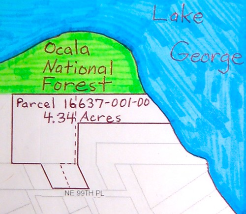
Camp is at the 'O' in Ocala on the Nat. Forest land. Shell dump is along the shore line to the right, S.E. from the 'O' in Ocala.
Shoreline was 400 feet before selling the two flag lots.
The shells are snails and are about 2 feet deep, 400 feet long and about 100 feet along the shore.
So 400 feet X 100 feet X 2 feet deep = 80,000 cubic feet of snail shells on my frontage anyway.
And a fair amount of shells at the 'O' camp site.
Both sites have alkaline loving large soap berry trees growing out of the calcium rich shell midden.
Soap berry trees infrequent along the vast shores of Lake George. In fact, they only grow in shell midden as far as I have observed.
The soap berry trees have a bright yellow green early spring foliage that can be spotted from a boat in early spring.
So an easy indicator of encampments for artifact hunting along the shoreline. Using soap berry tree as a flag.
Add 40+ miles of shoreline for the big lake, lots of opportunity.
Not sure if anyone else knows this, but I do, as the lake has served me for 20 years as a seed and plant cutting source for my biz for twenty years.
Back to the 'O' camp. Prevailing wind is out of SW-W-NW. Smelly shells dumped to the east shore. West wind keeping smell and flies away.
Prevailing cold wind is from the NW. 'O' camp on north facing shore, facing 6 miles of open water.
Cold NW winds substantially heated by 6 miles of warm lake water, of which, has a 35 million gallon/day spring flowing into it @72f(Salt Springs).
Spring inflow to lake NW of camp by 2 miles. Spring brings salt water into this portion of lake. Tarpon, blue crabs, shrimp, red fish, flounder common.
The salt water species come up St. John's River 125 miles and find refuge at this salty corner of the lake.
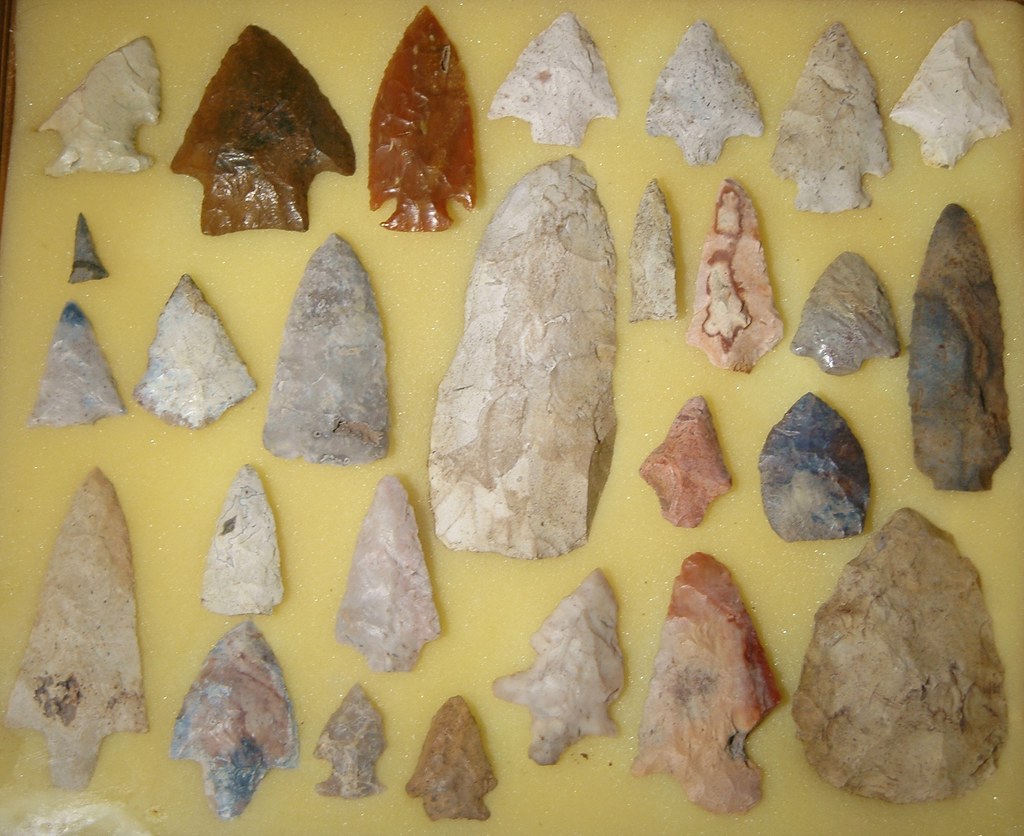
Area is devoid of chert, source begins 70 miles to the west along the Florida ridge, so chert for spearheads imported. Fairly infrequent.
About every piece of chert was used/knapped. Lake bottom is sand. Sand sand sand, no rocks. Shoreline recedes at a rate up to 100 yards/100 years in some areas.
Artifact hunting is mostly done way out in lake. At 2-5 foot depth. Using straight tined forks. Probing the sand and listening for a 'tink'. Indicating chert(or unfortunately broken glass).
Then going under water and digging down the 18 inch tines to the 'tink'. These forks hand made, welded to a steel conduit for sound transmission.
Tines 3/32 inch hardened spring wire, ground sharp on the ends. A shallow underwater ridge extends 1/2 mile off the 'O' camp. Lots of artifacts on the ridge.
Pay attention to the boats out in the remote giant lake. The game warden's is white with green trim. And very fast.
If you see him coming, get to the shore AFAP and head into the woods. He will get you for artifacting. Land access very limited, woods safe LOL.
Lake George home to the biggest alligators in the world, less forgiving than the good warden. You won't see him coming. Just a crushing force on your ankle.
Alligator rides doable, cast large plug in front of gators at dusk from kayak out in lake. When he grabs it, let him pull you around. Again, don't let the good warden catch you.
Layout:
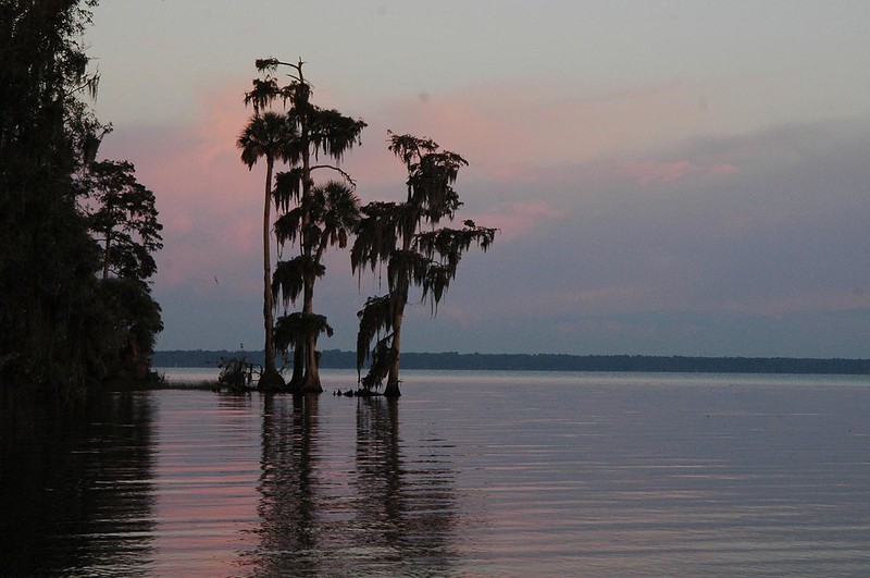
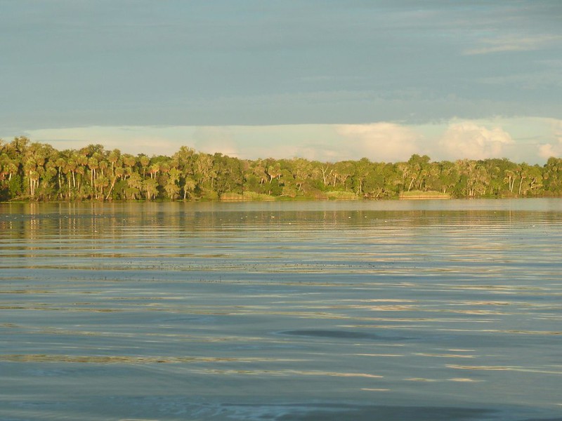
View of point from east shoreline looking north, morning, bright stripe in water is shallow E-W ridge going a half mile out in the lake:
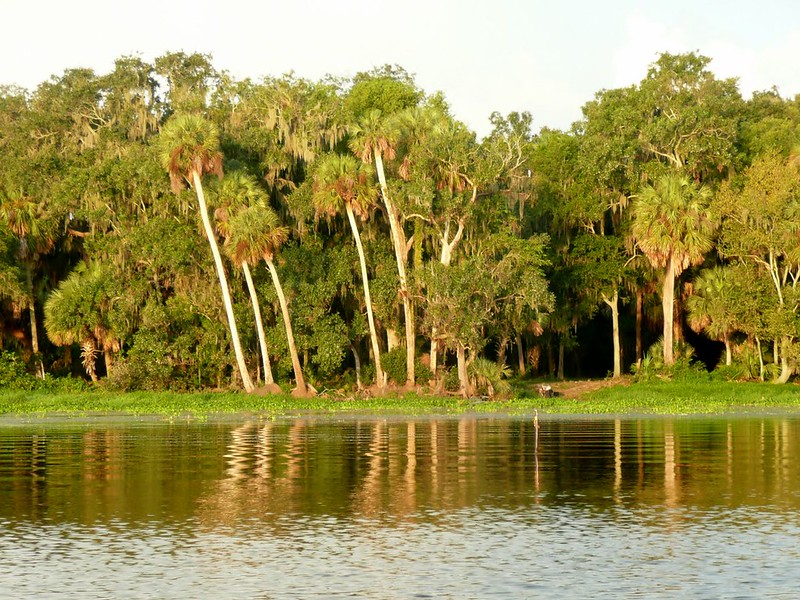
View from kayak looking at east shore, note ATV and size of trees
View from kayak looking south at shore of 'O' camp, water under kayak about 4 feet deep:
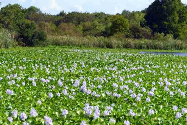
Closer in, 3 of many turkeys in view(2 white heads behind log), white stains on pond fronds mostly eagle/osprey crap:

Stick in upper right corner delineates weed line. Along with other gator to left of stick. This is the line we cast lures to bass to when wading further out.
A questionable practice:
Weed line visible where ripples in water begin this fine morning, wading out past weed line to fish. Gator disturbed and leaving.
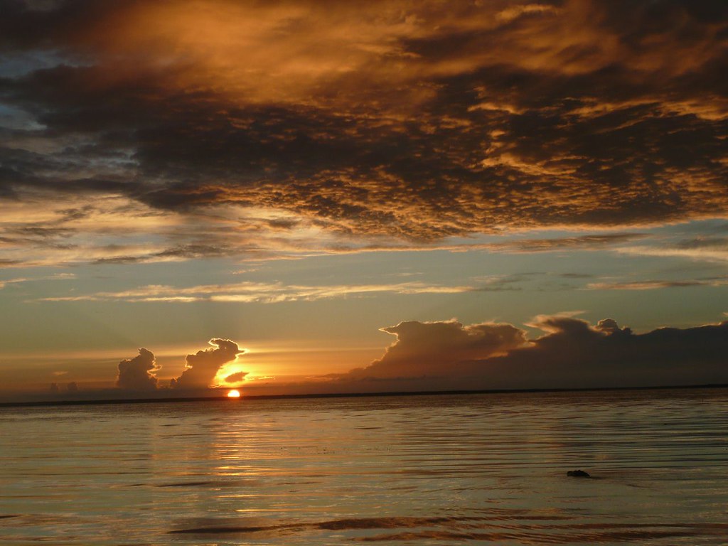
Come fish w/me Opposite shore 6 miles:
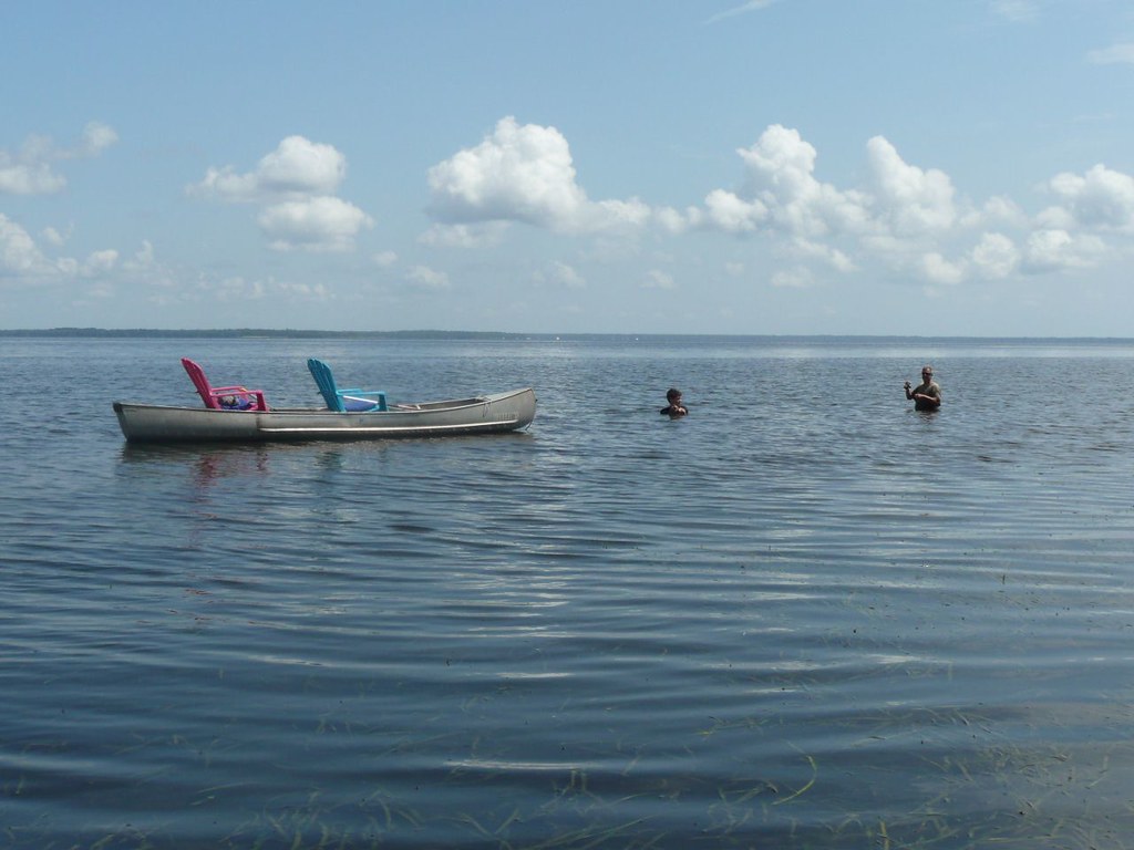
B-In-law and son out fishing past the weed line, wife-in-law and I going to split the life insurance
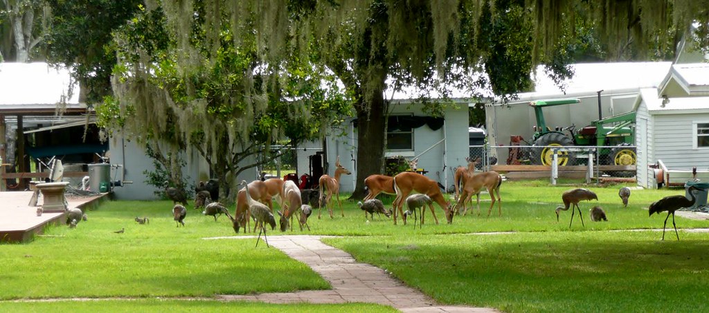
Neighbor's crib
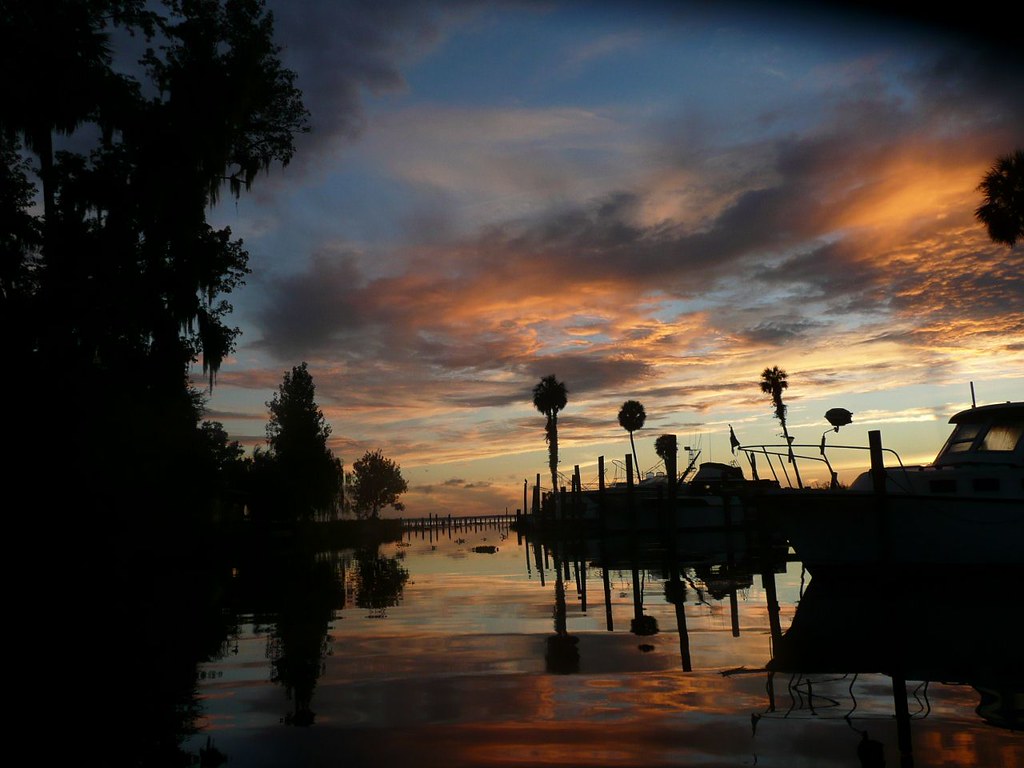
Boat ramp and canal 1/4 mile south, heading out to explore/fish from boat one morning:
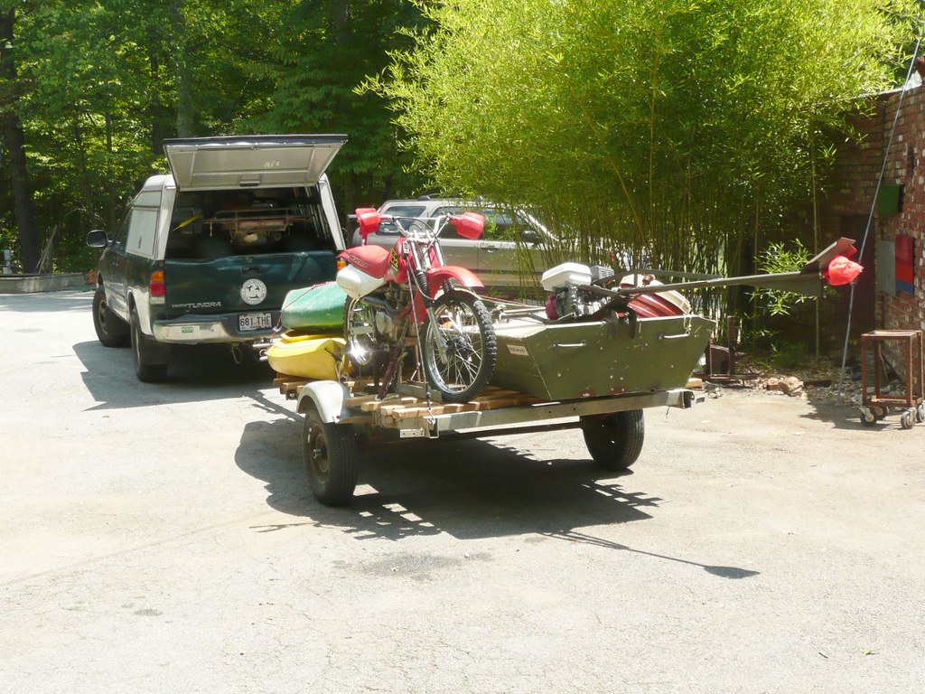
Ready to leave Atlanta Beverly Hill Billies style:
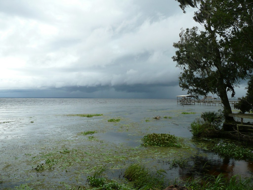
Wicked storm coming from the east, prepare to get back to cabin in about 3 minutes:
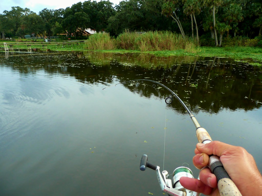
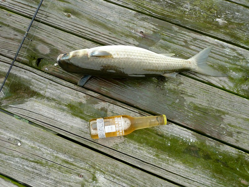
Hooked me about a 4 pound salt water mullet whilst white trash fishing from neighbor's dock, like bringing in a torpedo:
Said mullet, caught on oatmeal/doe ball mix and tiny hook:
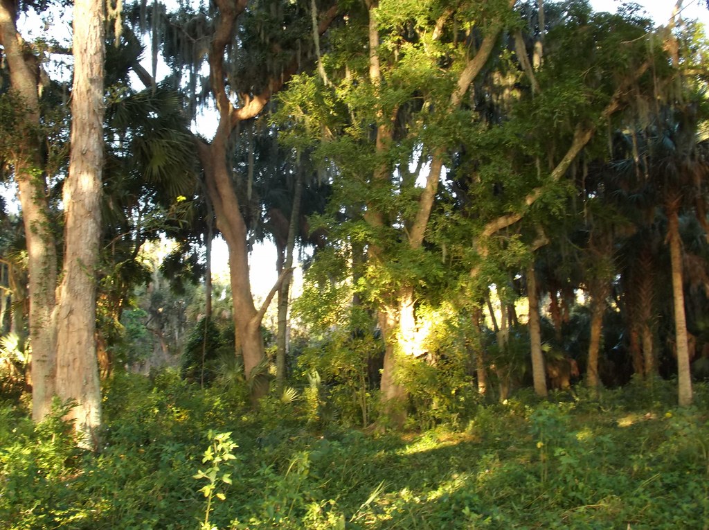
Aforementioned soap berry tree, Hurricane Francis snapped off three of them, good riddance, they send runners every which way.
A walk to that tree should be good for about 10 ticks, best to stay on mowed trail:
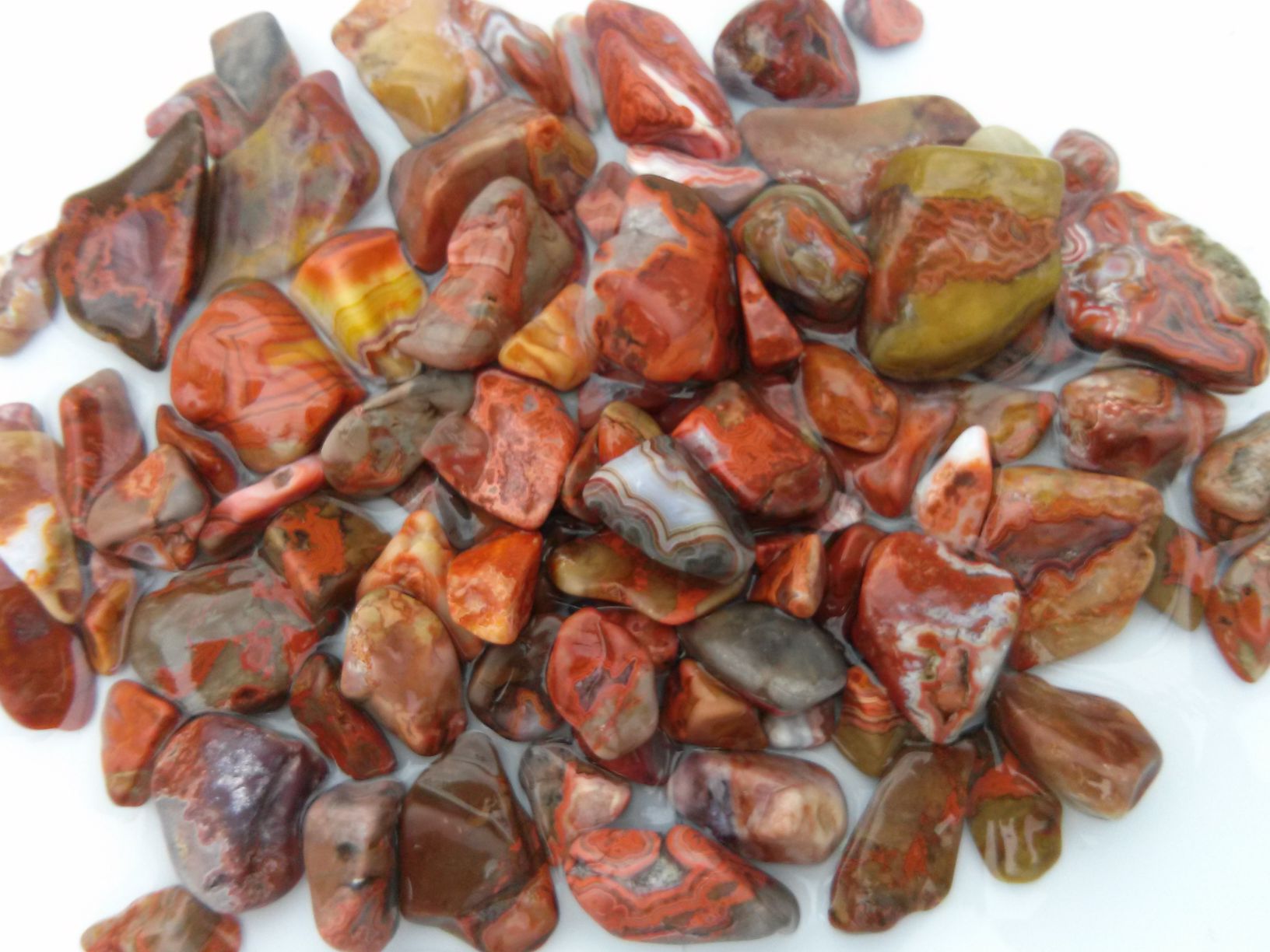
Enough, thanks for looking, a link to the camp and some coral trips and other goings ons in the area:
www.flickr.com/photos/67205364@N06/sets/72157634645780408
Then I asked the owner north of me if he would sell the lot that goes out to the lake, and he gave me too cheap of a price so I bought it.
Split it into three flag lots using the 4 small .3 acre lots and sold two of the flag lots, still holding the remaining 4 acre lot.
This area has a newer 10 acre lot minimum, lest you can enhance existing small lots by adding to them, so I did.
Camp is at the 'O' in Ocala on the Nat. Forest land. Shell dump is along the shore line to the right, S.E. from the 'O' in Ocala.
Shoreline was 400 feet before selling the two flag lots.
The shells are snails and are about 2 feet deep, 400 feet long and about 100 feet along the shore.
So 400 feet X 100 feet X 2 feet deep = 80,000 cubic feet of snail shells on my frontage anyway.
And a fair amount of shells at the 'O' camp site.
Both sites have alkaline loving large soap berry trees growing out of the calcium rich shell midden.
Soap berry trees infrequent along the vast shores of Lake George. In fact, they only grow in shell midden as far as I have observed.
The soap berry trees have a bright yellow green early spring foliage that can be spotted from a boat in early spring.
So an easy indicator of encampments for artifact hunting along the shoreline. Using soap berry tree as a flag.
Add 40+ miles of shoreline for the big lake, lots of opportunity.
Not sure if anyone else knows this, but I do, as the lake has served me for 20 years as a seed and plant cutting source for my biz for twenty years.
Back to the 'O' camp. Prevailing wind is out of SW-W-NW. Smelly shells dumped to the east shore. West wind keeping smell and flies away.
Prevailing cold wind is from the NW. 'O' camp on north facing shore, facing 6 miles of open water.
Cold NW winds substantially heated by 6 miles of warm lake water, of which, has a 35 million gallon/day spring flowing into it @72f(Salt Springs).
Spring inflow to lake NW of camp by 2 miles. Spring brings salt water into this portion of lake. Tarpon, blue crabs, shrimp, red fish, flounder common.
The salt water species come up St. John's River 125 miles and find refuge at this salty corner of the lake.
Area is devoid of chert, source begins 70 miles to the west along the Florida ridge, so chert for spearheads imported. Fairly infrequent.
About every piece of chert was used/knapped. Lake bottom is sand. Sand sand sand, no rocks. Shoreline recedes at a rate up to 100 yards/100 years in some areas.
Artifact hunting is mostly done way out in lake. At 2-5 foot depth. Using straight tined forks. Probing the sand and listening for a 'tink'. Indicating chert(or unfortunately broken glass).
Then going under water and digging down the 18 inch tines to the 'tink'. These forks hand made, welded to a steel conduit for sound transmission.
Tines 3/32 inch hardened spring wire, ground sharp on the ends. A shallow underwater ridge extends 1/2 mile off the 'O' camp. Lots of artifacts on the ridge.
Pay attention to the boats out in the remote giant lake. The game warden's is white with green trim. And very fast.
If you see him coming, get to the shore AFAP and head into the woods. He will get you for artifacting. Land access very limited, woods safe LOL.
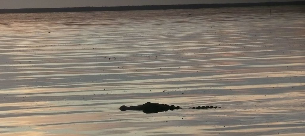
Lake George home to the biggest alligators in the world, less forgiving than the good warden. You won't see him coming. Just a crushing force on your ankle.
Alligator rides doable, cast large plug in front of gators at dusk from kayak out in lake. When he grabs it, let him pull you around. Again, don't let the good warden catch you.
Layout:
View of point from east shoreline looking north, morning, bright stripe in water is shallow E-W ridge going a half mile out in the lake:
View from kayak looking at east shore, note ATV and size of trees
View from kayak looking south at shore of 'O' camp, water under kayak about 4 feet deep:
Closer in, 3 of many turkeys in view(2 white heads behind log), white stains on pond fronds mostly eagle/osprey crap:
Stick in upper right corner delineates weed line. Along with other gator to left of stick. This is the line we cast lures to bass to when wading further out.
A questionable practice:
Weed line visible where ripples in water begin this fine morning, wading out past weed line to fish. Gator disturbed and leaving.
Come fish w/me
 Opposite shore 6 miles:
B-In-law and son out fishing past the weed line, wife-in-law and I going to split the life insurance
Neighbor's crib
Boat ramp and canal 1/4 mile south, heading out to explore/fish from boat one morning:
Ready to leave Atlanta Beverly Hill Billies style:
Wicked storm coming from the east, prepare to get back to cabin in about 3 minutes:
Hooked me about a 4 pound salt water mullet whilst white trash fishing from neighbor's dock, like bringing in a torpedo:
Said mullet, caught on oatmeal/doe ball mix and tiny hook:
Aforementioned soap berry tree, Hurricane Francis snapped off three of them, good riddance, they send runners every which way.
A walk to that tree should be good for about 10 ticks, best to stay on mowed trail:
Enough, thanks for looking, a link to the camp and some coral trips and other goings ons in the area:
www.flickr.com/photos/67205364@N06/sets/72157634645780408