|
|
Loess
Apr 25, 2017 8:24:48 GMT -5
Post by 1dave on Apr 25, 2017 8:24:48 GMT -5
Yes, that is the right area. Ed is trying to get permission to visit that part. The rest of Papago Buttes is inside the city of Phoenix. I appreciate your comments wherever they lead us!
In the book, Petersen mentions loess as a possible explanation for the Phoenix (Cibola) cave material, but that misses the mark. The cave material contains boulders of "metarhyolite" (low grade metamorphic but still recognizable as rhyolite)and granite up to fifteen feet in diameter.
However, the loess is an important and interesting subject all on it's own.
How is loess formed? So far I don't think the experts have got it right.
|
|
|
|
Loess
Apr 27, 2017 18:34:30 GMT -5
1dave likes this
Post by mohs on Apr 27, 2017 18:34:30 GMT -5
I got to tell you guys about the Great Papago Escape
German WW2 Prisoners escaped from the Papago Camp.
I think it was kind like Hogan Hero’s in reverse
And that how the buttes got the caves
heilmoslty
|
|
Thunder69
Cave Dweller  Thunder 2000-2015
Member since January 2009
Posts: 3,105
|
Post by Thunder69 on May 8, 2017 20:52:41 GMT -5
|
|
|
|
Loess
May 8, 2017 21:02:26 GMT -5
Post by 1dave on May 8, 2017 21:02:26 GMT -5
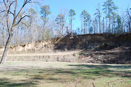
Good Info!  Image 2 of 2Where the Old Natchez Trace passed over Loess it formed sunken roads, in places 20 feet deep. |
|
|
|
Loess
May 9, 2017 2:37:36 GMT -5
Post by coloradocliff on May 9, 2017 2:37:36 GMT -5
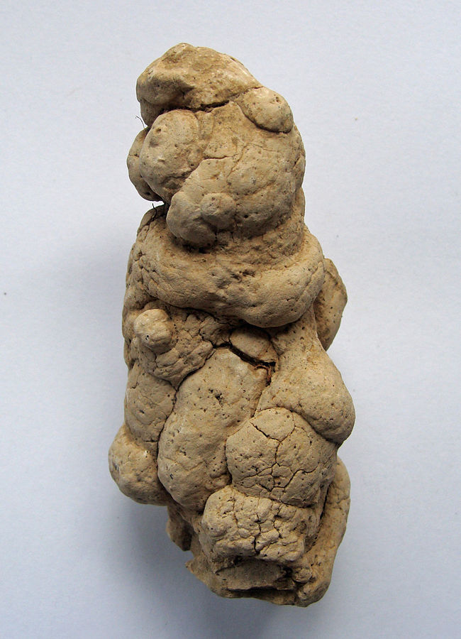
mohs roused my interest in this unusual material though the book "The Lost Cities of Cibola".  Petersen pointed out serious errors in the "Wind Blown" interpretation for their creation. 1. Loess is a geologically recent deposit that buries pre-existing landscape like a blanket from up to 300 feet thick as a massive uniform deposit. 2. "Loess" means loose, used because the material is extremely porous - exceeding 50%. In other words More than half it's bulk is vacant! 3. It has a tendency to cleave along vertical planes to form bluffs. This is because undisturbed loess is perforated with countless mainly vertical capillary tubes. How were they formed? Not by wind blown silt!  4. 4. The loess of Iowa is filled from top to bottom with snail shells and angular (not wind nor water worn!) pebbles!  5. 5. Odd dried clay nodules throughout that could not be wind blown..  So if not by wind or water, nor compacted by gravity, how were they formed? Low grade concretions?? Maybe German Shepard sized .. Might need to run a ballistics test to be certain... What did I win? What did I win...(hoping for the corvette) |
|
|
|
Loess
Jul 24, 2018 12:34:27 GMT -5
Post by mohs on Jul 24, 2018 12:34:27 GMT -5
O I was loessed over here by the Pre -Phoenix transporter
excellent !
gathering more info
stayed tunEd
mohs
There been a lot of discussion on whether a comet tail
could deposit massive amounts debris on the earth.
in my usual manner I tried to research some history on that hypothesis.
came across this early reference by Ignatius Donnely
Who is Ignatius Donnelly ?
He is an author who wrote
“Atlantis: The Antideluvian World"
written in 1882.
A book I’m sure many have perused.
Now I don’t want to go to far a field by bringing in the myth of Atlantis> whether it existed or not.
That is another whole thread.
I just wanted to highlight the comet tail debris theory
Ignatius did believe that Atlantis existed and was destroyed.
As outlined by Plato Atlantis demise was attributed to earthquakes volcanoes tsunamis.
It got covered over. The Gods were not pleased with Atlantis.
In the book “Atlantis: The Antideluvian World”
these catastrophes are due to comet tail debris!
No impact had to be created.
Just a serious dump of debris.
The force could move mountains or create those
there of.
So he might have been on to something…
whether Atlantis’s existed or not…
mohs
|
|
|
|
Loess
Nov 26, 2020 10:45:17 GMT -5
Post by 1dave on Nov 26, 2020 10:45:17 GMT -5
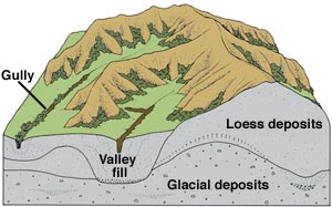
Mystery Solved. www.sciencedirect.com/topics/earth-and-planetary-sciences/loess Distribution Loess covers approximately 10% of the earth's land surface (Figure 1) and is generally associated with semiarid to semihumid climate regimes. The thickest deposits are found in China, where approximately 500 000 km2 is blanketed by loess that is up to 300 m thick. The Great Plains has the largest area of loess in North America. Loess there can be more than 60 m thick. Other loess deposits include the Pampas of Argentina, parts of Europe, the Ukraine, large areas in central Asia, the Palouse and Snake River Plain of the US Pacific Northwest (PNW US), parts of Alaska, and parts of northern Africa. Thinner and less extensive deposits are found worldwide.  Loess in the Quaternary Loess occupies large areas of China, Central Asia, Russia, Europe, Argentina, New Zealand, and North America. Most loess is concentrated in mid-latitude regions (Figure 5), and its texture and mineralogy make it one of the most favorable parent materials for agricultural soils. Indeed, loess-derived soils produce crops that support literally millions of people in Asia, South America, North America, and Europe. Loess is dominated by silt-sized particles (50–2 μm diameter), although most loess contains smaller amounts of sand and clay. This particle size distribution, along with slight carbonate cementation, produces interparticle binding that makes loess stand in vertical bluffs in exposures  The importance of loess in Quaternary studies is that it is one of the few terrestrial deposits that may contain nearly complete records of glacial–interglacial cycles. A classical model of loess is that it forms primarily during glacial periods, when continental ice sheets or valley glaciers produce silt-sized rock ‘flour’ by grinding. This silt is in turn transported and sorted by fluvial processes as outwash, deposited on floodplains, and ultimately entrained by the wind. It is now also known that nonglacial processes also produce silt-sized particles. Nevertheless, even in areas known to contain nonglacial loess, it appears that the most favorable times for loess entrainment, transportation, and deposition are during glacial periods. Mahowald et al. (1999) have pointed out several factors, including generally drier climates, decreased vegetation cover, stronger winds, and a decreased intensity of the hydrological cycle, that enhance loess and dust transport during glacial periods. The latter factor can account for loess or finer grained dust staying in suspension longer than is the case under nonglacial climates. Thus, Quaternary stratigraphic studies have shown that loess is characteristic of glacial periods in most regions  It is laid down over many years.  |
|
|
|
Loess
Nov 26, 2020 10:51:01 GMT -5
Post by 1dave on Nov 26, 2020 10:51:01 GMT -5
So glaciers grind rocks to silt particles. Spring thaw washes huge amounts into the lowlands where it settles and dries.
Bubbles drift up, snails proliferate, calcite glues particles together holding spaces as water evaporates, winter comes.
Next spring a new layer slithers over everything.
|
|
|
|
Loess
Nov 26, 2020 12:26:49 GMT -5
1dave likes this
Post by mohs on Nov 26, 2020 12:26:49 GMT -5
Very cool Dave !!!
I like that theory of the loess settlements
being sifted and sorted deep in to the bowels of the earth,
from the above massive water fill above.
That silt effectively being compacted under enormous pressure
into a compacted clastic mountain.
Then uplifted from quaking & rising to it full butte height.
Eons of erosion pecking out holes and tafoni's
Then they’re that question of the massive thomsonite boulder just resting on the surface by the canal.
All mysteries I hope to document before the end
of the year.....
|
|