Post by 1dave on Aug 30, 2017 10:52:31 GMT -5
The world She is a Changing! The way it looks today:

But they are all moving!

Can we put "Humpty Dumpty" back together again?
What did it look like a million years ago? Recognition of the Grenville Belt - pat of which runs through Mexico, Texas, the eastern US, and the northern tip of Scotland - has helped in re-construction ideas.

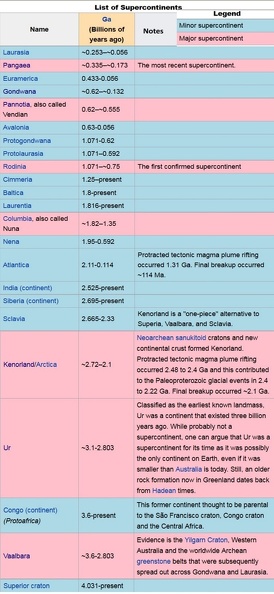
Best guesses can be found here: The First Supercontinent.
www.ccsf.edu/Departments/History_of_Time_and_Life/PDFs/Rodinia36x36.pdf
Rodinia is Russian for Homeland. a few excerpts from the PDF:


The rifting from way back then still effects us today!
The Reelfoot Rift, which has been detected using geophysical instruments, extends from the Gulf of Mexico to Illinios and is a failed, third rift from the Rodinia breakup. The active New Madrid
earthquake zone in Missouri occurs along the Reelfoot Rift. Large earthquakes sometimes
occur here because of the fragile nature of the rift, even though sealed.
earthquake zone in Missouri occurs along the Reelfoot Rift. Large earthquakes sometimes
occur here because of the fragile nature of the rift, even though sealed.

Map of the middle Mississippi River valley in the central U.S. showing topography (purple at about 47 m up to orange at about 360 m elevation). White heavy lines bound the Reelfoot Rift. White and blue circles are locations of small, but continual earthquakes in this area.
Several of the largest historical earthquakes to strike the continental U.S. occurred in the winter of 1811 & 1812 along the New Madrid seismic zone, which stretches from just west of Memphis, Tenn., into southern Illinois. Future seismic activity in this zone threatens the Mississippi,
Ohio, and Wabash River valleys. Image from USGS
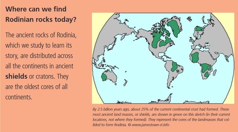
Where can Rocks From Rodinia be found today?

Another Reconstruction:


