Post by 1dave on Dec 27, 2019 15:10:54 GMT -5
Death Valley - artist's Drive

It is an interesting place to visit - the Race Track where rocks literally make tracks, Cotton ball Basin where ulexite (TV Stone) crystals can be found, PLUS ...
j.b5z.net/i/u/2089773/f/DeathValleyMiningHistory-DeniseSeith.pdf
The best geology information I have found is at:
pubs.usgs.gov/pp/0494a/report.pdf


More good info is at:
en.wikipedia.org/wiki/Geology_of_the_Death_Valley_area
Water in Furnace Creek made life bearable in 1871.

www.oasisatdeathvalley.com/lodging/the-ranch-at-death-valley/
The Oasis today


It is an interesting place to visit - the Race Track where rocks literally make tracks, Cotton ball Basin where ulexite (TV Stone) crystals can be found, PLUS ...
j.b5z.net/i/u/2089773/f/DeathValleyMiningHistory-DeniseSeith.pdf
Did you know that Death Valley has more abandoned mines than any other national park? Thousands of abandoned mine sites are scattered across the park’s 5,200+ square miles. It’s really not surprising when you consider that gold, silver, lead, zinc, antimony, flourspar, cinnabar, Epsom salts, mercury, tungsten, copper, borax, talc, sodium chloride, and manganese all have been mined here for well over 150 years. Some of the strikes were short-lived, others lasted for the life-time of the miner, but all prosperous large-scale metal mining in Death Valley ended around 1915.
Although the facts are sketchy, story has it that the Death Valley mining boom began when a westbound 49'er stumbled on a mound of pure native silver. The prospector used some of the silver to mold a primitive gunsight for his rifle. That bit of metal grew into the legendary Lost Gunsight Mine.
Although the facts are sketchy, story has it that the Death Valley mining boom began when a westbound 49'er stumbled on a mound of pure native silver. The prospector used some of the silver to mold a primitive gunsight for his rifle. That bit of metal grew into the legendary Lost Gunsight Mine.
The best geology information I have found is at:
pubs.usgs.gov/pp/0494a/report.pdf
1966 Stratigraphy, of Death Valley by Charles B. Hunt_____________________ 9
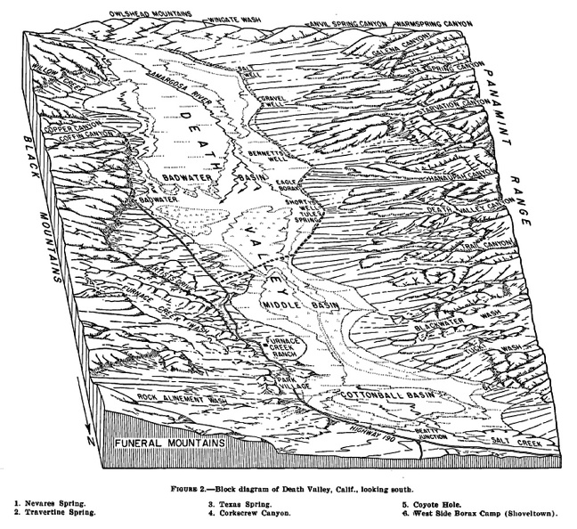
“The rocks exposed in Death Valley and the adjoining mountains aggregate more than 60,000 feet in thickness. The valley and the mountains around it have been the site of three major geosynclines-one formed during late Precambrian time, another during the Paleozoic, and a third during the early part of the Mesozoic Era.
During late Mesozoic and early Cenozoic time the southern Great Basin was ·part of a geanticline that was folded, ·thrust faulted, and invaded by granitic intrusions, and that shed sediments to surrounding regions. Later in Cenozoic time the southern Great Basin, including Death Valley, became fragmented, mostly by block faulting, into basins and ranges, and during this time sediments that were eroded from the ranges collected in the basins.”


More good info is at:
en.wikipedia.org/wiki/Geology_of_the_Death_Valley_area
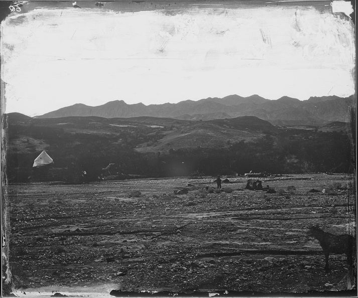
Water in Furnace Creek made life bearable in 1871.

www.oasisatdeathvalley.com/lodging/the-ranch-at-death-valley/
The Oasis today


