jamesp
Cave Dweller 
Member since October 2012
Posts: 36,154
|
Post by jamesp on Mar 1, 2022 11:54:40 GMT -5
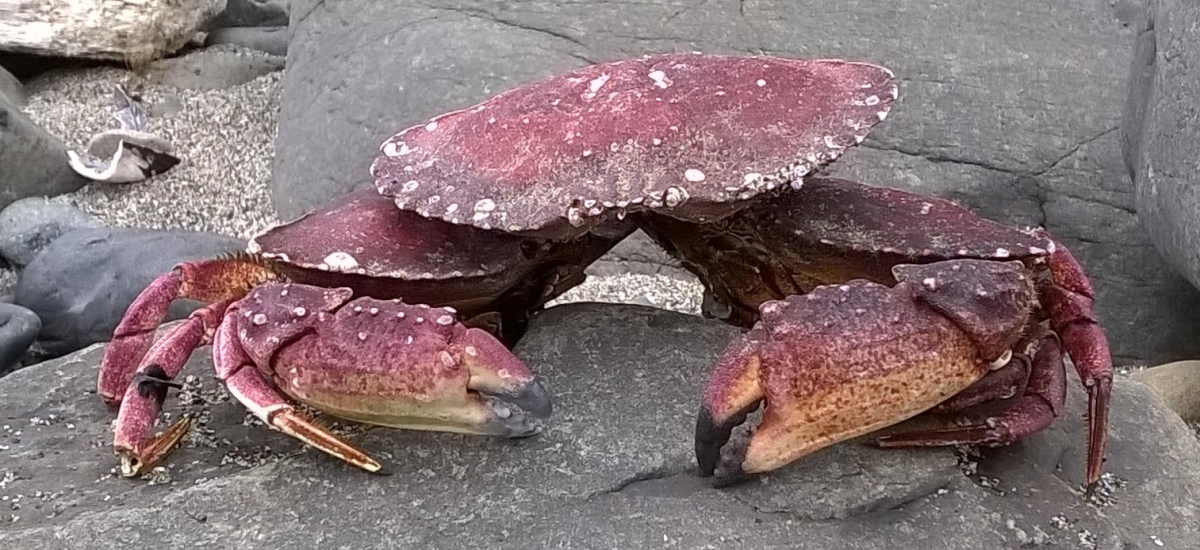
When planning an arrowhead trip always look for an alternate collectable in the location you are targeting. In this case fossils. Beautiful river quartzite has been a past target to this area close by, 3 hours from Atlanta in same area. Just to the west and south of the quartzite zone is limestone and a source of fine shark's teeth and other fossils in these rivers and creeks. So shark's teeth in the Conecuh River will be the primary target with an eye kept on creek/river artifacts as collecting. Because all creeks and rivers below the fall line(an ancient ocean beach) expose/cut thru cherts and silicified items for making fine arrowheads chert points will be there. Need basic trip maps for fast familiarization(IMPORTANT). I will explore Covington County, the dammed section of the Conecuh river and her tributaries for controlled and predictable water levels. Bringing small jon boat. This is new turf for me. Me lost here. My rock collecting books are organized by county, so this county map is helpful with notes regarding booty locations. The west border of south Alabama is on the bucket list but the large Tombigbee River has high water and is a further drive. Wait till summer on the Tombigbee...  General road map with roads and towns within 30+ mile radius. Target area circled. Watershed penciled in. Hotel room reserved near by.  Got to have topo of target area. Steep areas cause creek bottom erosion exposing rocks and creating rock bars. Deeper swampy creeks are useless. All will be convenient tributaries to the Conecuh River. These small creeks can only be done by foot(in waders).  Finally, creek check points at rural road crossings. Stop vehicle at these locations and do a quicky analysis of the fossil density by sampling in each creek. Using GE satellite telemetry on cell phone(or pad) helps with funky road names to avoid getting lost and finding timbered areas where surface collecting may be possible.  Predicting 4 to 5 spearpoints/arrowheads and a fine load of killer shark teeth lest I stay longer. Depending on water levels... |
|
jamesp
Cave Dweller
Member since October 2012
Posts: 36,154
|
Post by jamesp on Mar 1, 2022 12:03:37 GMT -5
And weather to kill for. Unusually high temps for this time. May stay longer to please wife. Not to be fooled, the water will be winter cold. Not sensor location is Chigger Hill, hmmm.  |
|
jamesp
Cave Dweller
Member since October 2012
Posts: 36,154
|
Post by jamesp on Mar 1, 2022 12:21:55 GMT -5
Booty from past quartzite trip 20 miles to east on 2015 expedition. I asked a rancher if I could hunt his place. Told him I would show him where his arrowheads were on his plowed grounds. We hunted and found a half dozen over a 4 hour walk. He was a young bull rider. I sent him tumbles for his kids a couple of months later. Hope to stop by say hi and see his point collection. www.flickr.com/photos/67205364@N06/sets/72157662367140412Check out these wow quartzite cobble bars that run for 10 miles at small creek 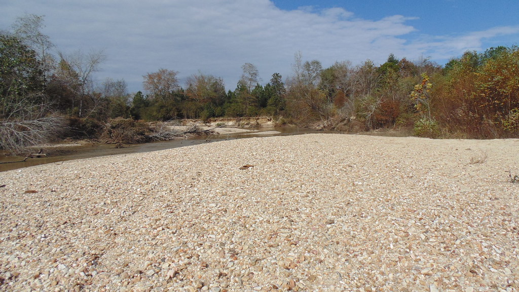 On site chipped tumbles from pebbles, yum. Super dense and takes a fine tumble polish.  shaped fast but took killer polish.   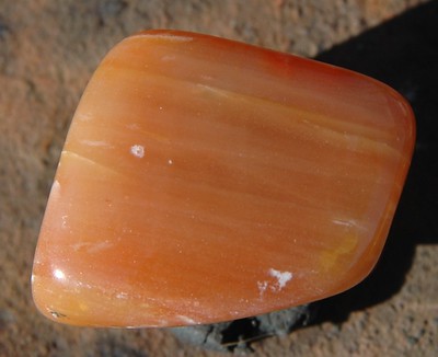 |
|
|
|
Post by liveoak on Mar 2, 2022 7:24:20 GMT -5
Thanks for the south AL tips- we live down on the Fl panhandle just south of there & are always looking for new places to explore. We shall check them out.
Patty
|
|
jamesp
Cave Dweller
Member since October 2012
Posts: 36,154
|
Post by jamesp on Mar 2, 2022 7:37:03 GMT -5
Thanks for the south AL tips- we live down on the Fl panhandle just south of there & are always looking for new places to explore. We shall check them out. Patty I should know more about S. Alabama after this trip. Feel free to ask about any hot collecting spots; I will help in any way I can. If ya see a white trash looking old worn out dude on a weird looking white trash boat going down a skinny little shallow river you must wave Patty.  Packed a bit of every tool and water gear possible till the equation is figured out. Cold start. 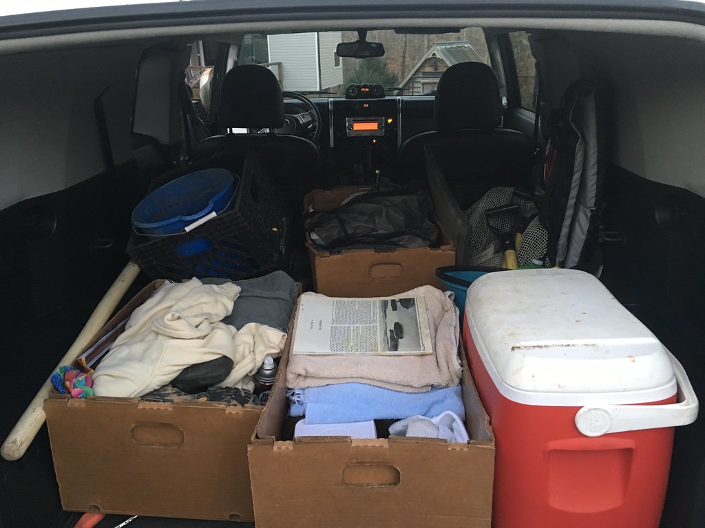 Wish me well. |
|
jamesp
Cave Dweller
Member since October 2012
Posts: 36,154
|
Post by jamesp on Mar 2, 2022 7:44:06 GMT -5
Thanks for the south AL tips- we live down on the Fl panhandle just south of there & are always looking for new places to explore. We shall check them out. Patty I'm staying at the Best Western in Andulusia. I'll give the shark teeth a try at the base of A-dam in Anadulusia. Y'all feel free to join me. Look at 'Andulisia Alabama shark teeth at the a-dam" on Youtube and you will get the waywhere to collect. I may be downstream on the Conecuh River where the booty is less picked over. |
|
|
|
Post by liveoak on Mar 2, 2022 8:49:30 GMT -5
Sorry, can't make it to meet up today .
But would love to hear your report.
You got my husband headed outside to get the Alabama atlas.
Wondering, since you seem to be the adventuring type, if you ever checked out Weiss Lake.
There are supposedly outcrops of trilobites along the shore.
On our list to get there, I think it's a fall / winter trip for when they draw the lake down.
Happy Hunting - look forward to hearing,
Patty
|
|
aGates
spending too much on rocks
 Building a silver studio
Member since January 2021
Posts: 457
|
Post by aGates on Mar 2, 2022 9:25:42 GMT -5
jamesp i hope you score the megaladon God Bless your adventuresous spirit.
|
|
jamesp
Cave Dweller
Member since October 2012
Posts: 36,154
|
Post by jamesp on Mar 5, 2022 7:50:09 GMT -5
jamesp i hope you score the megaladon God Bless your adventuresous spirit. Thanks aGates. It was a learning trip to a foreign zone. I drove 200 miles east to west across the southern end of the state and another 200 miles west to east across the middle part of the state. Not counting the 150 miles both ways from Atlanta. This was a sampling trip for the most part. Parked the car about 35 times and walked down to the creeks that the road passed over looking for fossils, rocks, and chips from the ancient artifact dudes. Sampling. Both directions crossed from the piedmont to the coastal plain so the geology changed from crystalline materials to limestone. 3 creeks were loaded with fossil bivalves for the most part. Very little chert. The biggest surprise was the tall hills in the coastal plain. Crystalline materials on the hills and limestones in the valleys. Totally complex. This is some of the most not populated territory. The middle part of the state is in farms due to the rich black soil. The southern part is all about timberland. Vast corporate clearings in S Alabama along creeks and rivers with few gates or trespassing restrictions perfect for artifact hunting. Will be returning there. But may be lacking cherts for making points... The rivers were too full to do any sharks teeth collecting. The one creek known for shark's teeth completely skunked me lol. |
|
jamesp
Cave Dweller
Member since October 2012
Posts: 36,154
|
Post by jamesp on Mar 5, 2022 7:56:25 GMT -5
Sorry, can't make it to meet up today . But would love to hear your report. You got my husband headed outside to get the Alabama atlas. Wondering, since you seem to be the adventuring type, if you ever checked out Weiss Lake. There are supposedly outcrops of trilobites along the shore. On our list to get there, I think it's a fall / winter trip for when they draw the lake down. Happy Hunting - look forward to hearing, Patty The most interesting geology I know of near you guys would be the silicified corals on the Withlacochee River Patty. It requires a canoe or kayak though.(at low water) The Suwannee and the Santa Fe the same for coral, perhaps the Aucilla river are your best bet. And Fossils. Florida is world class fossil territory. The trilobites at Weiss lake are pretty boring. Tiny and two dimensional. Florida fossils are class act if you can get on the right properties. I suggest a trip to the Peace River though iit is far away from you. |
|
jamesp
Cave Dweller
Member since October 2012
Posts: 36,154
|
Post by jamesp on Mar 5, 2022 8:23:43 GMT -5
Best find of the trip was the one and only(Copena) point. And a vein of Tallahatta quartzite(in background). Vein was 80 miles south of point find but Talhatta limestone is common in the southern third of Bama. This site is #1 for identifying points. Location, materials, sample comparisons, materials, culture etc. Copena point - projectilepoints.net/Points/Copena.html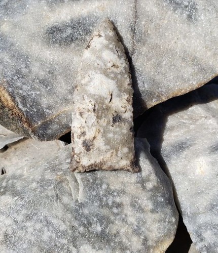 This is a weird quartzite. It is basically silicified by chalcedony. Call it "petrified sand stone": "The Tallahatta Formation is Middle Eocene in age and consists of silicic claystones, sands, and sedimentary quartzites of marine origin. The quartzites are composed of well-sorted, medium grained quartz sand that is hardened by weakly luminescent phases of opal-CT, chalcedony and some glauconite cemented together by silica. This binds the grains together so strongly that when broken, the fracture cuts through individual grains rather than around them as it would in sandstone." Wear protection when striking it with hammers. It sends razor fragments at high speeds upon impact like no other rock. RickB Can Tallahatta be heat treated to make it workable ? That is a mean material. |
|
jamesp
Cave Dweller
Member since October 2012
Posts: 36,154
|
Post by jamesp on Mar 5, 2022 9:54:04 GMT -5
Quartzite pebbles are all consistent. A highly micro-fractured white outer layer often with nicely colored centers. Some are spectacular with dead clear centers of yellows, oranges, reds, blues, smokey, stripes, mica sparkles etc. About 10 counties in the middle southern and east side of the state and into Georgia. The creeks and rivers that flow through the quartzite zone are apparent from satellite photos, look for massive rock bars. Any of many bridge crossings will load you buckets.  |
|
|
|
Post by liveoak on Mar 5, 2022 10:31:23 GMT -5
Well that's a pretty nice point you found- certainly would chalk that up to a good trip ( although sounds like a lot of driving).
You're right about the FL fossils, no trilobites though ( but thanks for the Weiss lake review- saves us a LONG trip)
We've been to the Peace river years ago & found sharks teeth, but only very small ones.
Near us, in the Econfina Creek we've found fossil shells (Chipola formation) .
A lot of real beauties, but hard to separate from the matrix.
More places to go then we have time to do it !
Patty
|
|
jamesp
Cave Dweller
Member since October 2012
Posts: 36,154
|
Post by jamesp on Mar 5, 2022 11:48:37 GMT -5
Well that's a pretty nice point you found- certainly would chalk that up to a good trip ( although sounds like a lot of driving).
You're right about the FL fossils, no trilobites though ( but thanks for the Weiss lake review- saves us a LONG trip) We've been to the Peace river years ago & found sharks teeth, but only very small ones.
Near us, in the Econfina Creek we've found fossil shells (Chipola formation) .
A lot of real beauties, but hard to separate from the matrix. More places to go then we have time to do it !
Patty
The ramp at Clyattville-Nankin bridge on the Withlacoochee river SW of Clyattville is the place I want you to go. But must have canoe/kayak. Go about 1/4 to 1/2 mile downstream ONLY when the water is low(220 cubic feet per second). and upstream but a challenge. The 'USGS river level data' will give the river flow numbers including the history of when it is low seasonally. a typical 3 day trip staying at hotel in Clyattville: www.flickr.com/photos/67205364@N06/sets/72157645769948855Having a rock saw helps but not required. |
|
|
|
Post by RickB on Mar 5, 2022 12:19:32 GMT -5
Best find of the trip was the one and only(Copena) point. And a vein of Tallahatta quartzite(in background). Vein was 80 miles south of point find but Talhatta limestone is common in the southern third of Bama. This site is #1 for identifying points. Location, materials, sample comparisons, materials, culture etc. Copena point - projectilepoints.net/Points/Copena.htmlThis is a weird quartzite. It is basically silicified by chalcedony. Call it "petrified sand stone": "The Tallahatta Formation is Middle Eocene in age and consists of silicic claystones, sands, and sedimentary quartzites of marine origin. The quartzites are composed of well-sorted, medium grained quartz sand that is hardened by weakly luminescent phases of opal-CT, chalcedony and some glauconite cemented together by silica. This binds the grains together so strongly that when broken, the fracture cuts through individual grains rather than around them as it would in sandstone." Wear protection when striking it with hammers. It sends razor fragments at high speeds upon impact like no other rock. RickB Can Tallahatta be heat treated to make it workable ? That is a mean material. James, they don't heat treat Tallahatta quartzite at all. They look for higher grades of it to knap. |
|
|
|
Post by liveoak on Mar 5, 2022 13:16:01 GMT -5
The ramp at Clyattville-Nankin bridge on the Withlacoochee river SW of Clyattville is the place I want you to go. But must have canoe/kayak. Go about 1/4 to 1/2 mile downstream ONLY when the water is low(220 cubic feet per second). and upstream but a challenge. The 'USGS river level data' will give the river flow numbers including the history of when it is low seasonally. a typical 3 day trip staying at hotel in Clyattville: www.flickr.com/photos/67205364@N06/sets/72157645769948855Having a rock saw helps but not required. Well Jim that is very interesting & you have our attention :-) Certainly not too far of a trip for us & definitely on our tentative schedule now- will be checking water levels.
Everything is still pretty high now - but we're hoping for a drier spring & summer . Thank you for the trip tip.
Question from my husband Tom, we have canoe & kayaks, no problem there - but we also have a little 14' Alumacraft skiff with a regular 5 hp outboard, that we use for expeditions like this.
He noticed that in your photos, that you're using a "mud motor".
Do you think a motor like this is necessary to get up a creek like that , that has rocks ??
Did I tell you that he's looking for an excuse to add a "mud motor" to the equipment list :-)
Your thoughts ?
Thanks,
Patty
|
|
jamesp
Cave Dweller
Member since October 2012
Posts: 36,154
|
Post by jamesp on Mar 5, 2022 13:43:33 GMT -5
The ramp at Clyattville-Nankin bridge on the Withlacoochee river SW of Clyattville is the place I want you to go. But must have canoe/kayak. Go about 1/4 to 1/2 mile downstream ONLY when the water is low(220 cubic feet per second). and upstream but a challenge. The 'USGS river level data' will give the river flow numbers including the history of when it is low seasonally. a typical 3 day trip staying at hotel in Clyattville: www.flickr.com/photos/67205364@N06/sets/72157645769948855Having a rock saw helps but not required. Well Jim that is very interesting & you have our attention :-) Certainly not too far of a trip for us & definitely on our tentative schedule now- will be checking water levels.
Everything is still pretty high now - but we're hoping for a drier spring & summer . Thank you for the trip tip. Question from my husband Tom, we have canoe & kayaks, no problem there - but we also have a little 14' Alumacraft skiff with a regular 5 hp outboard, that we use for expeditions like this.
He noticed that in your photos, that you're using a "mud motor".
Do you think a motor like this is necessary to get up a creek like that , that has rocks ??
Did I tell you that he's looking for an excuse to add a "mud motor" to the equipment list :-) Your thoughts ?
Thanks,
Patty
Go with a canoe or kayaks on the first trip. You will see there are shallow places for an outboard. Your call. The cheaper imported 'mud motor' brand works ok but they have tender props. I prefer a Go-Devil brand mud motor. They are tough with thick props for Florida chert bottoms. I use the 6.5hp on my 14' boat. Yall get a mud motor/Go Devil and I will meet you guys there and show you the game. Eat your Wheaties, the effort is well worth it. My BIL just bought one, can't wait to go with him. More the merrier, yall are welcome to join. I can't find people with those mud motors and they are the way to go to get to Florida treasures. warning, some years the river never goes low. The Suwannee is the #1 alternate. the hurricanes are the problem during the desirable warm season. just as the west has had 4 unusually dry years we have had 4 unusually wet years. These charts a for the Withlacoochee and Suwannee, either is best below 200 cubic feet per second, maybe 250... In the last 2 years there has been few low flow spells. Back in 2006 to 2015 I cleaned house because both those rivers were incredibly low. At times 50 cfs. I was finding stuff no one ever found. This is the problem with these rivers.   I assume you live at Live Oak. If so you need to talk to me. That is one of my favorite collecting spots for coral. You are at a gold mine for coral. But river access is an issue. Better for canoe/kayak. |
|
|
|
Post by liveoak on Mar 5, 2022 13:47:52 GMT -5
Having a rock saw helps but not required. One other question - How are you cutting at the river ?
Tom guessed you have a little saw & an inverter on your truck ??
Patty
|
|
jamesp
Cave Dweller
Member since October 2012
Posts: 36,154
|
Post by jamesp on Mar 5, 2022 13:50:23 GMT -5
Best find of the trip was the one and only(Copena) point. And a vein of Tallahatta quartzite(in background). Vein was 80 miles south of point find but Talhatta limestone is common in the southern third of Bama. This site is #1 for identifying points. Location, materials, sample comparisons, materials, culture etc. Copena point - projectilepoints.net/Points/Copena.htmlThis is a weird quartzite. It is basically silicified by chalcedony. Call it "petrified sand stone": "The Tallahatta Formation is Middle Eocene in age and consists of silicic claystones, sands, and sedimentary quartzites of marine origin. The quartzites are composed of well-sorted, medium grained quartz sand that is hardened by weakly luminescent phases of opal-CT, chalcedony and some glauconite cemented together by silica. This binds the grains together so strongly that when broken, the fracture cuts through individual grains rather than around them as it would in sandstone." Wear protection when striking it with hammers. It sends razor fragments at high speeds upon impact like no other rock. RickB Can Tallahatta be heat treated to make it workable ? That is a mean material. James, they don't heat treat Tallahatta quartzite at all. They look for higher grades of it to knap. No surprise Rick. It is a like a hybrid. It knows not if it is a quartz or a chert lol. I will say you best have strong hands to knap the stuff I found. the first hit with a 22 ounce hammer and I was bleeding in multiple spots from elbow down to hand. The chips were doing 15,000 mph lol. Faster ! Thanks for the info. |
|
jamesp
Cave Dweller
Member since October 2012
Posts: 36,154
|
Post by jamesp on Mar 5, 2022 13:59:54 GMT -5
One other question - How are you cutting at the river ?
Tom guessed you have a little saw & an inverter on your truck ??
Patty
I bring them home and cut them. The Suwannee coral is all solid. A hammer works ok for it. But the hollow ones from the Withla require a saw to avoid damaging them; the hollow ones are prized finds and tricky to ID. They are valuable. People have offered a bunch of money for some I found. From Suwannee. Some are heat treated(the ones with red). Found from Live Oak up to white Springs, the 'coral zone'. www.flickr.com/photos/67205364@N06/sets/72157649148934152 |
|