|
|
Post by 1dave on Apr 19, 2017 16:02:00 GMT -5
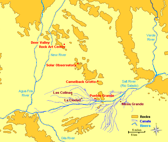
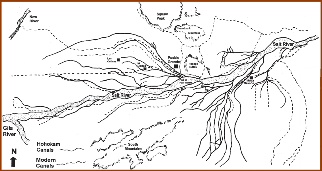
Thread Transporter (Under Construction) 1. Spanish Conquest a. Cabeza de Vaca routeb. Fray Marcos de Niza routec. Coronado Routec2. Coronado Route2.Geologic Forces of Papago a1. Mountain Buildinga2. Mountain BuildingTopob. Papago Cavesc1. Salt River Floodingc2. modern salt River Floodingd. Volcano Activity e. Tongue & Icicle Formation 3.Lost Cities Of Cibola a. Myths of Goldb. Hohokam c. Zuni d. Quiveriae. LDM 4.Comet Aoelian Theory a. Loess Distributionb. Easter Islandc. Dates of Occurrences mohs is also responsible for my interest in Phoenix through the book "The lost Cities of Cibola." By the time I finished reading the book I was convinced that the modern day city of Phoenix has indeed arisen from the "ashes" of the lost cities of Cibola." In brief the story began in 1521 with the Spanish conquest of Mexico where word of the fabled cities were often heard. De Vaca and three others, the only survivors of a failed attempt to conquer Florida arrived from the north with more stories in 1536. In 1539 Fray Marcos and company traveled to the cities on a course near the eastern coast of Mexico into present day Arizona. He recorded many wondrous lands, people numbering in the hundreds of thousands, buildings, adornments of turquoise, clothing of cotton, wool, cowhide, then fled back to Mexico City in mortal terror after the chief of Cibola was angered by a gift that contained Aztec copper bells. In 1540 Marcos was forced to lead Coronado and a rag tag army of 50 horsemen and a small infantry to the famed cities. It appears Marcos convinced Coronado they would all be killed, they were instead lead through middle Mexico into New Mexico and found the Zuni civilization and returned in disgrace. In 1694 Kino visited the Salt River area of Arizona and discovered La Casa Grande surrounded by many ruins, all that was left of the Cibola civilization. Modern archaeologists know it as the Hohokam, which in Zuni means "the worn out men." Hokam means "dead men." What happened to Cibola between 1539 and 1694? That is what the book is about. |
|
|
|
Post by 1dave on Apr 19, 2017 16:02:32 GMT -5
|
|
|
|
Post by 1dave on Apr 19, 2017 16:03:08 GMT -5
|
|
|
|
Post by melhill1659 on Apr 19, 2017 16:41:01 GMT -5
I always enjoy your post that delves into history mixed with Topos!!! Thank You for sharing this.
|
|
|
|
Post by mohs on Apr 19, 2017 19:04:44 GMT -5
Right on Dave ! posted some great images Glad you enjoyed the book! Certainly wild speculative geology Aeolian theory of massive comet deposits created the Papago’s Buttes? I discounted the theory. But as I give it more thought well… who knows? I have lots to comment on all it. Mostly though…. it’s of local interest and as kept this Phoenician searching through 60 years. You can be a serious Dutch Hunter and go tackle those mountains or do it as a armchair historian. Lots of sources on the net and GPS images. Search on…. Ed escholarship.org/uc/item/3jt748vt#page-1 |
|
|
|
Post by mohs on Apr 19, 2017 19:15:03 GMT -5
I’ve spent a lot of time tracking those canals. Amazing that the Hohokam did it without metal. Just stick & stones. Most are now underground. But I found the head gate of Dutch’s Ditch. That was the canal that Jacob Waltz was last known to do some digging in Phoenix. And wherever he dug--- I want to  . |
|
|
|
Post by spiceman on Apr 19, 2017 23:37:08 GMT -5
My aunt and uncle live down there and we visited. We went for a ride and they said lets go to "a mountain" we all laughed because they are all a mountain.
Went by a mountain close to the Arizone college and it had the letter A on one side of the mountain, from top to bottom.
They said that's "A" mountain. You had to be there but it was funny.
|
|
|
|
Post by mohs on Apr 20, 2017 12:46:19 GMT -5
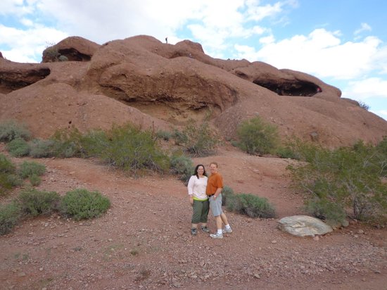
Hey Dave I climbed Barnes Butte this morning Took lots of pictures. Mostly vistas Of local interest only 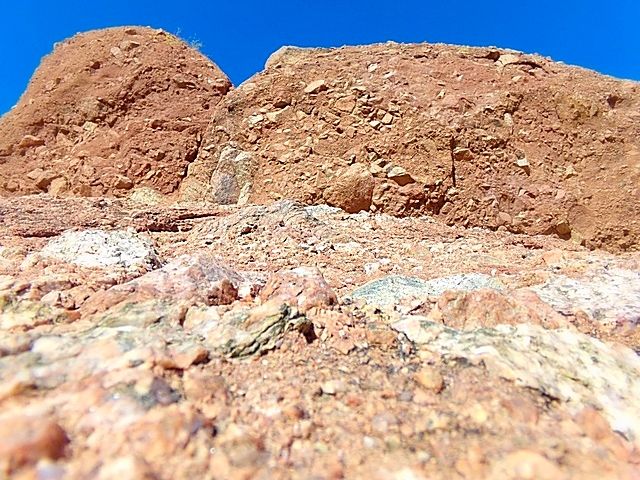 I wanted to more closly inspect the composition of the Buttes. Clastic. Mostly granite. Huge chunks. Boulders even. Embedded into the sedimentary red matrix Amazing how loess (loose) that sedimentary mix is. I can pick it out of the mountain- side with my hands. It crumbles easily. Must be evidence of a once humongous mudslide/landslide ? From massive mountains that no longer exist? Filled in the valley with fertile soil. That why the Hohokam-- if they only could figure out a canal system – would have prime land for farming. Anyway I’m no geologist (and I do like that Cosmik Debris theory  ) So I’ll leave the analysis to the more qualified. Thanks for the suggestion to take a hike I enjoyed it EdMohs |
|
|
|
Post by 1dave on Apr 20, 2017 12:58:12 GMT -5
mohs - What I'm interested in is the mud(?) flow out of the cave areas. The photos in the book suggest granite hills with a thick mud topping just thick enough to cover all but liquid enough to pour out of some pockets for a short (several hundred feet) distance. it seems to have covered only the high places, but the low places may have been covered with other sediments.
|
|
|
|
Post by mohs on Apr 20, 2017 14:15:18 GMT -5
Yep Dave
The melt theory
But that not what I observe, particularly
Of course, I don’t have the geological acumen of Petersen
But I do wonder where the red matrix binding,
which embeds the granite clastics into the buttes originates from?
Is it from the massive abrasive grinding of granite
occurring from this humungous landslide?
Combined with prodigious amount of fluids.
Floods!!
Colluvial soils!
Catastrophic Noahic Upheavals!
Talk about slurry !
Plus What role did the Aeolian soil theory play??
|
|
|
|
Post by mohs on Apr 20, 2017 16:00:00 GMT -5
I do have a question for you Dave I took the book back to library yesterday. I’m starting to kick myself for that. It was from the Mesa library. Not as easy for me to access as say the Phoenix library which I’m at practically everyday. Anyway as I recall the pictures that Petersen took of the melt area & icicle drippings were from a distance. Is this correct? Why was this? Why not a close up to inspect? One explanation is that- that part of Barnes Butte is on government defense land! National armory! Not accessible! You can see that on the map you posted. There is a big story behind that. But I best not divulge it here That said: Recall above that I mentioned on my hike this morning I could easily pick out this red matrix from the butte. Basically with my fingers. Easily dug out and crumbles finely Wouldn’t the ‘melt area’ of that red matrix be of different consistency? Wouldn’t that particular area be solidified and melded together? Not easily picked away or crumbly? Do I understand Petersen correctly that the melt was from the comet? Wasn’t he saying the melt froze quickly? Was it heat that caused the melt?? Or was mud flowing and for some reason just solidified quickly in its path ? from some yet unexplained force? 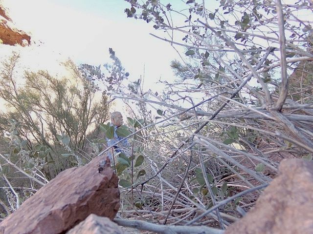 |
|
|
|
Post by 1dave on Apr 21, 2017 8:59:37 GMT -5
mohs and metalsmith , last night I think I came up with an answer. Edit 7/24/18: End of last Ice Age Floods. A thousand year dust storm capable of carrying large rocks colliding with a thousand year rain storm = 10,000 year mud fall! Like a too thick icing on a cake, top drying out, too moist inside at less supported areas pouring out.   Note the people at the bottom of 57 for dimensions!
|
|
|
|
Post by mohs on Apr 21, 2017 10:30:51 GMT -5
Thanks Dave!!! Those are some valuable pictures you posted! I really appreciate it! I do believe you’re onto the truth 10000year haboob w/a Noahic mud flow cataclysm I’m going to have go up there soon and follow your line of thinking I didn’t concentrate my photos on the mudflow caves This is my best shot Presently 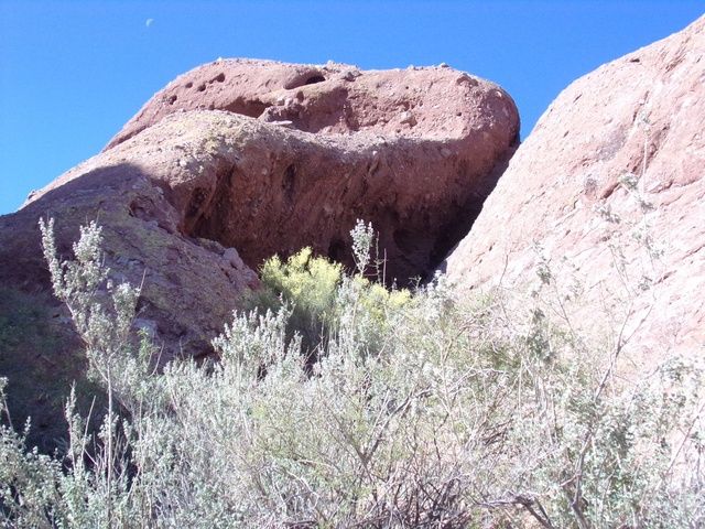 |
|
|
|
Post by 1dave on Apr 21, 2017 10:52:12 GMT -5
Thanks Ed! Anxiously waiting for more - Mostly.
|
|
metalsmith
Cave Dweller 
Member since October 2012
Posts: 1,537
|
Post by metalsmith on Apr 21, 2017 15:01:53 GMT -5
mohs and metalsmith , last night I think I came up with an answer. A thousand year dust storm capable of carrying large rocks colliding with a thousand year rain storm = 10,000 year mud fall! Like a too thick icing on a cake, top drying out, too moist inside at less supported areas pouring out.   Note the people at the bottom of 57 for dimensions! Well I don't think you're wide of the mark here; then again  , in parts I think you are wide of the mark. Think of the force needed to lift the larger clasts (described elsewhere mohs as some being / approaching boulders. Just what would be required to make those babies fly? Alternatively mud flows are well known agent for transporting boulders. Youtube will help out by demonstrating present-day equivalents. I'm not sure how you have pegged these sediments as aeolian. The authoritative sources I've seen suggest these are debris flows resulting in breccia. Perhaps there are aeolian components? There are present-day equivalents for this: Meteorologically the chance of a 1000 yr rainstorm colliding with a 1000 year dust-storm is very low. Of course, assuming statistical independence the likelihood is a product of the independent variables, thereby 1/1,000,000 years. The chance of a 1/1,000,000 year combo happening is very close to 1 i.e. a certainty in only a 5,000,000 period of which there are many such 5ma periods over a geological epoch. However, what does a 1/1000 year storm look like? Well the relationship of increasing magnitude / reducing frequency (increasing rarity) is approximated closely by a log-scale. River flow can be generalised as doubling with a power-increase to the exponent, i.e. from 10 to 100 year rarity or from 100 to 1000. I don't know what your Q10 storms look like and you may even have seen a Q100; there's a roughly 1/5 chance of this occurring in a 100-year period. I'm not sure how the relationship stacks up for wind, but some severe amount of energy would be required to make the boulders take off. Aeolian deposits are forming in present day China, but the wind is generally not laden with rocks, even if dust-storms are noted. The flows that created this sediment were probably landslide, if dry, fluvial or alternatively submarine avalanches (I don't know enough about the setting). Either way they were highly energetic and turbulent. They will no doubt have been rare events. I don't think we need to consider aeolian influences as additional. If there are aeolian components, then reworking is the much-more-likely candidate for incorporating them. A rare (severe) storm event could be enough to form a debris flow and precipitate (pun intended) a breccia. Debris flow deposits are unlikely to include aeolian sediments outside of re-working. The reason for this stems from the meteorological difference between dry dust-laden air and moisture laden storms: a cushioning effect would be effectively pushing the dry dust air mass in front of the storm. |
|
|
|
Post by mohs on Apr 21, 2017 17:27:35 GMT -5
Thanks metalsmith for the insights !
I realize you’re out of the loop in this discussion
as it based on a theory described in the book.
I enjoyed the book & author's theory
but right now I’m at stalemate
Though leaning towards a tremendous mudslide/landslide
from previous (massive) mountains that no longer exist.
That seems to be the most logical explanation.
If you’re interested in geological survey of this area
I offer this
Interpreted map of bedrock geology below the basin fill and Salt River Gravels ...
The bedrock pediment surface is exposed in Papago Park, but becomes buried to ...
Its pretty intense study
I think you guys would enjoy
it may clear up some anomalies
its a pdf file
If the link doesn’t work
you can google it
should get you there
let me know...
|
|
|
|
Post by mohs on Apr 21, 2017 17:31:37 GMT -5
Yes!! This is all Pre-Phoenix even before ol'mohs time.... m  stly |
|
|
|
Post by 1dave on Apr 21, 2017 18:30:22 GMT -5
metalsmith - precisely! What happened on December 31 1860? Petersen was (is?) a very precise physicist. After diligent research he tied three extremely unusual occurrences together. Easter Island, Cibola, and Nebraska. 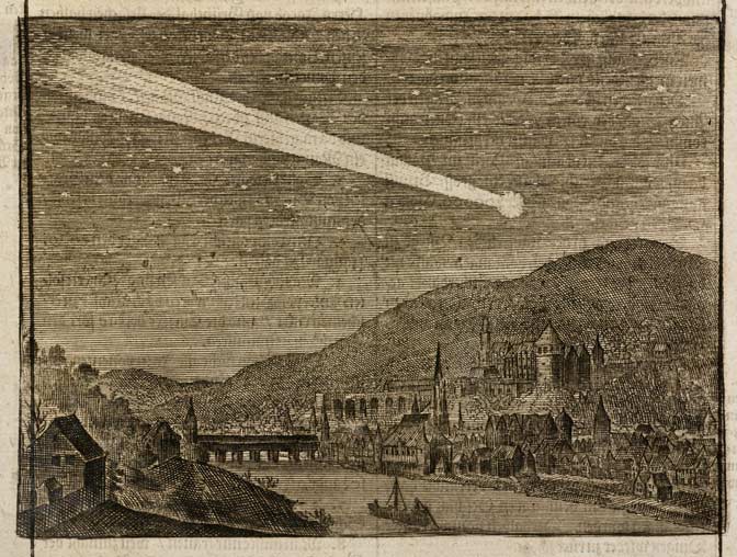 The Great Comet of 1860 passed within 0.42 AUs from Earth on 30 November 1680 traveling 186,000 mph. Earth entered it's tail (estimated to be 30,000,000 miles in length) 31 days later.  1. The people of Easter Island 1. The people of Easter Island wrote: Large numbers of their statues were buried.  2. Destruction of Cibola 2. Destruction of Cibola and the weird covering of granite in Pre-Phoenix - Previously discussed.  3. Large sphere in Nebraska. 3. Large sphere in Nebraska.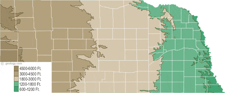 Are winds of 186.000 mph (3,100 mp Minute, 51 mp second) fast enough?
|
|
gemfeller
Cave Dweller 
Member since June 2011
Posts: 4,037 
|
Post by gemfeller on Apr 21, 2017 19:07:20 GMT -5
Maybe I'm getting into this late and uninformed, but have you checked out this link? www.gemland.com/geohistory.htmIts simplified overview seems to attribute the clastic material to an orogeny that built mountains so steep they were subject to great mudflows and avalanches. I bought the Cibola book and have read about 1/8 of it. I'd be further along but Ed mentioned the book by Alvarez which I downloaded to my Kindle and can't put down. I live and breathe Big History and have endless admiration for Alvarez and his work. I'm hoping the book will tie a few more loose ends together. |
|
|
|
Post by 1dave on Apr 21, 2017 20:14:12 GMT -5
Welcome Rick!
The photos of McDermett Butte have my mind boggled!
Each investigator has unique filters. If enough become involved, the truth will out.
With the comet theory I was thinking a single chunk but that has to be wrong. Comets are mostly debris collections of material similar to earth's surface and hard to identify after it impacts - that could be at a very slow speed, especially if it is traveling the same direction as earth.
I am now thinking many chunks colliding along the tail and earth's rotation path at much slower speeds.
|
|








 .
. 
 )
)


 , in parts I think you are wide of the mark.
 stly
stly 


