Post by 1dave on Dec 28, 2017 8:21:07 GMT -5
tennesseefossils.com/images/TennGeoMap%20-%20Large.jpg
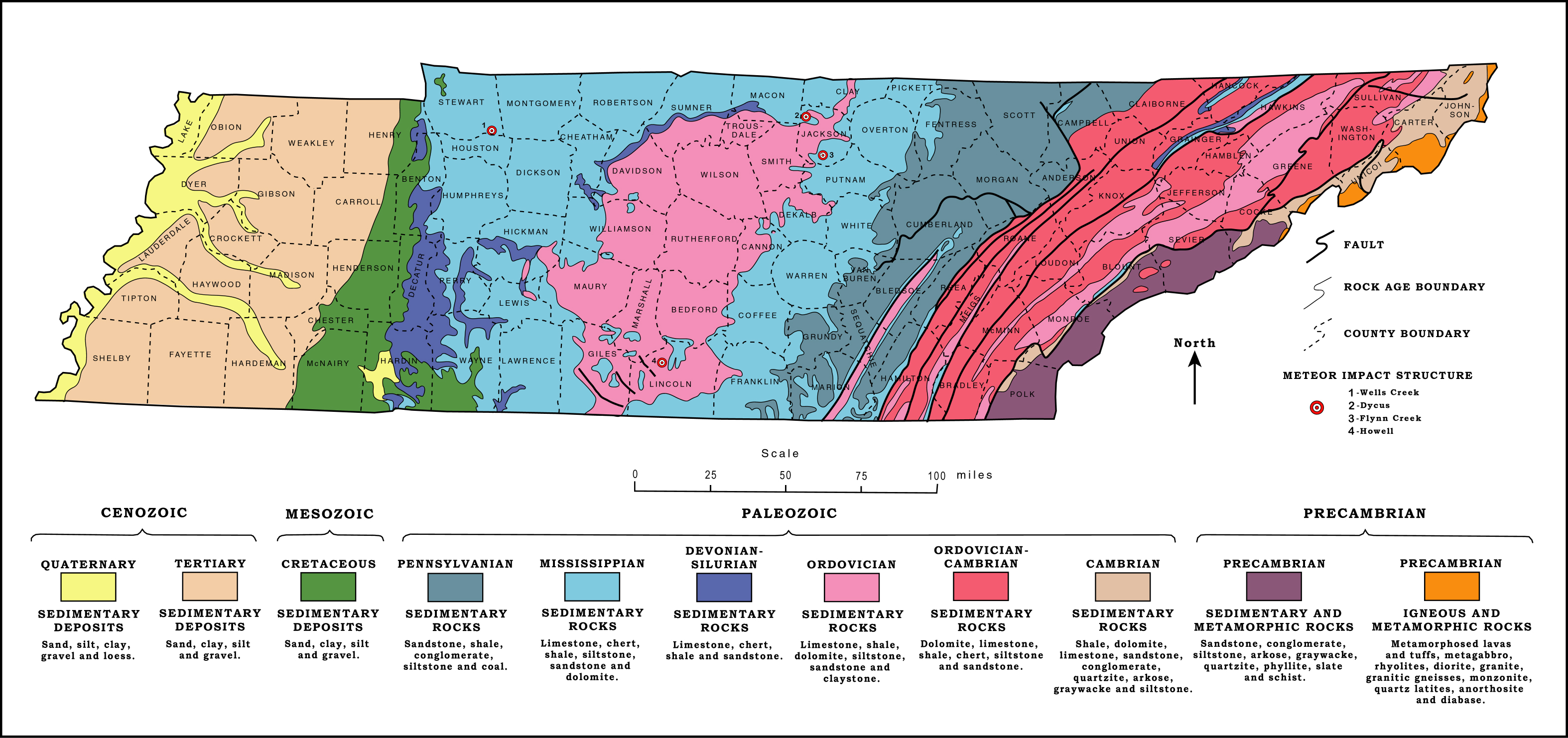
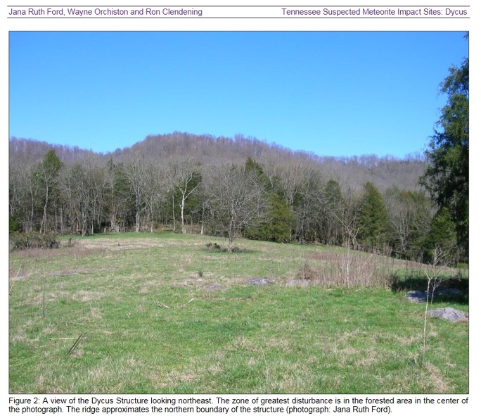
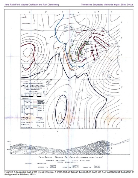
Tennessee has excellent coverage of ancient rocks. NOTE the four known impact sites!
#1 in Stewart Co., #2 and #3 in Jackson Co., and #4 in Lincoln Co.
Click on map, select "View Image" for large view.
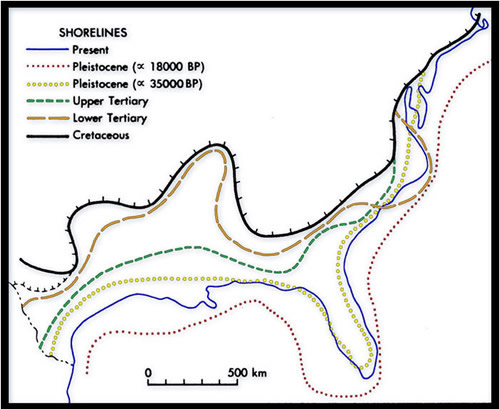
Changes in shore lines over the millennia has greatly changed the land forms.
Wikipedia has a good presentation. Go there and click on any named group to get more detail.
en.wikipedia.org/wiki/Geology_of_Tennessee

Tennessee has excellent coverage of ancient rocks. NOTE the four known impact sites!
#1 in Stewart Co., #2 and #3 in Jackson Co., and #4 in Lincoln Co.
Click on map, select "View Image" for large view.
Changes in shore lines over the millennia has greatly changed the land forms.

Wikipedia has a good presentation. Go there and click on any named group to get more detail.
en.wikipedia.org/wiki/Geology_of_Tennessee
Geology of Tennessee
From Wikipedia, the free encyclopedia
This article does not cite any sources. Please help improve this article by adding citations to reliable sources. Unsourced material may be challenged and removed. (August 2011) (Learn how and when to remove this template message)
The geology of Tennessee is as diverse as its landscapes. Politically, Tennessee is broken up into three Grand Divisions: East, Middle, and West Tennessee. Physically, Tennessee is also separated into three main types of landforms: river valley plain, highlands and basins, and mountains.
Contents
1 The Paleozoic
2 The Mesozoic
3 The Cenozoic
4 Geological formations of Tennessee
5 See also
6 External links
The Paleozoic
Most of the sediment across Middle Tennessee was deposited from the Ordovician to the Mississippian, roughly between 400 and 300 million years ago. The sediment was primarily deep ocean limestones with some shale layers. Mississippian limestones are generally thicker than those of the Ordovician, and additionally, more cherty. In the Ordovician, the Appalachian Mountains began to form and by the end of the Paleozoic were tall peaks. During the Pennsylvanian, the Cumberland Plateau formed along the edge of the Appalachians as beach and shore sediments, primarily sandstone today.
The Mesozoic
Most Mesozoic sediments were deposited in West Tennessee, along the present course of the Tennessee River. The Coon Creek Formation is one of these, deposited as a sandy shoreline along the Mississippi Embayment during the Cretaceous. Many large sea creatures, including mosasaurs and plesiosaurs as well as ammonites ruled the seas that covered the area. Because this area was underwater at this time, there are no land dinosaurs in the fossil record. The Appalachians to the east also experienced erosion at this time and were smoothed down to near their current elevation.
The Cenozoic
Level of the ocean drops over millennia creating recent formations
By the Cenozoic, the sea level had dropped to its current level and the North American continent dried out. The Mississippi River as well as the Tennessee and Cumberland Rivers formed and cut deep into the valleys. The Nashville Basin, which in reality is a geologic dome, was pushed up from underneath by a mantle plume, exposing softer strata that with additional erosion on the Highland Rim surrounding the basin expanded the size of the basin. The basin is likely to continue widening far into the future.
Most Cenozoic deposits occur in West Tennessee near the Mississippi embayment as sands and silts.
Geological formations of Tennessee
Cretaceous
Coon Creek Formation
Pennsylvanian
See Cumberland Plateau
Crooked Fork Group, including Wartburg Sandstone, Glenmary Shale, Coalfield Sandstone, Burnt Mill Shale, Crossville Sandstone, Dorton Shale
Crab Orchard Mountains Group, including Rockcastle Conglomerate, Vandever Formation, Newton Sandstone, Whitwell Shale, and Sewanee Conglomerate
Gizzard Group, including Signal Point Shale, Warren Point Sandstone, and Raccoon Mountain Formation
Mississippian
Pennington Formation
Bangor Limestone
Hartselle Sandstone
Ste. Genevieve Limestone
St. Louis Limestone
Warsaw Formation
Fort Payne Formation
Devonian
Chattanooga Shale
Silurian
Ordovician
Richmond Group (geologic feature)
Lebanon Limestone
Ridley Limestone
Bigby-Cannon Limestone
Leipers Formation
Catheys Formation
Pegram Formation
Hermitage Formation
Laurel Limestone
Murfreesboro Limestone
Pierce Limestone


