|
|
Post by 1dave on Sept 6, 2024 10:23:02 GMT -5
|
|
|
|
Post by rockjunquie on Sept 6, 2024 12:11:35 GMT -5
Absolutely beautiful. Great job, Dave!
I think it would have to be copied and pasted over to RTH.
|
|
|
|
Post by chris1956 on Sept 6, 2024 12:22:19 GMT -5
That was a very interesting article. I have a scoop shovel just like that in my barn. Didn't know you could use them for harder material. Used to dig out farm ponds around here. Maybe realrockhound should get one for that tough to dig pet wood he went after earlier this week. |
|
realrockhound
Cave Dweller  Chucking leaverite at tweekers
Member since June 2020
Posts: 4,483
|
Post by realrockhound on Sept 6, 2024 12:47:38 GMT -5
That was a very interesting article. I have a scoop shovel just like that in my barn. Didn't know you could use them for harder material. Used to dig out farm ponds around here. Maybe realrockhound should get one for that tough to dig pet wood he went after earlier this week. I'll just go on private property I have access to and bring an excavator. My days of hard digging are pretty much non existent haha |
|
|
|
Post by 1dave on Sept 8, 2024 7:55:14 GMT -5
From Wikipedia, the free encyclopedia  Variscite and Pyrite from Bisbee, Arizona "Variscite is a hydrated aluminum phosphate mineral (AlPO4·2H2O). It is a relatively rare phosphate mineral. It is sometimes confused with turquoise; however, variscite is usually greener in color. The green color results from the presence of small amounts of trivalent chromium (Cr3+)." www.gemselect.com/gem-info/variscite/variscite-info.phpThe U.S. Post office made a stamp for it:  Variscite Locations in Utah:  Variscite is orthormbotic and on rare occasions can crystalize.  |
|
|
|
Post by 1dave on Sept 8, 2024 7:56:10 GMT -5
From Wikipedia, the free encyclopedia  Variscite and Pyrite from Bisbee, Arizona "Variscite is a hydrated aluminum phosphate mineral (AlPO4·2H2O). It is a relatively rare phosphate mineral. It is sometimes confused with turquoise; however, variscite is usually greener in color. The green color results from the presence of small amounts of trivalent chromium (Cr3+)." www.gemselect.com/gem-info/variscite/variscite-info.phpThe U.S. Post office made a stamp for it:  Variscite Locations in Utah:  Variscite is orthormbotic and on rare occasions can crystalize.  |
|
|
|
Post by 1dave on Sept 8, 2024 7:56:35 GMT -5
From Wikipedia, the free encyclopedia  Variscite and Pyrite from Bisbee, Arizona "Variscite is a hydrated aluminum phosphate mineral (AlPO4·2H2O). It is a relatively rare phosphate mineral. It is sometimes confused with turquoise; however, variscite is usually greener in color. The green color results from the presence of small amounts of trivalent chromium (Cr3+)." www.gemselect.com/gem-info/variscite/variscite-info.phpThe U.S. Post office made a stamp for it:  Variscite Locations in Utah:  Variscite is orthormbotic and on rare occasions can crystalize.  |
|
|
|
Post by 1dave on Sept 8, 2024 7:57:05 GMT -5
From Wikipedia, the free encyclopedia  Variscite and Pyrite from Bisbee, Arizona "Variscite is a hydrated aluminum phosphate mineral (AlPO4·2H2O). It is a relatively rare phosphate mineral. It is sometimes confused with turquoise; however, variscite is usually greener in color. The green color results from the presence of small amounts of trivalent chromium (Cr3+)." www.gemselect.com/gem-info/variscite/variscite-info.phpThe U.S. Post office made a stamp for it:  Variscite Locations in Utah:  Variscite is orthormbotic and on rare occasions can crystalize.  |
|
|
|
Post by 1dave on Sept 8, 2024 7:58:49 GMT -5
Snowville (Named after Apostle Lorenzo Snow)   In the 1950's Utah decided to build a rest stop on U.S 84 Just before it interred Idaho. My Uncle, Dee Johnson, owner of Johnson Electric got the bid. I worked for him and made many trips there as the work progressed. We often stopped at the gas station in Snowville, and they sold pieces of Variquoise (French for Variscite) there. That is where I got the following pieces   Flying J had their head quarters and refining station in Salt lake City. They had many fires there, so we called them "The Frying J." |
|
|
|
Post by 1dave on Sept 8, 2024 8:00:19 GMT -5
|
|
|
|
Post by 1dave on Sept 8, 2024 8:04:12 GMT -5
Lucin Location of Utahlite Hill about 5 miles north of the abandoned Railroad stop of Lucin, Utah.  The hill rises about 350 feet above the surrounding desert floor. it is composed of the Rex Chert member of the Permian Park City Formation. it was first claimed by C. J. Burk in 1902. He thought it was copper/gold, and dug a pit about20 feet deep. Finding no gold nor copper, he abandoned it. Frank Edison in 1905 claimed it as a Variscite mine, but did little work on it until 1909. The next owners were Dwight Bates and Leland O. turner of Provo Utah. Leland was a member of the Tempanogas Rock Club and was the owner of The Turner Glass Company. I knew him and bought a lot of his material including the images at the bottom of this article. Topo 1  Topo 2  The main deposit was in shattered limestone, about 1,000 feet long and 50 feet wide. he told me he used a scoop shovel and his pick up truck to dig it.  The Geology:   Getting there. Take the road heading north. Drive about 4 miles, find the unmarked gate on the right side. the road is VERY ROUGH!      The main body is long gone, but there are lots of small pieces laying around and waiting to be dug out.   From my collection: Lucin slab 1: front:  Back:  Lucin Slab 2: Front:  Back:  |
|
|
|
Post by 1dave on Sept 8, 2024 8:05:59 GMT -5
Amitrice Hill We well know about Utah's variscite and variations from all the literature generated about them. Interest in these deposits is rekindled from time to time, especially when a volume of new material is found. In 1972 a new cluster of variscite nodules was found on the Amatrice Hill deposit through the work of Dale James, Claude Atkin, and Irvin Jones, all of Tooele, Utah. In September of 1972, Dale James visited H, H, Doelling and invited him to investigate the property You can download it here: ugspub.nr.utah.gov/publications/reports_of_investigations/RI-74.pdfHe produced the following maps:    In a later publication he published:    I think I found it on Google Earth, bit the hill looks longer.    |
|
|
|
Post by 1dave on Sept 8, 2024 8:07:07 GMT -5
Sparrowhawk Location:   |
|
|
|
Post by 1dave on Sept 8, 2024 8:07:59 GMT -5
|
|
|
|
Post by 1dave on Sept 8, 2024 8:09:13 GMT -5
|
|
|
|
Post by 1dave on Sept 8, 2024 8:10:24 GMT -5
Clay Canyon Location:   Minerals: 
The Most famous of all! Discovered in 1893 by Frank Butt and his brother. They claimed it as a gold mine, sent one of the Green nodules to the U. S. National Museum (now the Smithsonian) Where the curator, George P. Merrill, identified it as Variscite. The material was reported as "Nuggets in a quartz vein." The material wasn't popular, hard to sell, most of the loose material went to China. Next on scene was: Don Maguire, a famous mining Expert, Trader, Archaeologist, Linguist, Mathematician, wrote several books including: " Gila Monsters And Red-Eyed Rattlesnakes Don Maguire's Arizona Trading Expeditions, 1876 - 1879" Declared in The Salt Lake Mining Review | 1904-11/15/Page 7 : Still, not much was happening. 1936 (the year I was born) enter the partnership of Montgomery and Over.  Montgomery, a Geologist and teacher, was the promoter and salesman, Over was the miner.   Montgomery donated Clay Canyon material to the Smithsonian.          My slab: Front:  Back:  |
|
|
|
Post by 1dave on Sept 8, 2024 8:11:57 GMT -5
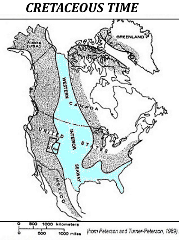
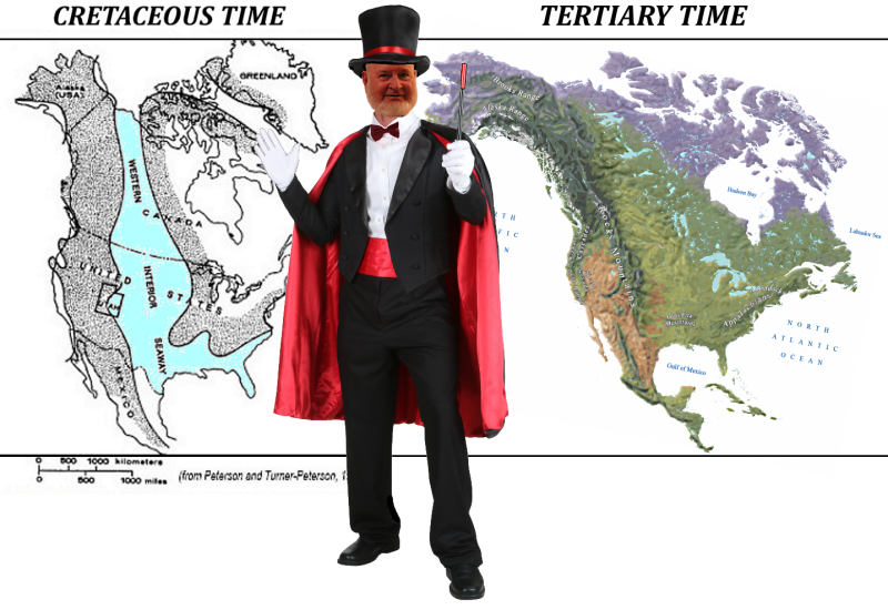
Afterthoughts In all cases they are in Permian shattered siliceous Limestone, about 1,000 feet long and 50 foot wide and 10 feet deep running form northwest to southeast all of aluminum phosphate and water with a small amount of trivalent chromium which tells me that they had a common origin. That fits in with my theory of the Midas Comet which barely grazed earth's surface to end Jurassic time and start the Cretaceous. In my mind I see a huge water balloon a thousand miles in diameter, Entering at a 1 degree angle, never more than 10 miles in contact with earth, continually shoving the continent down into the mantle, the continent rebounding, like a basketball dribbling down the court, but the continent is doing the dribbling, not the comet.  It pushed 100 miles of compressed atmosphere in front of it, makes first contact at the Beaufort Sea and pushed sea water and air into Canada/Yukon, starting flat thin thrust faulting  and rolled toward the southeast into Idaho and Montana depositing bits of it's DNA of vanadium, uranium, copper, gold, silver, lead, tin, Molybdenum etc. along the way. Remember this comet is mostly water Ice, the friction of contact heats the surface into steam with perhaps up to 5-10 miles liquid water with metal asteroids and small parts of other metals here and there. Gold, vanadium, uranium etc. in Canada, the Yukon and Alaska. then deposits in Idaho and Montana, Wyoming, Colorado, Utah and Nevada, and California. That explains How and Why there is gold on the mountain tops!    At 20-50 miles per second, it is bouncing fast! The atmosphere has stripped away the water from the leading part of the comet and it his Utah, creating Upheaval Dome followed by a cloud of vanadium, uranium and bits of copper to create the 60 mile diameter ring of Impact Funnels known as Uranium Folds by 1950 miners, actually whole trees, stripped of their leaves and limbs, driven into the ground and impregnated with vanadium, uranium and various rare earth minerals.  The shock waves created a standing Wave between Upheaval and the fault below the Colorado River to generate heat to explode Roberts Rift.  This explains the sudden appearance of Uranium over a long distance at te beginning of Cretaceous Time.  It dug a trench, the beginnings of the Rocky mountains.  In Utah it hit Brigham City, Ogden, Antelope Island, Salt Lake City, Provo  here is the main Variscite area. by Bingham Canyon. Where it says South Rim is Amitrice Hill, The red pin is at Mercur, Sparrowhawk, and Golden Gate, South of there is The Little Green Giant.  The waters from the Beaufort Sea poured into the trench creating the seaway.  The continent shattered into two peaces, pressed together by pressure from the widening Atlantic ocean, lower sections being driven into and below the same layers creating repeat Geography (the Laramide Orogeny) during all of creations Time. the Asteroid removed layers of Jurassic and even Triassic Rocks here and there as it hit Wyoming, Utah, Arizona (stripped down to bed rock) the same in Old Mexico. It continued into the Pacific ocean, converting the seafloor into andesite, which was later shoved up onto South America as the Andes Mountains containing Tin and Copper, silver, gold Porphyry Rocks. Still moving faster than 11 Miles per second,it exited back into space, and in y mind later smashed head long into Venus, which is why that planet is so hot. When the Asteroid hit Yucatan and ended cretaceous Time, the shock waves allowed the two pieces to disconnect and reconnect rise to form the Rocky Mountains and replace the seaway.  A perfect Explanation of all of the above! |
|
|
|
Post by parfive on Sept 8, 2024 12:30:30 GMT -5
|
|