Post by churross on Aug 18, 2008 21:19:41 GMT -5
1184: A Rockhound Roadtrip
Friday, 9:00 a.m.: The Power of Inverse
The last time I attempted to skirt the consequences of driving through LA county, we left home an hour and a half late, at 11:30 a.m. and arrived at Jalama Beach at 6:45 p.m. Now I've set the bar at 9:00 a.m., when the bank opens. I've made arrangements to pickup my check an hour before I officially can, figure we'll have the car packed and gassed and on the road after a quick bank drive through. My wife, Victoria, is bathing the Yorkshire Terrier we've decided to take with us (and then proceed to hand off responsibility for the entire trip prefaced with, "It was YOUR idea to take him…") . Bathing the Yorkshire Terrier we are taking to the beach.

Shampooing, at the hour we were scheduled to leave, the soon to be sandy salty Yorkie. Add confused to all of the other things I am running around doing trying to get out of the house, but I say nothing. Maybe too confused to begin to try to sort out sense. I keep packing, watering plants, etc.
Friday 10:00 a.m. Inverse Squared
Back from the bank where I've finished the 'on our way of town' errands, I return home to the unfinished preparation activities. Victoria's in the bathroom, getting stuff together I guess as I keep chugging along. After about ten minutes and looking for sunscreen, I poke my head around the door of the bathroom. Victoria is sitting comfortably on the bathroom floor talking to her mother on the phone. Since I am the recipient of the joy of sitting in rush hour traffic in a manual shift car gridlocking gears and clutch up and down for hours in the baking sun listening to newsradio so as not to get caught in the caughtness I'm already in, I immediately sense a conspiracy because it appears that my wife is doing the exact opposite of whatever needs to be done to facilitate our exit. She's not wild about rocks, tolerant would be kind, maybe she's caught wind of the true nature of our 'weekend nature getaway' and is getting even.
"I'm talking to my mom. I haven't talked to her all week and she called."
Can you tell her you'll call her from your cell phone in fifteen minutes when we're on the road?"
"Scott! She's my mom."
Conspiracy proven, but we are on the road at 10:30 with the biggest "shoulda' remembered that" from leaving the thermostat at 81 degrees instead of turning it up or off. So much for the costs savings factored into the trip.
Friday 10:42 a.m.: "San Diego's That Way"
"Yeah, but I thought we'd go back to that one beach we stopped at on the way to San Francisco, the first one, past Santa Barbara."
"Is this a rock trip?"
"Honey, I showed you where we were going on the map, I talked it over with you. We're going to be outside enjoying nice temperatures and nature all weekend. Yes, there's rocks at these spots, but it's really just about getting away from home."
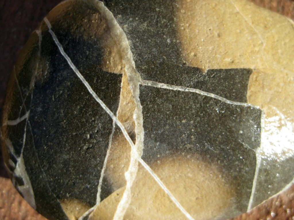
It's a rock trip alright. First stop Jamala Beach, home to the very rare piece of nephrite jade, the more common root beer agate, and my personal favorite, an eggshell colored chert that gets rounded in the 15-35 grit tumbler, otherwise known as the beach, into a crushed, but somehow reconstituted dinosaur egg of surprising smoothness and later, surprising polish.
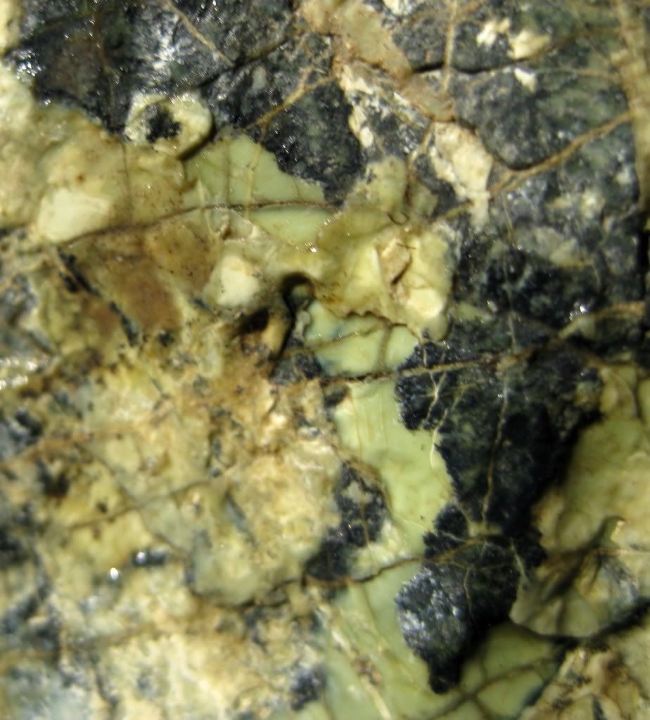
The second stop is a run and gun stop up Figueroa Mountain Road past Los Olivos to grab a batch of nice hard serpentine.
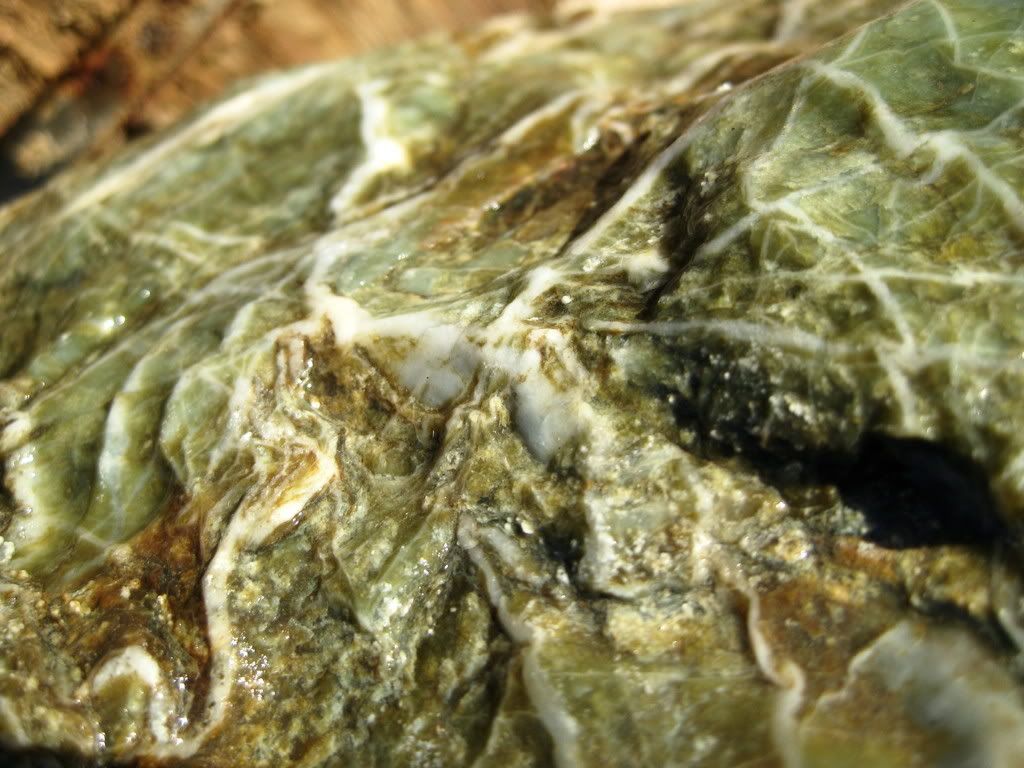
The next stop on this three day weekend is going to be an exploratory trip to the Clear Creek Management Area to check the areas still open for rockhound opportunities.
An Animal House inspired road trip to escape the oppression, not of Dean Wormer's revoking the fraternity charter, but the 105-115 degree daily grind, beginning its third month, of an El Centro summer. Off to Lompoc…
Saturday, 7:56 a.m.: How Surf Beach Earned Its Name
Mini-trip for the Yorkie, Babaloo, and I as Victoria appreciates a 10:00 a.m. function time on weekends. Since Jalama Beach, 45 minutes to the south and west is renowned for rocks and too far for a preview run before Victoria gets ready, we take the 10 mile power run through Vanderburg Airforce Base to the County Beach and Surf Beach, the city beach. It's a beautiful central cal beach morning, a nice breeze, cloudy, and 57 degrees, the perfect weather to break a summer heat doldrums moment.
Windows down, cruising the Cal coast. County beach is closed. As in CLOSED, like for eternity or something. They should remove it from the sparkly new hi-gloss area magazine map. Surf Beach right down the road, pull a semi-swerve in and out of the county beach road and keep moving. It's a coastal Amtrak station, with an ATM ticket kiosk. You'd need someone to give you a ride from here. OK, we'll cross the tracks over to this gate and…strike 1, it is sandy, no rocks.
Oh well. Keep walking. Ooooo, strike two, it doesn't open until 8:00 a.m., how can it be renowned for its fishing (as it says in the colorful descriptive sign next to the kiosk). Checking my pine tar, taking a couple of practice cuts and digging back in I wait for the next pitch, a big NO FISHING sign, fouled that one off, I didn't bring the gear this time. There's the wind up and the pitch; another big sign NO DOGS and lots of zeroes after the fine amount and a big lumbering old dude kind of scanning the area prior to the 8:00 a.m. unlocking of the gate. But to whom? The seven on the platform are train takers, plus the guy, Babaloo, and I.
A moment of splendid insight: Surf Beach, thus named because the only thing on the beach is the only thing they couldn't disallow, the surf. Babaloo leaves a healthy doo doo on the sidewalk next to my car in the parking lot, not wanting to tempt the finers; I flick it into the ice plants with a small stick.
Saturday, 9:10 a.m. Flip Flops and Poison Oak: A Tale of Whoa
The shiny magazine map shows another county park not too far from town,
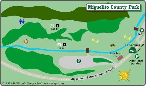
Babaloo and I park and look for rocks. The only rocks are in the walls of a narrow creek bed. There are signs that say "Stay Out Of Creek", but nothing that says stay out of the ravine, we scramble down and Babaloo is not very comfortable. He does not like moving water it seems. He rivets himself to a spot; that's fine with me. I start looking along the edges and viola, the same rocks that are found at Jamala Beach only pre-ocean tumbling. I find a couple of nice agates, bigger than fist size. ..

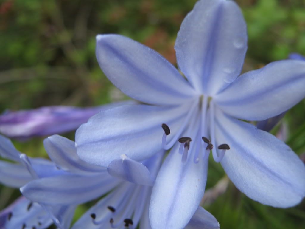
I also explore a side creek bed that's dry. I notice the flip flops aren't too protective as I'm trying to avoid walking through too many plants, a mental note that is repaid in redness, swelling, pustules and itching by Saturday night into Sunday and Monday. Walking in the ocean later probably helped quite a bit. These are the plants that tricked me into stepping on the poison oak:

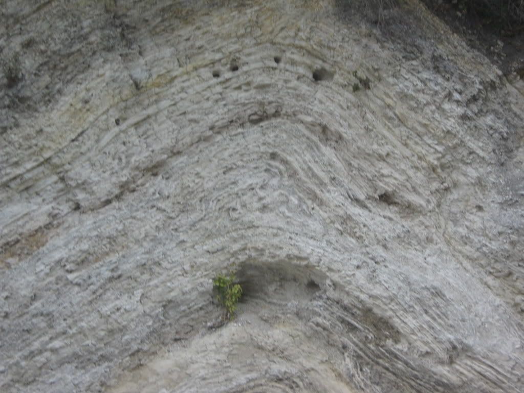
We drive back, stopping to take a picture of layers of rock that have been folded into a W shape. I'm imagining a poster saying "I'm as flexible as rock."
Saturday, 10:45 a.m. Which came first, the Beach or the Burger?

Alternate Title: Where's all the Rocks or Who Cares, We'll Spend All Day Here

Jamala Beach rules: for 8 bucks you get this nearly unpopulated beach, even on a sunny summer weekend, out of cell phone range.
Stopped there this spring, rocks from here to there and back. All gone now, but as the title suggests we are also glad to hang out and look. We find them about two miles down the beach trapped behind some near shore boulders.
A couple of pictures,
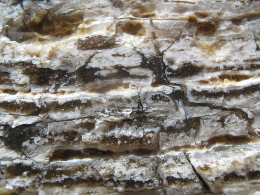

a bag of rocks and we're on our way back to try the Jalama Beach Hamburger. It (the hamburger, not the beach) is delicious, well-balanced so everything can be tasted with finely shredded lettuce, very apt to name the beach after it. The camera starts making strange noises, something about not liking beaches.
Saturday 4:46 p.m.: Los Olivos
Figueroa Mountain Road is my kind of road. There is no posted speed limit. There are no signs advising of any dangerous curves. It is essentially a serpentine two way, 1.5 lane driving concentration exercise. After passing some road cuts that I can't park at, we come to an exposed hilltop of greenish serpentine. The intensity of the road, and some ominous sign about needing some permit thing to be in US Forest Service land (which, if you're reading this in an official place is too busy to read at 40 mph ergo not helping) led me to stop here, grab my rocks


And head back down the road. Passed a CHP about a mile back down. Must enjoy mountain driving. Drive to Coalinga,

eat sleep.
Sunday: 6:38 a.m.: Yes Martha, There's Rocks on the Condon Peak Trail
Setting of with the Yorkie in tow, I went to discover if the Clear Creek Management area closure was somehow mitigated by the remaining open areas, foremost the Condon Peak trailhead. Also, it seems like with every pass at an area I become more in tuned to where the rocks are, what they look like and how to find them, so a quick trip in the morning before Victoria is up and going into the hills followed by a second trip up there with her doubles the exposure for this event. Off we go.
Driving up Los Gatos Road, I seem to hit a thermocline where the temperature is climbing in relation to my increasing altitude at a fixed rate so it stays 63 degrees for almost the entire trip and not to foretell my hand, but boy I wished it had stayed at 63 degrees.
The trailhead is mostly uphill, usually quite steep and sometimes worse. After the first uphill ridge I doubt its 63 degrees. I'm huffing, sweating. The Yorkie is riding in the newspaper/rock gathering bag quite comfortably. The dirt is mostly grass covered but has fractures of 3 inch cracks.
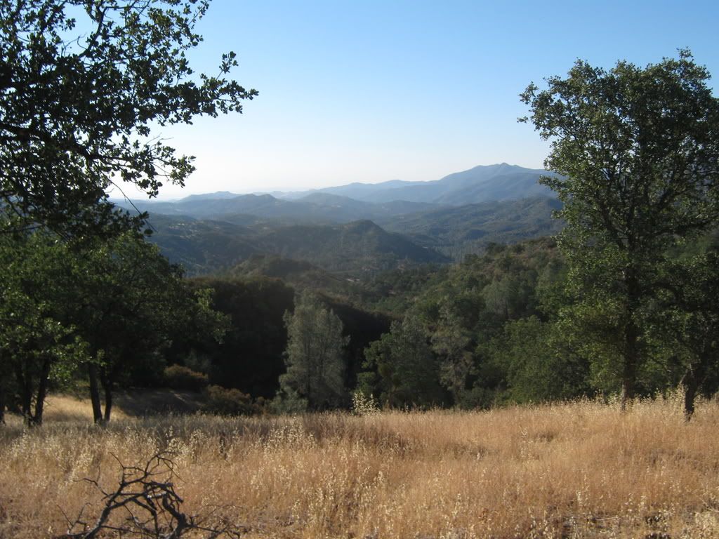
I know this area is uplifting rapidly (18 inches a year) and wonder if this is moisture loss or uplift and try not to sprain my ankles while lost in pondering this. And this is the last real time picture as the camera's strange noises equaled lens motor failure, something about sand and salt water.
Up in the sun, nice view, toasting, shirt soaked, no rocks yet. Will this be my final entry I wonder? There is a lot of animal shit up here, stacks of dog turd shaped crap at regular intervals along the trail, wild pig crap mounds under the tore up floor of the oak tree shade, and then a fresh pile along the trail. Light brown and full of berries and steaming fresh. I find a sharp pointed and solid stick to tag along for company, thinking that mostly bears eat berries like that. And start making more noise. And wish I had a real dog.
Ooooo…rocky outcrops, finally a start, after three miles like straight uphill. Mostly basic rock, a couple of pieces look like the rare and valuable nondescript brown jasper. Wait, after another mile (I've got GPS, I'm not exaggerating) and 700 ft. in altitude (GPS!) a serpentine outcrop, just like the serpentine I gathered at carside yesterday only not as nice. Now we're talking. I start paying attention. Another couple of uphills and the red jaspery stuff starts showing up. Another couple and it begins to turn green. I didn't think it could get steeper (or more steep I suppose), but it is and looking forward on the trail hurts ones neck as it is basically straight up. Looking sideways I see some of the red to green stones are even more green and see an outcropping tip of a nice green one.
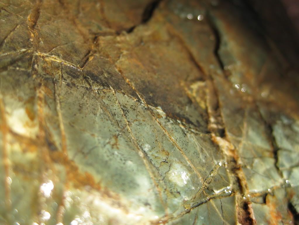
Deciding enough is enough I dig it, at about 30 pounds and its three buddies, another 40 pounds out and throw them into the rock bag displacing the Yorkie and joining the few smaller rocks I had picked up along the way. Drink bottled water knowing I'm headed back. Don't litter (there's enough trash to notice already).
Now I begin the descent with a bag full of rocks. Steep downhill actually worse than the uphill, compounded by the weight of the rocks. I know why running shoes aren't used for hiking, at least one reason. On steep downhill trails, your entire weight gets thrown into the toe of your shoe where running shoes lack the support of hiking boots. So the front of your foot begins to ooze between the nylon mesh in neat diamond patterns after a while.
Bright idea: let the rocks slide down the steep downhill with you holding the strap so they don't tumble out of the bag. Good for the back and butt, not so good for the bag. Plus I'm having to carry the Yorkie. So to recap: carrying the rocks, except on steep declines of which there are a bunch, carrying the Yorkie, rock bag disintegrating rapidly, down to the four big rocks.
Bear alert: rock bag strap on top of head, head lowered, visor blocking view of more than a couple of feet ahead of me. Feeling like cougar bait I manage to tear the visor strap, ruining my face shade. Did I mention it is hot and I am walking into the sun? I am. Still, I am no man's folly to the predators; I am dangerous and alert. Bag gives out a mile from the car and rocks all fall out. Somehow tie tore out bottom of bag, continue on. GPS is making happy end of trail signs. See car. Drink big water. Drive to hotel. Rinse. Repeat.
Sunday 11:46 a.m. Brief Reprise
Head back up to the Clear Creek area, looking for the little spot where Bureau of Land Management land overlaps the San Benito River, right next to the county line. Los Gatos/Old Coalinga is another ballsy road of minimal warnings and nothing as structured as a speed limit sign. I bet San Benito County is livid at the BLM closure of Clear Creek Rec. Area because their road into the area is brand new and beautiful, designed to carry all those beer buying offroaders into the back country. We're alone on the road, so lonely we feel compelled to wave to the two pick-up trucks going the opposite direction on the fifty minute drive. They wave too.
Going slow enough to find the spot, we find it. Victoria is ready to head home, so I know this is my big shot (I was hoping to search another creek bed above Clear Creek and the San Benito where it meets Clear Creek. Also I had thought about asking permission of the ranchers on the 2.3 miles of Clear Creek before BLM land for permission to rockhound, big plans for 2:00 p.m. on Sunday and seven hours from home). So we stop, it is 90 degrees now. I move quick knowing I'm on a teetering on the edge of rockhounding more than vacationing. I find a few rocks including a promising smini-boulder and quickly pack the car beyond weight capacity. Here's a few…


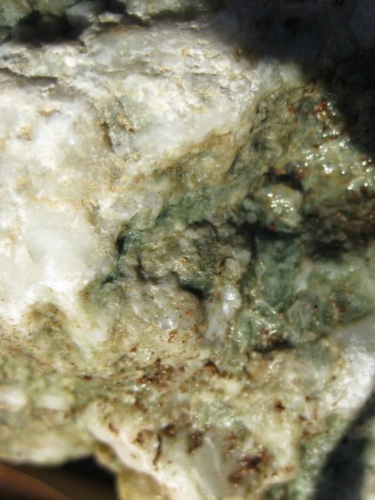

The last one's the mini-boulder, about 60 lbs. Pick 'em up, throw them in and drive home. Trip odometer turning the last block for home: 1184.
_________________<a
Friday, 9:00 a.m.: The Power of Inverse
The last time I attempted to skirt the consequences of driving through LA county, we left home an hour and a half late, at 11:30 a.m. and arrived at Jalama Beach at 6:45 p.m. Now I've set the bar at 9:00 a.m., when the bank opens. I've made arrangements to pickup my check an hour before I officially can, figure we'll have the car packed and gassed and on the road after a quick bank drive through. My wife, Victoria, is bathing the Yorkshire Terrier we've decided to take with us (and then proceed to hand off responsibility for the entire trip prefaced with, "It was YOUR idea to take him…") . Bathing the Yorkshire Terrier we are taking to the beach.

Shampooing, at the hour we were scheduled to leave, the soon to be sandy salty Yorkie. Add confused to all of the other things I am running around doing trying to get out of the house, but I say nothing. Maybe too confused to begin to try to sort out sense. I keep packing, watering plants, etc.
Friday 10:00 a.m. Inverse Squared
Back from the bank where I've finished the 'on our way of town' errands, I return home to the unfinished preparation activities. Victoria's in the bathroom, getting stuff together I guess as I keep chugging along. After about ten minutes and looking for sunscreen, I poke my head around the door of the bathroom. Victoria is sitting comfortably on the bathroom floor talking to her mother on the phone. Since I am the recipient of the joy of sitting in rush hour traffic in a manual shift car gridlocking gears and clutch up and down for hours in the baking sun listening to newsradio so as not to get caught in the caughtness I'm already in, I immediately sense a conspiracy because it appears that my wife is doing the exact opposite of whatever needs to be done to facilitate our exit. She's not wild about rocks, tolerant would be kind, maybe she's caught wind of the true nature of our 'weekend nature getaway' and is getting even.
"I'm talking to my mom. I haven't talked to her all week and she called."
Can you tell her you'll call her from your cell phone in fifteen minutes when we're on the road?"
"Scott! She's my mom."
Conspiracy proven, but we are on the road at 10:30 with the biggest "shoulda' remembered that" from leaving the thermostat at 81 degrees instead of turning it up or off. So much for the costs savings factored into the trip.
Friday 10:42 a.m.: "San Diego's That Way"
"Yeah, but I thought we'd go back to that one beach we stopped at on the way to San Francisco, the first one, past Santa Barbara."
"Is this a rock trip?"
"Honey, I showed you where we were going on the map, I talked it over with you. We're going to be outside enjoying nice temperatures and nature all weekend. Yes, there's rocks at these spots, but it's really just about getting away from home."
It's a rock trip alright. First stop Jamala Beach, home to the very rare piece of nephrite jade, the more common root beer agate, and my personal favorite, an eggshell colored chert that gets rounded in the 15-35 grit tumbler, otherwise known as the beach, into a crushed, but somehow reconstituted dinosaur egg of surprising smoothness and later, surprising polish.

The second stop is a run and gun stop up Figueroa Mountain Road past Los Olivos to grab a batch of nice hard serpentine.

The next stop on this three day weekend is going to be an exploratory trip to the Clear Creek Management Area to check the areas still open for rockhound opportunities.

An Animal House inspired road trip to escape the oppression, not of Dean Wormer's revoking the fraternity charter, but the 105-115 degree daily grind, beginning its third month, of an El Centro summer. Off to Lompoc…
Saturday, 7:56 a.m.: How Surf Beach Earned Its Name
Mini-trip for the Yorkie, Babaloo, and I as Victoria appreciates a 10:00 a.m. function time on weekends. Since Jalama Beach, 45 minutes to the south and west is renowned for rocks and too far for a preview run before Victoria gets ready, we take the 10 mile power run through Vanderburg Airforce Base to the County Beach and Surf Beach, the city beach. It's a beautiful central cal beach morning, a nice breeze, cloudy, and 57 degrees, the perfect weather to break a summer heat doldrums moment.
Windows down, cruising the Cal coast. County beach is closed. As in CLOSED, like for eternity or something. They should remove it from the sparkly new hi-gloss area magazine map. Surf Beach right down the road, pull a semi-swerve in and out of the county beach road and keep moving. It's a coastal Amtrak station, with an ATM ticket kiosk. You'd need someone to give you a ride from here. OK, we'll cross the tracks over to this gate and…strike 1, it is sandy, no rocks.
Oh well. Keep walking. Ooooo, strike two, it doesn't open until 8:00 a.m., how can it be renowned for its fishing (as it says in the colorful descriptive sign next to the kiosk). Checking my pine tar, taking a couple of practice cuts and digging back in I wait for the next pitch, a big NO FISHING sign, fouled that one off, I didn't bring the gear this time. There's the wind up and the pitch; another big sign NO DOGS and lots of zeroes after the fine amount and a big lumbering old dude kind of scanning the area prior to the 8:00 a.m. unlocking of the gate. But to whom? The seven on the platform are train takers, plus the guy, Babaloo, and I.
A moment of splendid insight: Surf Beach, thus named because the only thing on the beach is the only thing they couldn't disallow, the surf. Babaloo leaves a healthy doo doo on the sidewalk next to my car in the parking lot, not wanting to tempt the finers; I flick it into the ice plants with a small stick.
Saturday, 9:10 a.m. Flip Flops and Poison Oak: A Tale of Whoa
The shiny magazine map shows another county park not too far from town,

Babaloo and I park and look for rocks. The only rocks are in the walls of a narrow creek bed. There are signs that say "Stay Out Of Creek", but nothing that says stay out of the ravine, we scramble down and Babaloo is not very comfortable. He does not like moving water it seems. He rivets himself to a spot; that's fine with me. I start looking along the edges and viola, the same rocks that are found at Jamala Beach only pre-ocean tumbling. I find a couple of nice agates, bigger than fist size. ..

I also explore a side creek bed that's dry. I notice the flip flops aren't too protective as I'm trying to avoid walking through too many plants, a mental note that is repaid in redness, swelling, pustules and itching by Saturday night into Sunday and Monday. Walking in the ocean later probably helped quite a bit. These are the plants that tricked me into stepping on the poison oak:


We drive back, stopping to take a picture of layers of rock that have been folded into a W shape. I'm imagining a poster saying "I'm as flexible as rock."

Saturday, 10:45 a.m. Which came first, the Beach or the Burger?

Alternate Title: Where's all the Rocks or Who Cares, We'll Spend All Day Here

Jamala Beach rules: for 8 bucks you get this nearly unpopulated beach, even on a sunny summer weekend, out of cell phone range.
Stopped there this spring, rocks from here to there and back. All gone now, but as the title suggests we are also glad to hang out and look. We find them about two miles down the beach trapped behind some near shore boulders.
A couple of pictures,


a bag of rocks and we're on our way back to try the Jalama Beach Hamburger. It (the hamburger, not the beach) is delicious, well-balanced so everything can be tasted with finely shredded lettuce, very apt to name the beach after it. The camera starts making strange noises, something about not liking beaches.
Saturday 4:46 p.m.: Los Olivos
Figueroa Mountain Road is my kind of road. There is no posted speed limit. There are no signs advising of any dangerous curves. It is essentially a serpentine two way, 1.5 lane driving concentration exercise. After passing some road cuts that I can't park at, we come to an exposed hilltop of greenish serpentine. The intensity of the road, and some ominous sign about needing some permit thing to be in US Forest Service land (which, if you're reading this in an official place is too busy to read at 40 mph ergo not helping) led me to stop here, grab my rocks


And head back down the road. Passed a CHP about a mile back down. Must enjoy mountain driving. Drive to Coalinga,

eat sleep.
Sunday: 6:38 a.m.: Yes Martha, There's Rocks on the Condon Peak Trail
Setting of with the Yorkie in tow, I went to discover if the Clear Creek Management area closure was somehow mitigated by the remaining open areas, foremost the Condon Peak trailhead. Also, it seems like with every pass at an area I become more in tuned to where the rocks are, what they look like and how to find them, so a quick trip in the morning before Victoria is up and going into the hills followed by a second trip up there with her doubles the exposure for this event. Off we go.
Driving up Los Gatos Road, I seem to hit a thermocline where the temperature is climbing in relation to my increasing altitude at a fixed rate so it stays 63 degrees for almost the entire trip and not to foretell my hand, but boy I wished it had stayed at 63 degrees.
The trailhead is mostly uphill, usually quite steep and sometimes worse. After the first uphill ridge I doubt its 63 degrees. I'm huffing, sweating. The Yorkie is riding in the newspaper/rock gathering bag quite comfortably. The dirt is mostly grass covered but has fractures of 3 inch cracks.

I know this area is uplifting rapidly (18 inches a year) and wonder if this is moisture loss or uplift and try not to sprain my ankles while lost in pondering this. And this is the last real time picture as the camera's strange noises equaled lens motor failure, something about sand and salt water.
Up in the sun, nice view, toasting, shirt soaked, no rocks yet. Will this be my final entry I wonder? There is a lot of animal shit up here, stacks of dog turd shaped crap at regular intervals along the trail, wild pig crap mounds under the tore up floor of the oak tree shade, and then a fresh pile along the trail. Light brown and full of berries and steaming fresh. I find a sharp pointed and solid stick to tag along for company, thinking that mostly bears eat berries like that. And start making more noise. And wish I had a real dog.
Ooooo…rocky outcrops, finally a start, after three miles like straight uphill. Mostly basic rock, a couple of pieces look like the rare and valuable nondescript brown jasper. Wait, after another mile (I've got GPS, I'm not exaggerating) and 700 ft. in altitude (GPS!) a serpentine outcrop, just like the serpentine I gathered at carside yesterday only not as nice. Now we're talking. I start paying attention. Another couple of uphills and the red jaspery stuff starts showing up. Another couple and it begins to turn green. I didn't think it could get steeper (or more steep I suppose), but it is and looking forward on the trail hurts ones neck as it is basically straight up. Looking sideways I see some of the red to green stones are even more green and see an outcropping tip of a nice green one.

Deciding enough is enough I dig it, at about 30 pounds and its three buddies, another 40 pounds out and throw them into the rock bag displacing the Yorkie and joining the few smaller rocks I had picked up along the way. Drink bottled water knowing I'm headed back. Don't litter (there's enough trash to notice already).
Now I begin the descent with a bag full of rocks. Steep downhill actually worse than the uphill, compounded by the weight of the rocks. I know why running shoes aren't used for hiking, at least one reason. On steep downhill trails, your entire weight gets thrown into the toe of your shoe where running shoes lack the support of hiking boots. So the front of your foot begins to ooze between the nylon mesh in neat diamond patterns after a while.
Bright idea: let the rocks slide down the steep downhill with you holding the strap so they don't tumble out of the bag. Good for the back and butt, not so good for the bag. Plus I'm having to carry the Yorkie. So to recap: carrying the rocks, except on steep declines of which there are a bunch, carrying the Yorkie, rock bag disintegrating rapidly, down to the four big rocks.
Bear alert: rock bag strap on top of head, head lowered, visor blocking view of more than a couple of feet ahead of me. Feeling like cougar bait I manage to tear the visor strap, ruining my face shade. Did I mention it is hot and I am walking into the sun? I am. Still, I am no man's folly to the predators; I am dangerous and alert. Bag gives out a mile from the car and rocks all fall out. Somehow tie tore out bottom of bag, continue on. GPS is making happy end of trail signs. See car. Drink big water. Drive to hotel. Rinse. Repeat.
Sunday 11:46 a.m. Brief Reprise
Head back up to the Clear Creek area, looking for the little spot where Bureau of Land Management land overlaps the San Benito River, right next to the county line. Los Gatos/Old Coalinga is another ballsy road of minimal warnings and nothing as structured as a speed limit sign. I bet San Benito County is livid at the BLM closure of Clear Creek Rec. Area because their road into the area is brand new and beautiful, designed to carry all those beer buying offroaders into the back country. We're alone on the road, so lonely we feel compelled to wave to the two pick-up trucks going the opposite direction on the fifty minute drive. They wave too.
Going slow enough to find the spot, we find it. Victoria is ready to head home, so I know this is my big shot (I was hoping to search another creek bed above Clear Creek and the San Benito where it meets Clear Creek. Also I had thought about asking permission of the ranchers on the 2.3 miles of Clear Creek before BLM land for permission to rockhound, big plans for 2:00 p.m. on Sunday and seven hours from home). So we stop, it is 90 degrees now. I move quick knowing I'm on a teetering on the edge of rockhounding more than vacationing. I find a few rocks including a promising smini-boulder and quickly pack the car beyond weight capacity. Here's a few…


The last one's the mini-boulder, about 60 lbs. Pick 'em up, throw them in and drive home. Trip odometer turning the last block for home: 1184.
_________________<a


 ;D
;D


