rbush
starting to spend too much on rocks

Member since February 2008
Posts: 116
|
Post by rbush on May 19, 2009 11:08:27 GMT -5
|
|
|
|
Post by NatureNut on May 19, 2009 11:29:42 GMT -5
Oh now that was a nice excursion and an even nicer haul. Thanks for taking us along. Jo
|
|
Sabre52
Cave Dweller  Me and my gal, Rosie
Member since August 2005
Posts: 20,487
|
Post by Sabre52 on May 19, 2009 14:11:54 GMT -5
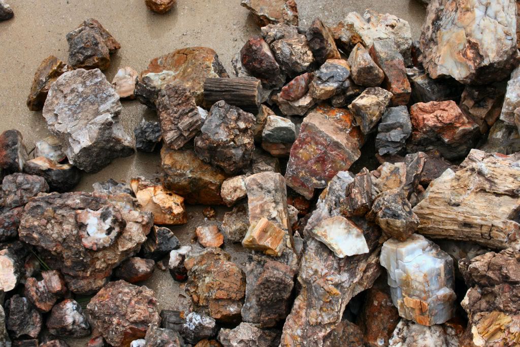
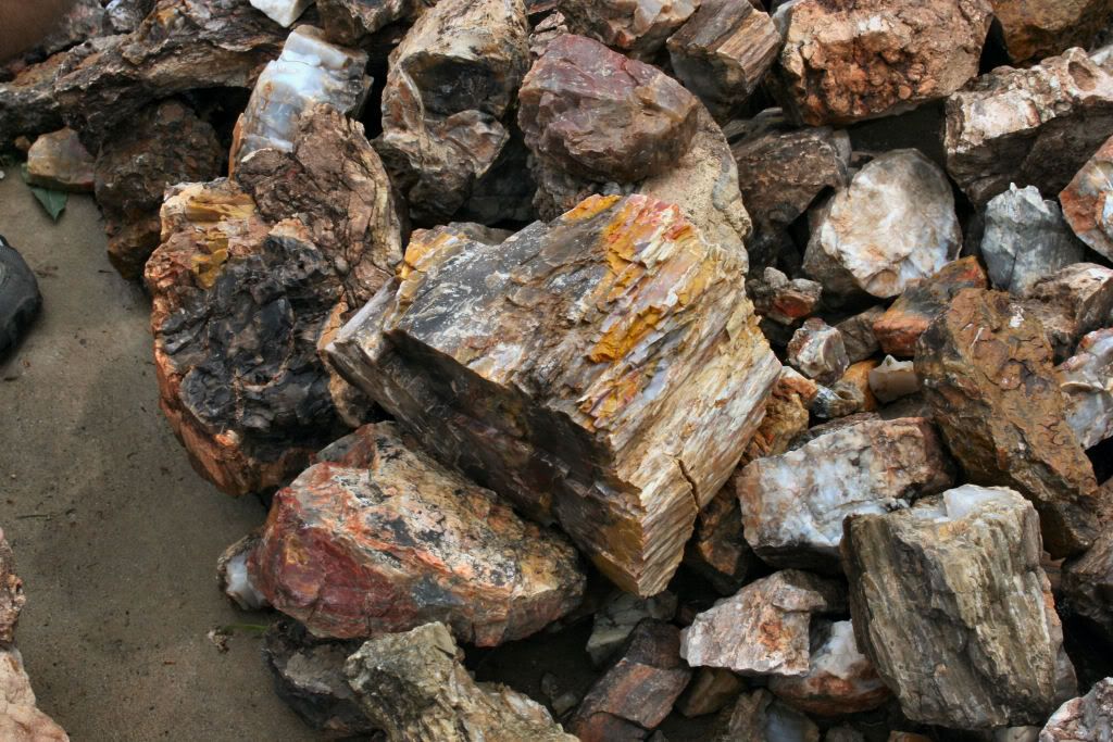
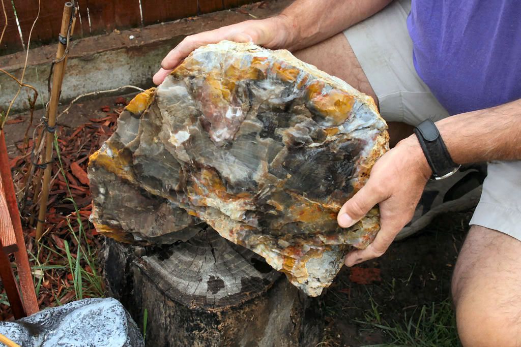
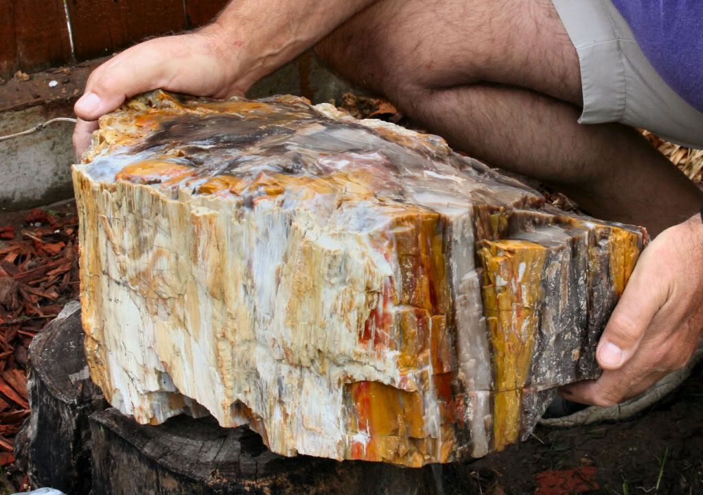
Now this is why I love field trip reports! Beautiful photos and what a haul. That Henry Mountains Morrison formation material looks the same as or very much like the Arizona stuff from the Chinle. Those colors really pop.......Mel
|
|
adrian65
Cave Dweller
Arch to golden memories and to great friends.
Member since February 2007
Posts: 10,787
|
Post by adrian65 on May 19, 2009 14:35:26 GMT -5
Beautiful landscapes and the pet woods you found are amazing!
Adrian
|
|
rbush
starting to spend too much on rocks
Member since February 2008
Posts: 116
|
Post by rbush on May 19, 2009 19:11:16 GMT -5
Adrian, I just knew you would like those pet wood pics, I had you in mind when I was posting them.
|
|
stoneviews
fully equipped rock polisher

Member since April 2009
Posts: 1,864
|
Post by stoneviews on May 19, 2009 19:20:21 GMT -5
Looks like you had a great trip, beautiful.
|
|
SteveHolmes
fully equipped rock polisher
Member since July 2009
Posts: 1,900
|
Post by SteveHolmes on May 19, 2009 19:31:19 GMT -5
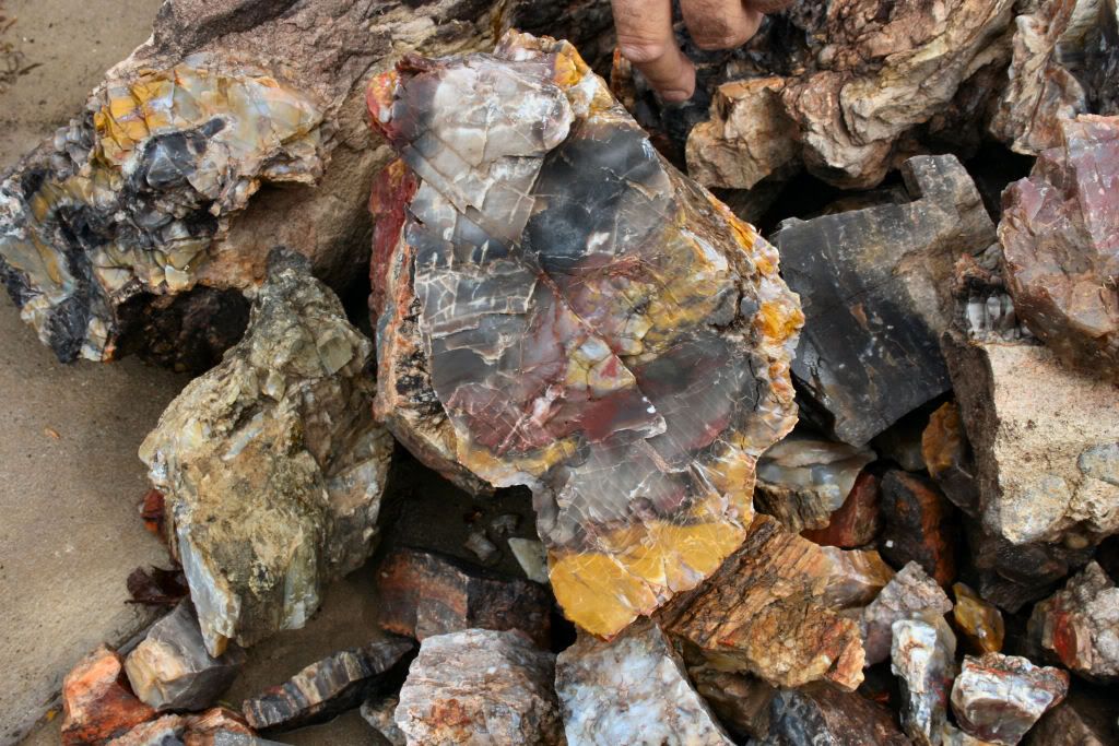
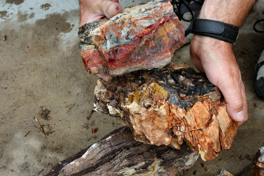
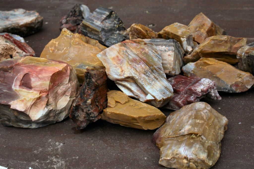
I really need to get down that way...SOOOON! Great haul there....and that big one is quite a FIND! I actuallly like the little one in the 1st pic that looks like a perfect little log. I am going somewhere this weekend and I've been debating Henry Mtns or Green River.....
Steve
|
|
|
|
Post by texaswoodie on May 19, 2009 19:52:08 GMT -5
Fantastic scenery! Steve sent me some Henry Mt wood and it is PURDY.
Curt
|
|
|
|
Post by 150FromFundy on May 19, 2009 20:40:51 GMT -5
Killer material that is definately worth killing yourself hauling out. But, what a place to die.
Amazing colors in the wood from that region.
150FromFundy
|
|
bushmanbilly
Cave Dweller
Member since October 2008
Posts: 4,719 
|
Post by bushmanbilly on May 19, 2009 23:21:01 GMT -5
Nice countryside and haul.
|
|
Saskrock
fully equipped rock polisher
Member since October 2007
Posts: 1,852
|
Post by Saskrock on May 20, 2009 0:46:10 GMT -5
Really really pretty petrified wood. Looks like the stuff at the petrified forest in AZ.
|
|
|
|
Post by Bejewelme on May 20, 2009 7:24:48 GMT -5
WOW, what a great trip!! You found some awesome pieces. We are still hoping you can make Moab in August!!! It will be fun!!!
Amber
|
|
morticiamonroe
starting to spend too much on rocks
Member since October 2008
Posts: 147
|
Post by morticiamonroe on May 20, 2009 7:57:36 GMT -5
Wow, what a haul! I could die happy there... I want to tumble the whole mountain. But first, my driveway....  |
|
|
|
Post by catmandewe on May 20, 2009 8:48:33 GMT -5
Nice Haul!!
That wood is gorgeous, and the scenery is fantastic!!
Thanks for takin us.......................Tony
|
|
|
|
Post by Tonyterner on May 20, 2009 13:18:59 GMT -5
Great scenery and some fantastic rocks. Do you have GPS coordinates that you want to share?
|
|
rbush
starting to spend too much on rocks
Member since February 2008
Posts: 116
|
Post by rbush on May 20, 2009 20:52:33 GMT -5
Amber, I honestly don't know at this point whether we'll make it to Moab or not. It is so beastly hot there in August and I have a real problem with extreme heat. We'll just have to see at that point whether we can do it or not.
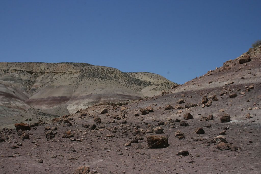
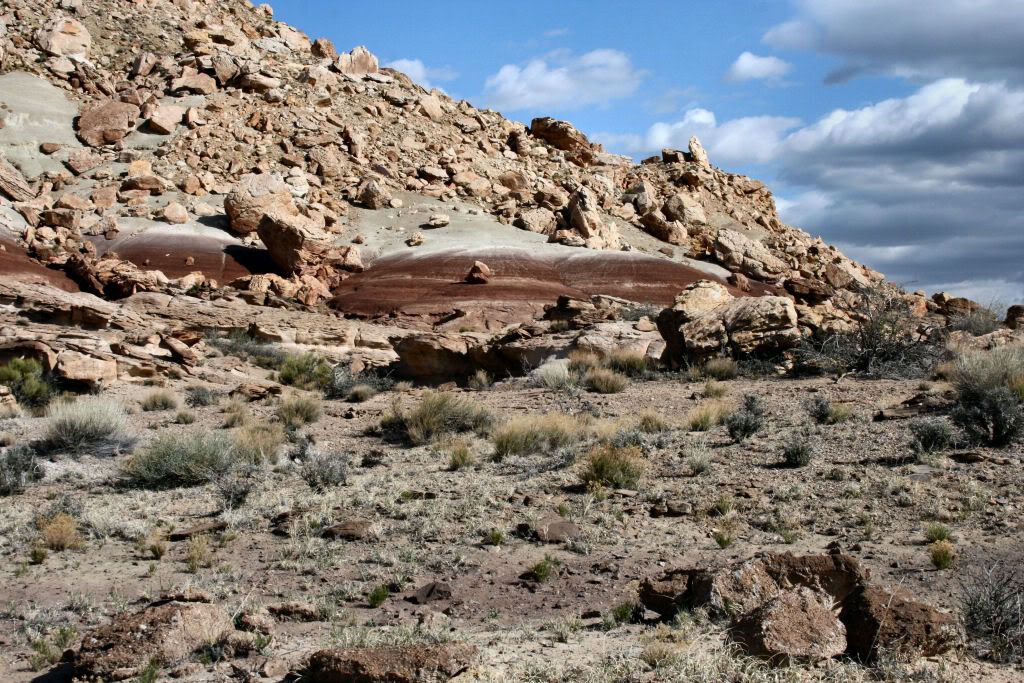
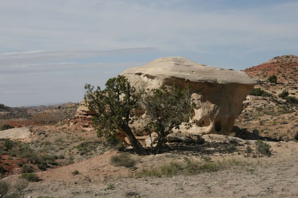
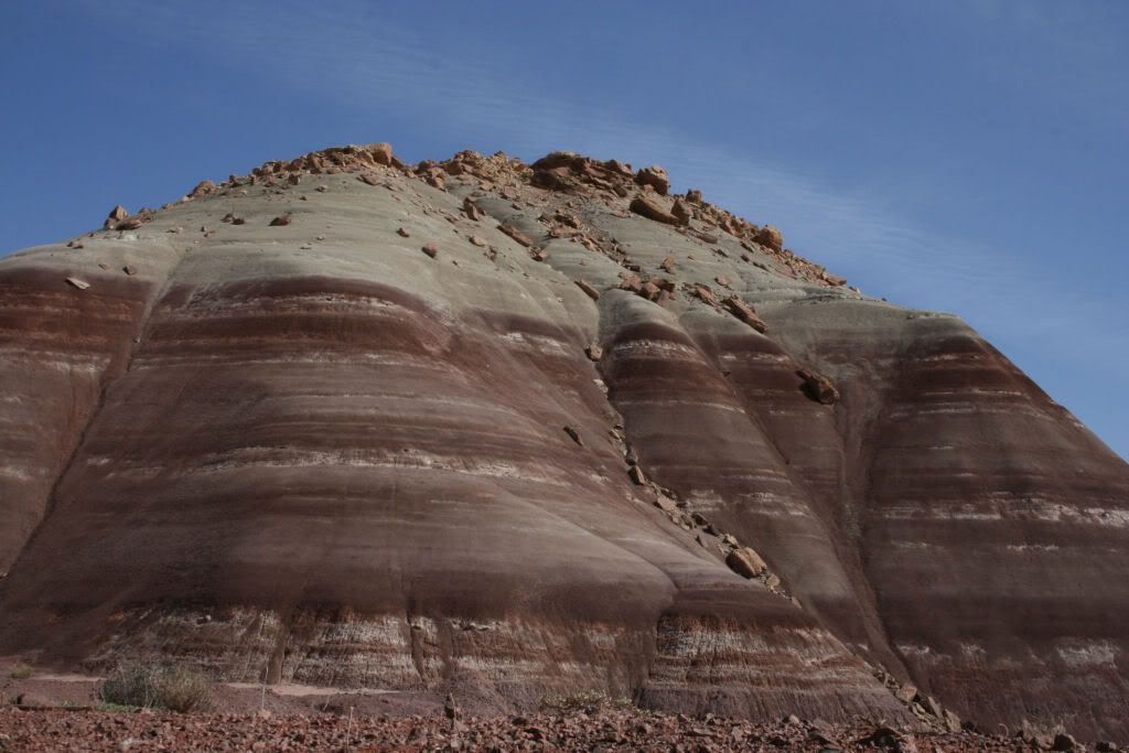
tonyterner, these are the coordinates . 37.49.178 N 110.38.708 W. That should put you at the base of the hill in the foreground of the first picture. The easy way to find it is to take the Starr Springs turnoff from SR 276 at mile 17 (276 is the road south to the Bullfrog Marina from SR 95 which comes south out of Hanksville) that's about 150 miles from Moab to the Starr Springs turnoff. About .8 mile from the highway, an ATV trail crosses the Starr Springs road. There are markers there that say it's the Copper Creek ATV trail, follow this west for a little over a mile. It is a rough road, but some of our team went on it in high clearance 2 wheel drive vehicles. A little over a mile down this road, you will see the Morrison Formation(those purple colored hills in the pictures) we found wood at the lower levels of this and below and for miles south along it. I'm sorry, I rambled a little bit there, but I just took a look at Google Earth and you can even see the purple hills and the trail on their map. If we manage to make it to Moab, I'd be glad to show whoever wants to make the drive.
Tony (Catmandewe), after all the great stuff and trips you have showed us, I'm glad I could return some.
|
|
|
|
Post by Bejewelme on May 20, 2009 22:05:44 GMT -5
I know it will be hot, we will all be nasty, but having fun!! Champagne under the big arch at sunset, be there!! 8/8/09 is the day!! Thanks for telling Tony where to go, if we have time I think he wants to check that area out! Amber |
|
SteveHolmes
fully equipped rock polisher
Member since July 2009
Posts: 1,900
|
Post by SteveHolmes on May 20, 2009 22:06:57 GMT -5
Thanks for posting the directions! How far of a drive is that from Green River??? Maybe a few hours?? I'll be in Green River hunting Saturday and was thinking about driving down that way Sunday for the day.
Steve
|
|
rbush
starting to spend too much on rocks
Member since February 2008
Posts: 116
|
Post by rbush on May 21, 2009 7:55:25 GMT -5
Steve, DeLorme shows that to be just at 100 miles from Green River to the Starr Springs turnoff. Have fun!
|
|
rbush
starting to spend too much on rocks
Member since February 2008
Posts: 116
|
Post by rbush on May 21, 2009 8:52:16 GMT -5
Just to clarify my directions, here's a view from Google earth with my comments. I highlighted the Copper Creek trail in yellow and the X is where we parked, right at the base of the hill that is in the foreground of the first scenery pic. 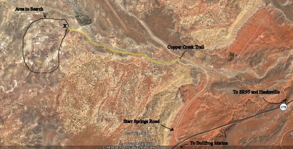 A word of caution, GPS is recommended as there are mining roads and old trails going everywhere and it would be very easy to get confused out there. |
|