|
|
Post by mohs on Apr 21, 2017 20:52:11 GMT -5
Hi Guys 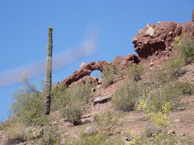 I found this arch on my morning hike this morning. So I post it as just something different While we contemplate this mystery If anyone as any suggestion of what to look for or to photograph on the Cibola phenomena let me know my main question is why are the granites embedded in the red bed chunked up? The bedrock is a single unified mass of granite that the buttes sit atop. Is this the base of the orogenic mountains that crashed violently to the ground? Causing the chunking? O and I found some metaryholite out on the ground. Now I’m not sure where that comes from? My idea is that a granite pluton crashed through the rhyolite bed rock. Metatizing it? Enjoy ! Ed |
|
|
|
Post by mohs on Apr 21, 2017 21:03:13 GMT -5
matter of fact I see comet tale streaking across my arch
mostly
|
|
Deleted
Deleted Member
Member since January 1970
Posts: 0
|
Post by Deleted on Apr 21, 2017 21:16:50 GMT -5
This formation is called "Mormon Rocks". Please any Mormon friends do not take offence. This is the real name for them. They look similar. They are on my way to work every day! 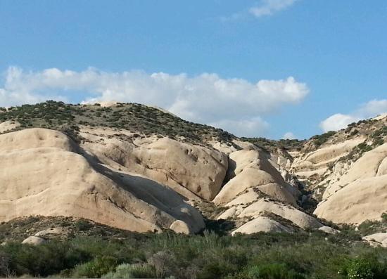 |
|
|
|
Post by 1dave on Apr 22, 2017 6:35:26 GMT -5
@shotgunner The Mormon Rocks appear to be sandstone. is that correct? The "Cibola" Buttes are shattered granite peaks with a THICK mud and boulder cover running in a line from Phoenix to Tempe and Mesa along the Salt River. Other areas? I don't know yet, having never been there. Each of the 7 cities contained a temple, each dedicated to a principle direction - North, South, East, West, Center, Up and Down. They had a long history of several thousand years, farming through irrigation to support a huge population of several hundred thousand. All were destroyed in a short time - irrigation ditches now useless at 18 feet above the river level, buildings knocked down, people buried, hills buried in a single sheet. The "worn out people" of Hohokam.  These were not high speed particles that would have melted or vaporized. They are regular looking rocks and dirt that could have come from a landslide - except they are the local highlands and show no or little erosion. |
|
|
|
Post by 1dave on Apr 22, 2017 7:10:31 GMT -5
An examination of the above map led me in another more likely direction. A flash flood (mostly mud and boulders) from the upper reaches of the Salt River, then water to lower the river level? 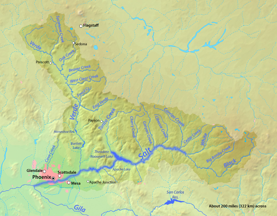 How high would a mud flow need to be to cover Barnes, McDowell and the Papago Buttes? |
|
|
|
Post by mohs on Apr 22, 2017 12:15:49 GMT -5
That serious question Dave
That mudflow had to be of biblical proportions!
The defined path is huge as you noted.
Yet compared to the size of the valley it only accounts for a certain low percent.
Regardless the path is long. At least 7 miles
From the Camel Head Formation to the Tempe buttes
of which ‘A’ Mountain encompasses
How wide? Estimate about 4 miles?
I have vista pictures taken from atop the McDowell Butte in both directions.
North to the Camel Head Formation and southerly to “A” mountain.
One of your posted pictures shows the Camelback vista.
The southerly vista I’ll need to post…
|
|
|
|
Post by mohs on Apr 22, 2017 12:19:44 GMT -5
What caused all those caves/ holes in the buttes?
It would seem that they are the excavated holes of where granite boulders fell from.
It evident that the buttes are brecciaed with serious rock
Through weathering & erosion the boulders would give way from the soft red bed and fall.
This would leave a cavity.
The fine red bed matrix that was holding the rock would granulate out; and gather at the base of the cavity.
As monsoon rains pelted the area it would solidify. Creating an appearance of a melt flow?
But then I’ve got to account for the lack of granite boulders lying on the desert floor.
So the geological conundrum sort of deepens. …mohs
|
|
|
|
Post by mohs on Apr 22, 2017 12:49:55 GMT -5
Here’s a possible scenario
A cataclysmic mud event occurred mya
This left breccia/clastic granite blocks gathered
in the ‘event’ region.
Monsoon rains and erosion over the course of millions of years
turned the mud into silt clay soil ect…
This is the weak part of my hypothesis.
Then the ‘comet tale event’ occurred around 1680.
This scattered the red bed debris .
This would certainly had a devastating effect on the Hohokam/Cibola settlements.
This theory at least accounts for the granite breccias
with out resorting to Aeolian transportation
Question: As anyone done a scientific analysis on the red bed dust to determine its origin?
Is it -- terrestrial or extra terrestrial?
The whole area looks like something from Mars.
The Curiosity rover could easily do the test.
Stay tuned
Moslty6
|
|
metalsmith
Cave Dweller 
Member since October 2012
Posts: 1,537
|
Post by metalsmith on Apr 22, 2017 13:26:33 GMT -5
|
|
Deleted
Deleted Member
Member since January 1970
Posts: 0
|
Post by Deleted on Apr 22, 2017 13:37:20 GMT -5
Where would the sheer volume of material have come from. Forget what moved it. Where did it come from?
|
|
gemfeller
Cave Dweller 
Member since June 2011
Posts: 4,059 
|
Post by gemfeller on Apr 22, 2017 14:47:39 GMT -5
Ed, I downloaded and skimmed the following pdf file. It gives a detailed petrologic analysis of the rocks in the general Phoenix area. It may provide the kind of info you're looking for. I don't know the area well enough to relate the discussion to the specific areas you have in mind but they do mention events which might account for what you're seeing -- but in geologic, not historic time. reynolds.asu.edu/pubs/phx_mtns_field_guide.pdf |
|
|
|
Post by mohs on Apr 22, 2017 15:18:03 GMT -5
Thanks Guys for the links!!! Where would the sheer volume of material have come from. Forget what moved it. Where did it come from? That’s a good question gunner Like asking where did all the sediment from the Grand Canyon deposit ? Where did the massive amount of mud come from? I always thought it came from the Mogollon Rim area. That considered a Transition Zone and the higher elevation makes for logical cataclysmic mud/landslide. down to the Basin Range area of the Valley Perhaps some of this Papago sediment is from Colorado Plateau & formation of the Grand Canyon ? Anyway I think the mudflow came from the northerly higher altitude direction. And I like the alluvial submarine idea But if none of these pan out Then we get back to some sort of aoelian occurrence to account for the dust soil sand ect… Have to admit the South Mountain origin theory for the buttes leaves me wanting. Plus the ‘tifoni’ explanation for the caves? Well... once again were in Aeolian territory Admittedly my explanation for the caves -- comet theory or even a mudslide--- crumbles pretty easily. Ha -- I’m not sure why the gemstone author refers to the ‘red beds” as sandstone? The material I crumbled was much finer than sand ....... |
|
|
|
Post by mohs on Apr 22, 2017 15:31:17 GMT -5
Ed, I downloaded and skimmed the following pdf file. It gives a detailed petrologic analysis of the rocks in the general Phoenix area. It may provide the kind of info you're looking for. I don't know the area well enough to relate the discussion to the specific areas you have in mind but they do mention events which might account for what you're seeing -- but in geologic, not historic time. reynolds.asu.edu/pubs/phx_mtns_field_guide.pdfThanks Rich! That author S.J. Reynold is a serious writer and geologist. I add the below from Wikipedia as interesting side...mostly |
|
|
|
Post by 1dave on Apr 22, 2017 15:44:54 GMT -5
Obviously dust motes trailing Buckaroo Banzai across the 8th dimension.  seriously my best guess is a massive landslide blocking the salt river well upstream. When that became waterlogged it broke loose as perhaps a 10-20 mile long mudflow at perhaps 2-300/hour. it could stay narrow for quite a distance, then the lower points drug away and the river channel deepened s the backed up lake drained. metalsmith the question is what destroyed the cities of Cibola and when. The author gave us a half dozen guesses. it appears to have happened 1500-1684. (94? I don't remember anymore) |
|
|
|
Post by mohs on Apr 22, 2017 16:03:16 GMT -5
Interesting theory Dave!
I’ll do the research
8 dimensions ?
sometimes when I contemplate the Phoenix Phenomenon I enter here
mohs
|
|
|
|
Post by mohs on Apr 22, 2017 16:21:53 GMT -5
As promised here a southerly vista shot of “A” mountain from atop McDowell butte. 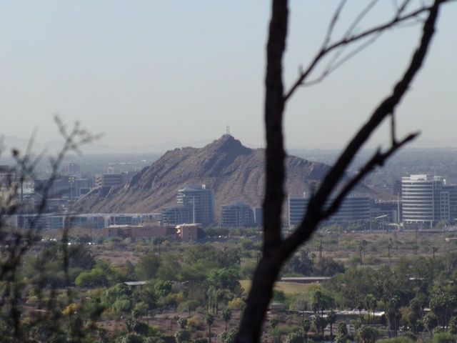 It is deceiving because I’m using zoom. It’s a good 3 miles away and is on the other side of the Salt River. Tempe is consider the boundary for the event Camel Head Formation being the northern boundary Tempe as built up and incredible complex on a manmade lake. |
|
Deleted
Deleted Member
Member since January 1970
Posts: 0
|
Post by Deleted on Apr 22, 2017 17:30:53 GMT -5
The contents of the grand canyon where spread across southern Nevada and Colorado desert south and further into the sea of cortez. Something easily explained by time.
I'm getting the impression from this thread that those millions of cubic yards were set there in a very short period of time.
I will reread the relevant posts regarding the comet. First pass left me empty headed.
|
|
gemfeller
Cave Dweller 
Member since June 2011
Posts: 4,059 
|
Post by gemfeller on Apr 22, 2017 18:14:09 GMT -5
[quote author=" mohs " source="/post/922033/thread" timestamp="1492647303 I’ve spent a lot of time tracking those canals. Amazing that the Hohokam did it without metal. Just stick & stones. [/quote] Ed, an antiquarian's tour of the U.K. is revealing about what can be accomplished without metal tools. I visited Stonehenge a few years ago and an English friend who was kind enough to serve as my guide insisted that we visit the Avebury Complex just a few miles away. While Stonehenge is astonishing in its use of incredibly heavy stones, Avebury is an amazing 425-meter diameter trench, dug into the chalk with no tools but the scapulas of oxen. It's huge and just one of literally dozens of similar trenched hill forts spread throughout the country all dug with bone tools. All date from around 2600 to 1800 B.C. 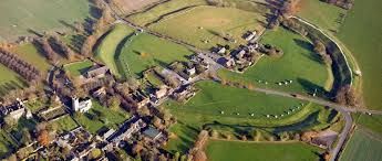 |
|
|
|
Post by 1dave on Apr 22, 2017 21:46:57 GMT -5
@shotgunner impact was just one of several competing possibilities on the abrupt destruction of the Cibola Civilization.
Right now the most convincing for me is a massive mud flow down the salt River.
|
|
|
|
Post by 1dave on Apr 22, 2017 22:09:54 GMT -5
mohs I've been looking at your photo of Papago Arch. Am - a - zing view that I hadn't even heard of! The steep drop was not able to sustain the cohesion on the bottom of the huge mud/rock ball beside it, and the interior of the arch appears to still be laying just below it, not washed away. How high did the following flood waters rise? Near the bottom of the arch? Good view of the top of what came hurtling down canyon. Much better now than then!  Thanks! Dave
|
|