|
|
Post by 1dave on May 8, 2018 9:30:41 GMT -5
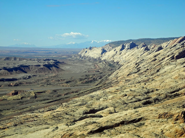
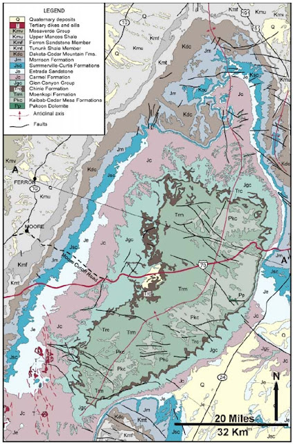
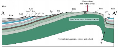
For geologists, ~70 million years ago the Laramide Revolution pushed San Rafael straight up. For me, if that had been the case, the southeastern slope would have been the Mancos Shale, NOT the Salt Wash Member of the Morrison. For me, 150 million years ago a comet impact slid the Jurassic rocks from the Utah/Colorado Border at least 3 miles to the northwest, forming the San Rafael Swell, and buckling the land beyond, creating Castle valley, forcing up the Coal Cliffs, etc. Cool! So, where's the crater? Aye, there's the rub. What does a comet impact site look like? Comets are mostly nebulous Comas with a "dirty snowball" center jammed together over billions of years traveling through deep space filled with supernova remnents, the total having less than half the density of water. First a Google look at the "Swell."  See how everything has been jammed to the northwest? Now the BIG Picture:  MY interpretation MY interpretation is that a multi-lobed comet spiraled in on a low orbit allowing the ice of the central section to melt and become a vanadium/uranium/niobium/tantalum contaminated water balloon. That portion carved out the paradox valley and emplaced the 80 mile radius "Uravan Mineral Belt" centered on Upheaval Dome. The direction of travel is established by Robert's Rift. The northeastern portion produced Eagle Basin and forced up the 2nd Uncompahgre Uplift (and there was a third), while the southern portion created the Zuni Depression. The huge vibrations created sand waves that forced water repeatedly out of the surrounding sandstone creating leisegang lines, goethite pipes, and Moqui Marbles. The waves created the weaknesses that allowed for the later erosion to form Arches National Park. The underlying Paradox Salt Formation allowed the overlying Triassic and Jurassic rocks to be slid north for Dinosaur National Park, northwest for San Rafael, Southwest for Capitol Reef, the waterpocket Fold, and Comb Ridge/Monument uplift. So far the Geology Community ignores the whole thing. The accepted explanation for Uravan is that the uranium came from eroding granite. Why so much in a circular area and very little in the surrounding area before or after? |
|
timloco
has rocks in the head
  
Member since April 2012
Posts: 545
|
Utah
May 8, 2018 12:33:21 GMT -5
1dave likes this
Post by timloco on May 8, 2018 12:33:21 GMT -5
Cool! So, where's the crater? Aye, there's the rub. What does a comet impact site look like? Comets are mostly nebulous Comas with a "dirty snowball" center jammed together over billions of years traveling through deep space filled with supernova remnents, the total having less than half the density of water. The accepted explanation for Uravan is that the uranium came from eroding granite. Why so much in a circular area and very little in the surrounding area before or after? I can see why there's disagreement on this... From what I've read the uranium is because of the porous sandstone of the layers it's found in, under it is impermeable layers of shale so the water paused and the chemistry allowed it to reduce the minerals, then it would precipitate in the pores of the rock. The uranium was most likely from tuffaceous shale and siltstone that was over those layers that came from the Sierra arc, the water allowed the unstable volcanic glasses to degrade and free up the uranium. With such a big impact there should be evidence in the rocks like shocked quartz, etc even if it was mostly water that hit. That's a lot of energy to move that much earth that far. I imagine there should be evidence of that in those layers deposited - shocked quartz, isotopes that don't match, around a wide area. |
|
|
|
Utah
May 8, 2018 12:38:20 GMT -5
Post by 1dave on May 8, 2018 12:38:20 GMT -5
They are also ignoring the fallout - Triassic Chinle Petrified forest rocks scattered all over the top of the J2 unconformity in the middle of the Salt Wash layer.
EDIT: For me, the best evidence of the impact is the vegetation and trees and bones saturated by radioactive material in the "rolls" miners search for in their uranium ore.
|
|
timloco
has rocks in the head
  
Member since April 2012
Posts: 545
|
Utah
May 8, 2018 12:53:52 GMT -5
1dave likes this
Post by timloco on May 8, 2018 12:53:52 GMT -5
They are also ignoring the fallout - Triassic Chinle Petrified forest rocks scattered all over the top of the J2 unconformity in the middle of the Salt Wash layer. EDIT: For me, the best evidence of the impact is the vegetation and trees and bones saturated by radioactive material in the "rolls" miners search for in their uranium ore. Those uraniferous logs are common in that layer, again I think from the reducing chemistry of the groundwater. In the K/T boundary there's definite isotopic differences from what is normal in the planets crust, so I imagine there should be the same kind of evidence in this case - the dirt in the dirty snowball would have isotopes in it that can be measured. |
|
|
|
Utah
May 8, 2018 14:05:02 GMT -5
Post by 1dave on May 8, 2018 14:05:02 GMT -5
They are also ignoring the fallout - Triassic Chinle Petrified forest rocks scattered all over the top of the J2 unconformity in the middle of the Salt Wash layer. EDIT: For me, the best evidence of the impact is the vegetation and trees and bones saturated by radioactive material in the "rolls" miners search for in their uranium ore. Those uraniferous logs are common in that layer, again I think from the reducing chemistry of the groundwater. In the K/T boundary there's definite isotopic differences from what is normal in the planets crust, so I imagine there should be the same kind of evidence in this case - the dirt in the dirty snowball would have isotopes in it that can be measured. Exactly! The unique signature accompanying elements are conclusive to all that will consider it. also the catastrophy that knocked down and buried all that material is extremely uncommon. |
|
|
|
Post by 1dave on May 12, 2018 11:35:31 GMT -5
|
|
timloco
has rocks in the head
  
Member since April 2012
Posts: 545
|
Utah
May 13, 2018 11:00:56 GMT -5
1dave likes this
Post by timloco on May 13, 2018 11:00:56 GMT -5
Love your blog, pretty pictures! I've hiked a few canyons in the Swell - Little wild horse/Bell, Crack, Iron Wash, Eardly. Camped all over the top of it. Cool country!
|
|
|
|
Post by 1dave on Dec 26, 2018 6:29:53 GMT -5
Delicate Landscape Arch and a Utah starry starry night.  |
|
|
|
Utah
Dec 26, 2018 9:43:08 GMT -5
via mobile
1dave likes this
Post by orrum on Dec 26, 2018 9:43:08 GMT -5
One of your best I think Dave!!! Merry Xmas!!!
|
|
|
|
Utah
Dec 30, 2018 22:52:41 GMT -5
Post by 1dave on Dec 30, 2018 22:52:41 GMT -5
Utah Arches Utah has over 2,000 natural arches, many of them in Arches National Park. Here is a list. ANP is 27 miles northeast of the Upheaval impact. There was a whole lot of shaking going on! 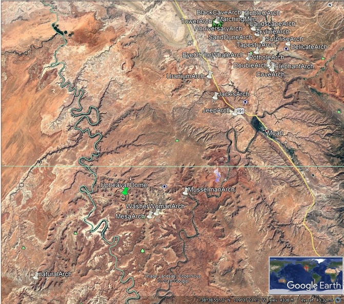 |
|
|
|
Utah
Dec 31, 2018 10:17:53 GMT -5
Post by 1dave on Dec 31, 2018 10:17:53 GMT -5
Looking North . . . 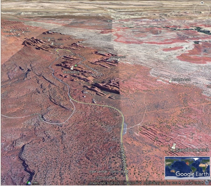 |
|
|
|
Utah
Dec 31, 2018 10:25:21 GMT -5
Post by 1dave on Dec 31, 2018 10:25:21 GMT -5
Skyline Arch 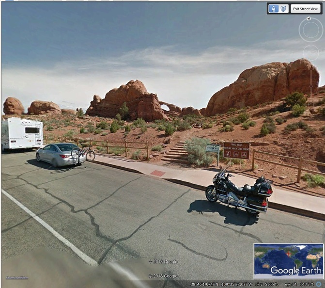  |
|
|
|
Utah
Sept 4, 2019 21:08:30 GMT -5
Win likes this
Post by 1dave on Sept 4, 2019 21:08:30 GMT -5
|
|
|
|
Post by 1dave on Dec 1, 2020 14:31:33 GMT -5
How to Recognize The Cretaceous Period in Eastern Utah www.academia.edu/19561831/Cedar_Mountain_and_Dakota_Formations_Around_Dinosaur_National_Monument?auto=download&email_work_card=download-paper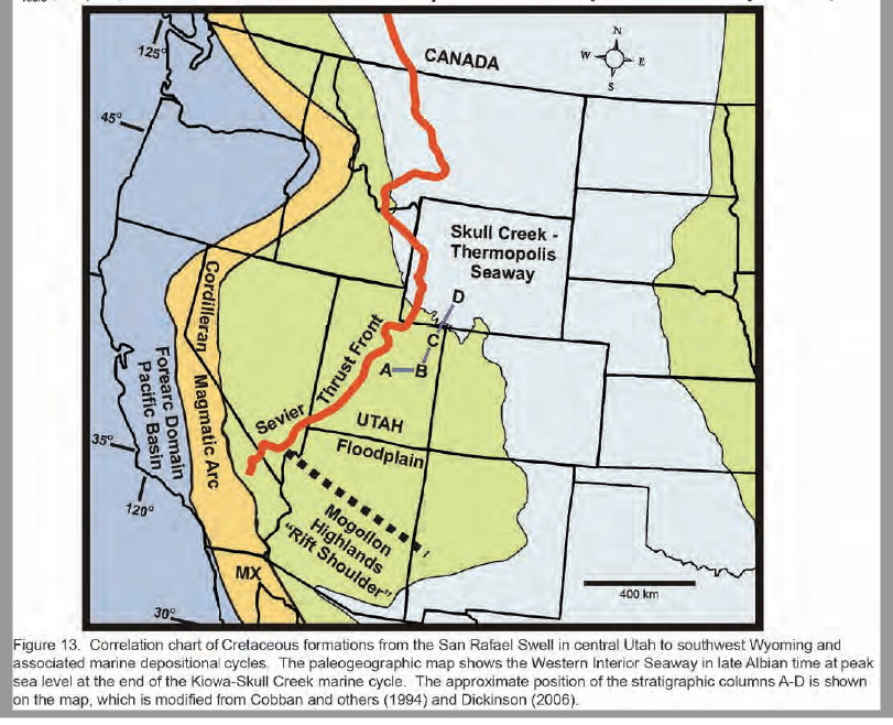 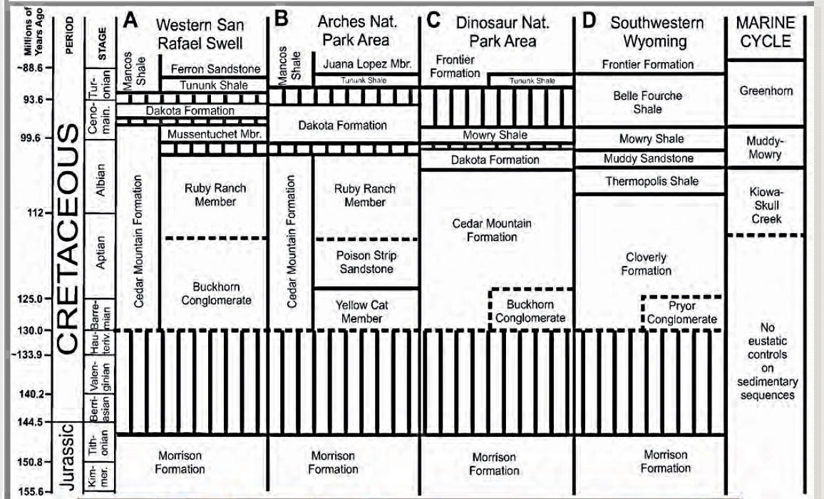    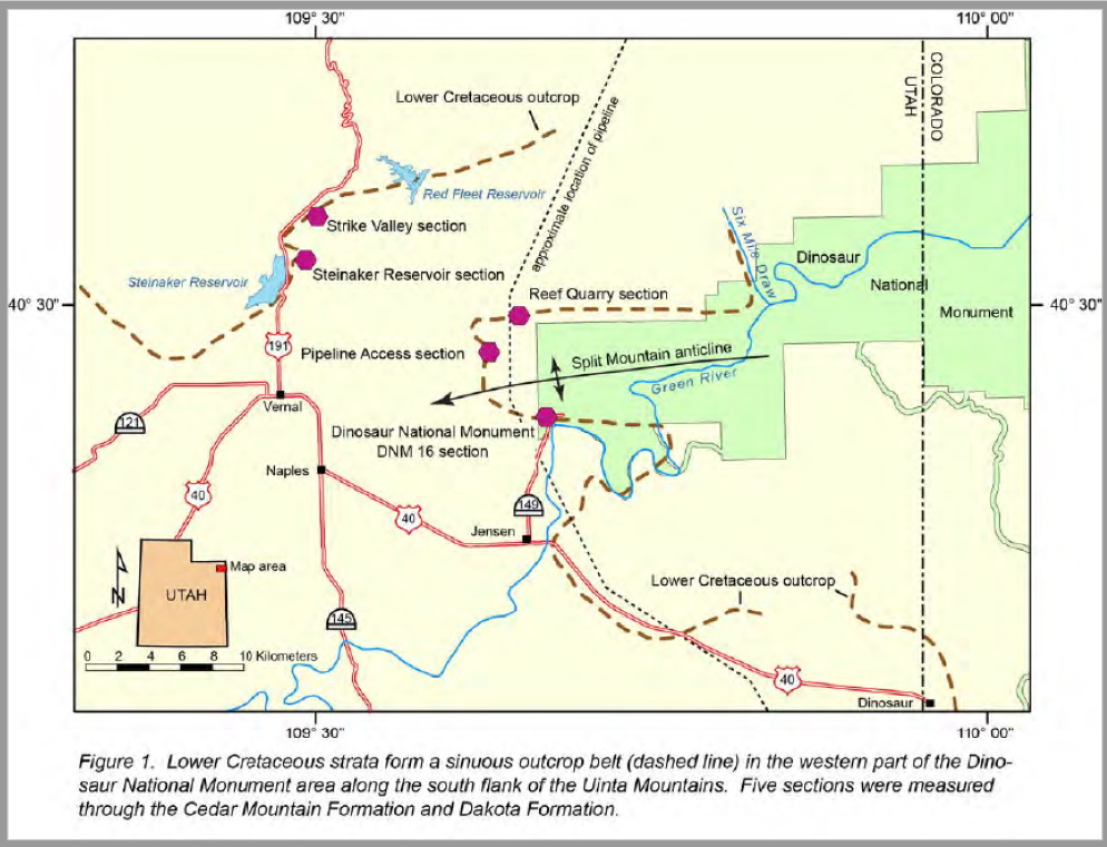  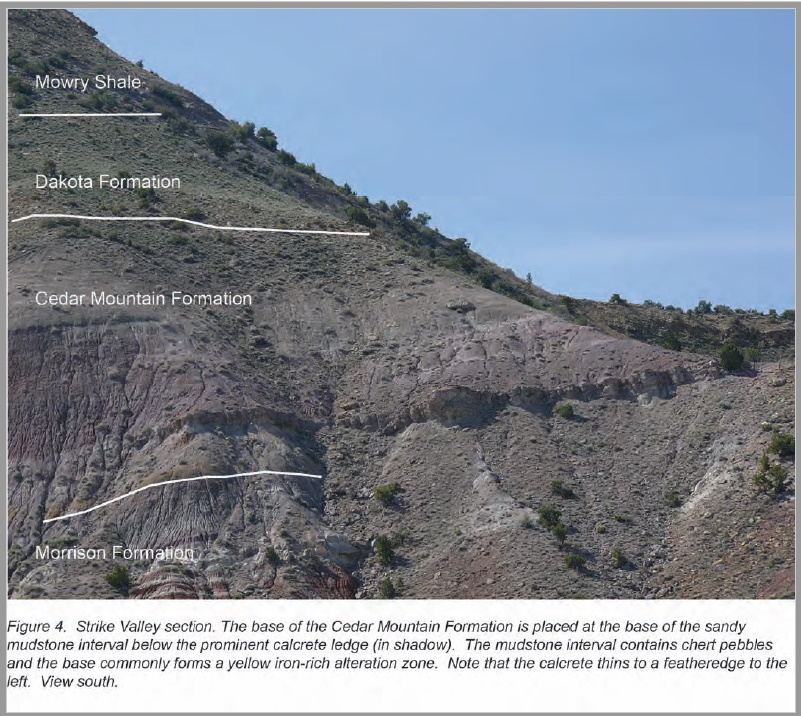  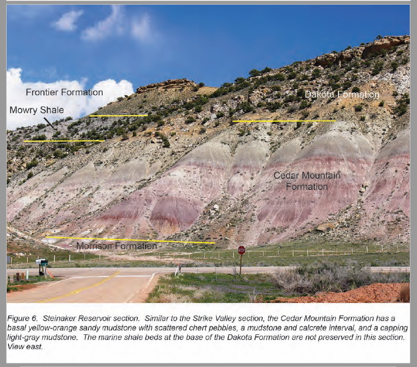 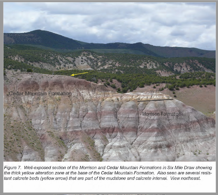      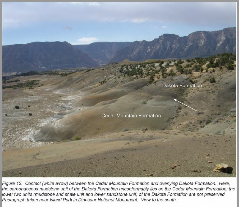 Calcareous dinoflagellate cysts Calcareous dinoflagellate cysts or calcareous dinocysts are dinoflagellate cysts produced by a group of peridinoid dinoflagellates, called calcareous dinoflagellates. Definition Organisms producing calcareous structures are exclusively found in a small group of peridinoid dinoflagellates, called calcareous dinoflagellates. Such calcareous structures are either dinocysts (systematized as Calciodinelloideae[1]), which are formed during the life cycle (i.e., mostly hypnozygotes, after sexual reproduction, or resting stages; an overview of potential cyst formations is given by[1]) or found in vegetative stages (namely in Thoracosphaera Kamptner). The potential to produce calcareous structures has been considered as apomorphic within alveolates,[2] arguing for the monophyly of Calciodinellaceae (including Thoracosphaera[3][4]). Distribution and ecology Calciodinellaceae (Peridiniales, Dinophyceae) comprise 35 extant species of calcareous dinophytes,[5] plus about 260 fossil species.[6][7] They are distributed in cold through tropical seas of the world (neritic and pelagic).[8] Calcareous cysts are deposited in both marine sediments that are coastal[9][10] and oceanic.[11] The first freshwater dinoflagellate that produces calcareous cysts was recently discovered.[12] Fossil record According to the fossil record, calcareous dinoflagellates originate in the Upper Triassic[4] and are highly diverse during the Cretaceous and throughout the Tertiary.[2][13][14]  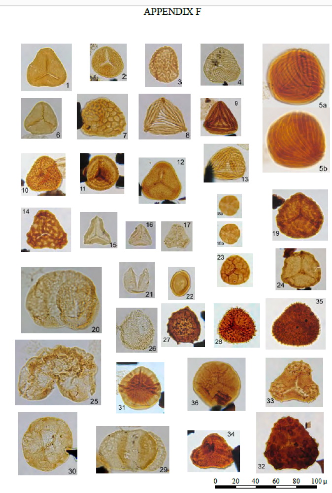 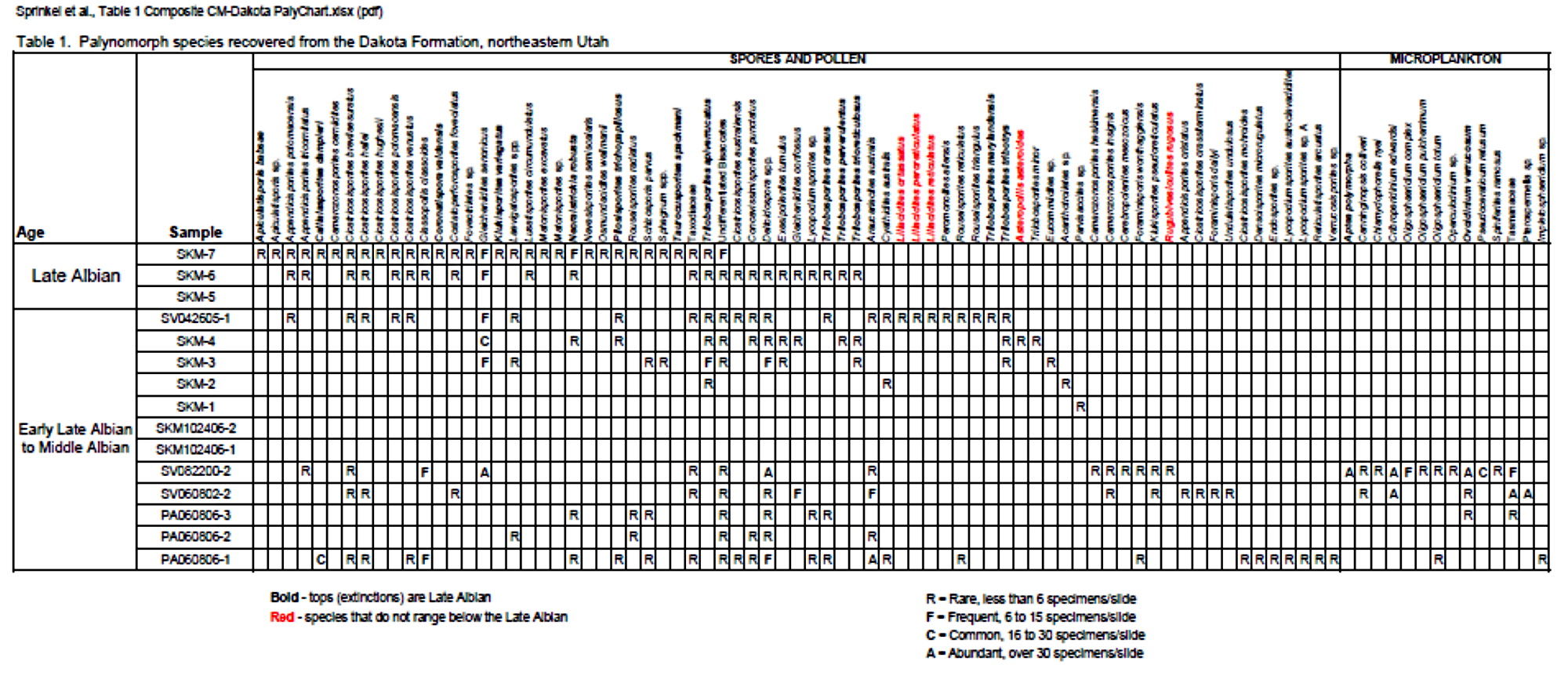 |
|
gregniel
off to a rocking start

Member since February 2020
Posts: 24
|
Utah
Dec 11, 2020 14:24:23 GMT -5
1dave likes this
Post by gregniel on Dec 11, 2020 14:24:23 GMT -5
This information is amazing! Thank you so much!
|
|
|
|
Utah
Mar 16, 2021 7:35:36 GMT -5
Post by 1dave on Mar 16, 2021 7:35:36 GMT -5
Something to Think About.
140 Million years ago Utah got all Shook Up!  clear into Colorado.  And Even into New Mexico!  |
|
|
|
Post by 1dave on May 3, 2021 18:16:40 GMT -5
|
|
pizzano
Cave Dweller 
Member since February 2018
Posts: 1,390
|
Utah
May 3, 2021 18:27:53 GMT -5
1dave likes this
Post by pizzano on May 3, 2021 18:27:53 GMT -5
Natures Aquaduct.........cooler fluids traversing the gravity/grade least path of resistance at work here....! |
|


