|
|
Post by 1dave on Aug 20, 2018 12:42:54 GMT -5
At the beginning of the Triassic the land from present day Nevada to Texas only raised several hundred feet above sea level. What leveled the land?  At the end of the Permian, Nevada, Utah and Arizona were the west coast of North America. Then came the Great Dying, the Permian Extinction Event. Death of 90% of all sea life and 70% of all land life. Oxygen removed from the seas. Massive Siberian Flood Volcanics. AND flattening of the sea coasts? Lots of guesses and arguing . . . until May 31, 2006 news.osu.edu/big-bang-in-antarctica----killer-crater-found-under-ice/Big Bang In Antarctica -- Killer Crater Found Under IceA 250 Million year old crater 500km - 300 miles in diameter. What would those waves do? Where is that crater? I did a search. Is this it?  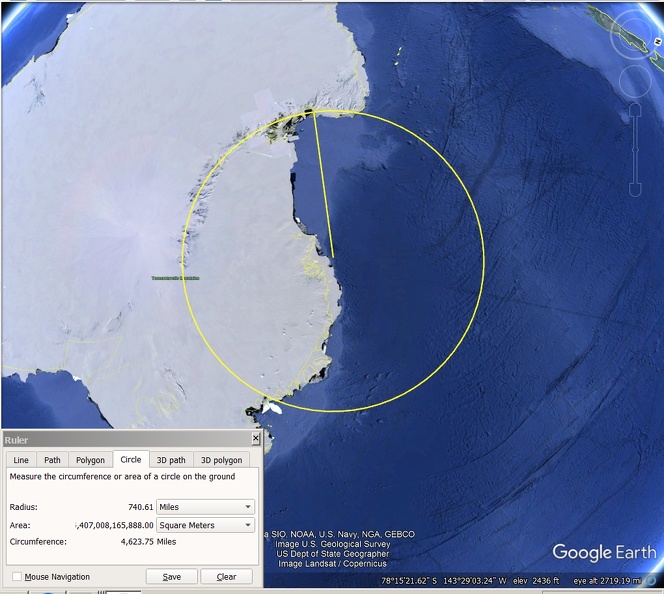 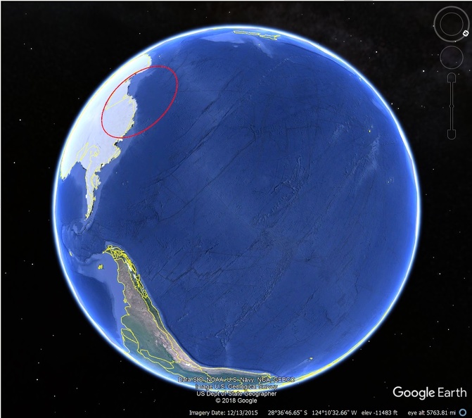 300 mile diameter? IF THIS IS IT, IT HAS A 740 MILE RADIUS! No wonder the coast lands got flattened. |
|
|
|
Post by grumpybill on Aug 20, 2018 14:08:55 GMT -5
Wouldn't the impact site have been dry land 250.000.000 years ago?
|
|
|
|
Post by 1dave on Aug 20, 2018 15:06:07 GMT -5
It looks to me like the north boundary between Antarctica and Australia.
Explains why they got driven so far apart!
|
|
|
|
Post by 1dave on Aug 20, 2018 17:27:43 GMT -5
I tried fitting it to the Great Australian Bight GAB, but that requires too much spin. I suppose the curve in the Capricorn plate works better. 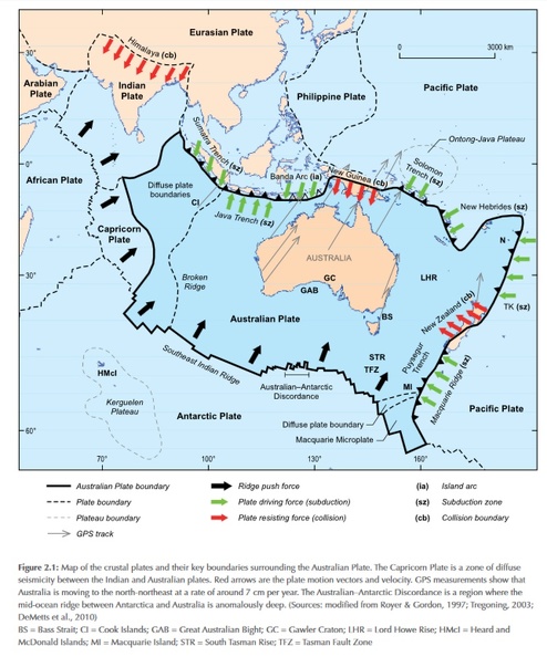 Figure 2.1: Map of the crustal plates and their key boundaries surrounding the Australian Plate. The Capricorn Plate is a zone of diffuse seismicity between the Indian and Australian plates. Red arrows are the plate motion vectors and velocity. GPS measurements show that Australia is moving to the north-northeast at a rate of around 7 cm per year. The Australian–Antarctic Discordance is a region where the mid-ocean ridge between Antarctica and Australia is anomalously deep. (Sources: modified from Royer & Gordon, 1997; Tregoning, 2003; DeMetts et al., 2010) BS = Bass Strait; CI = Cook Islands; GAB = Great Australian Bight; GC = Gawler Craton; LHR = Lord Howe Rise; HMcI = Heard and McDonald Islands; MI = Macquarie Island; STR = South Tasman Rise; TFZ = Tasman Fault Zone Where the Antarctic Plate has been driven UNDER the Australian Plate? 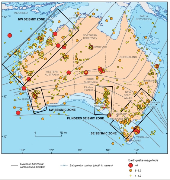 |
|
|
|
Post by 1dave on Aug 20, 2018 18:32:37 GMT -5
I've looked at Australia from all sides now, from up and down, but still somehow, I don't understand Australia at all. 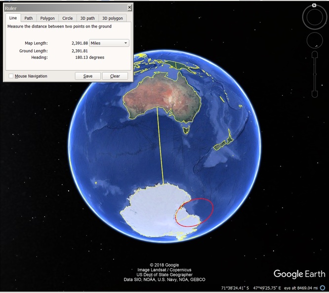 Antarctica is due south of Australia. The Great Bight fits with Antarctica's northern coast - at a distance of about 2,400 miles. IF the reconstruction of Pangea is correct, how can their plates still be in contact? |
|
|
|
Post by 1dave on Aug 20, 2018 18:45:10 GMT -5
Spin the globe, and it is easy to imagine huge waves from the impact hitting our west coast. 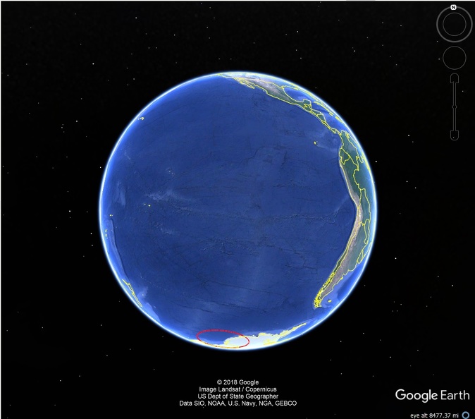 |
|
|
|
Post by grumpybill on Aug 20, 2018 20:42:33 GMT -5
Spin the globe, and it is easy to imagine huge waves from the impact hitting our west coast. Still assumes the impact was (at least partially) in the ocean, which may or may not have been the case. There are nothing but "best guesses" about how the land masses/plates were arranged. |
|
|
|
Post by grumpybill on Aug 20, 2018 20:57:32 GMT -5
Is it possible western US was flat because there hadn't been any upheaval events?
|
|
|
|
Post by 1dave on Aug 20, 2018 21:23:33 GMT -5
Some reconstructions imagine a mountainous west.
Look how Antarctica and Australia are aligned - East of South America.  |
|
|
|
Post by 1dave on Aug 20, 2018 21:28:24 GMT -5
Spin the globe, and it is easy to imagine huge waves from the impact hitting our west coast. Still assumes the impact was (at least partially) in the ocean, which may or may not have been the case. There are nothing but "best guesses" about how the land masses/plates were arranged. An impact of those dimensions will create waves everywhere. |
|
|
|
Post by grumpybill on Aug 21, 2018 8:23:58 GMT -5
Yep. The Earth would have really had its bell rung!
Interesting about the 195 Ma vs 250 Ma reconstructions/suppositions/guesses:
50M yrs after the mega-impact, the Western Mts. have formed, but Antarctica and Australia haven't started to separate.
Makes one wonder if the "experts" can make better guesses than you or I.
|
|
|
|
Post by 1dave on Aug 21, 2018 8:43:33 GMT -5
Yep. The Earth would have really had its bell rung! Interesting about the 195 Ma vs 250 Ma reconstructions/suppositions/guesses: 50M yrs after the mega-impact, the Western Mts. have formed, but Antarctica and Australia haven't started to separate. Makes one wonder if the "experts" can make better guesses than you or I. AND they are shown to be east-west from each other. NOW they are north-south. |
|
|
|
Post by 1dave on Aug 21, 2018 11:40:48 GMT -5
|
|
pizzano
Cave Dweller 
Member since February 2018
Posts: 1,390
|
Post by pizzano on Aug 21, 2018 13:11:16 GMT -5
Kinda gives a better understanding of the Pacific Rim (ring of fire) volcanic action and San Andreas fault line relationship to the west-southwest coastal boundaries.
|
|
|
|
Post by grumpybill on Aug 22, 2018 11:43:54 GMT -5
Is there any explanation as to what caused the inland sea? Did the land sink or the sea rise?
|
|
|
|
Post by mohs on Aug 22, 2018 14:01:00 GMT -5
the west left that behind to the plain states
,oslty
|
|
|
|
Post by 1dave on Aug 22, 2018 14:34:41 GMT -5
Is there any explanation as to what caused the inland sea? Did the land sink or the sea rise? Probably a little of both. Who knows what ancient sea beds are doing under the continents. Here is something I am playing with: 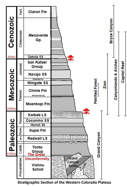 The Colorado Plateau area was slowly sinking. The surface was usually near sea level. Limestone was formed below sea level, shale at, sand above. Then as the Farallon Ocean plate was forced under it, the land was lifted up. Wind moves sand. The faster the wind, the larger the grit. What kind of grit? Water moves rock. Gravity or huge waves moves large rocks. Weathered Basalt: Lots of clay, little silica. Types: 1. Tholeiitic basalt is relatively rich in silica and poor in sodium. Included in this category are most basalts of the ocean floor, most large oceanic islands, and continental flood basalts such as the Columbia River Plateau. 2. High and low titanium basalts. Basalt rocks are in some cases classified after their titanium (Ti) content in High-Ti and Low-Ti varieties. High-Ti and Low-Ti basalts have been distinguished in the Paraná and Etendeka traps[10] and the Emeishan Traps.[11] 3.Mid-ocean ridge basalt (MORB) is a tholeiitic basalt commonly erupted only at ocean ridges and is characteristically low in incompatible elements. E-MORB, enriched MORB N-MORB, normal MORB D-MORB, depleted MORB 4. High-alumina basalt may be silica-undersaturated or -oversaturated (see normative mineralogy). It has greater than 17% alumina (Al2O3) and is intermediate in composition between tholeiitic basalt and alkali basalt; the relatively alumina-rich composition is based on rocks without phenocrysts of plagioclase. 5. Alkali basalt is relatively poor in silica and rich in sodium. It is silica-undersaturated and may contain feldspathoids, alkali feldspar and phlogopite. 6. Boninite is a high-magnesium form of basalt[citation needed] that is erupted generally in back-arc basins, distinguished by its low titanium content and trace-element composition. Andesite weathers to:Amphibole, Apatite, Biotite, Feldspar, Garnet, Hornblade, Ilmenite, Magnetite, Plagioclase, Pyroxene, Zircon, Silicon Dioxide. Granite weathers to: sand and clay. Pegmatite - the incompatibles. |
|