jamesp
Cave Dweller 
Member since October 2012
Posts: 36,607
|
Post by jamesp on Jun 17, 2022 20:00:13 GMT -5
|
|
Deleted
Deleted Member
Member since January 1970
Posts: 0
|
Post by Deleted on Jun 17, 2022 22:25:58 GMT -5
jamespThose are all really nice. The first one is awesome!!!
|
|
|
|
Post by orrum on Jun 18, 2022 4:19:57 GMT -5
Got some gooders rhere Jim
|
|
|
|
Post by rockjunquie on Jun 18, 2022 6:05:47 GMT -5
Got some gooders rhere Jim Howdy, Bill! |
|
|
|
Post by rockjunquie on Jun 18, 2022 6:06:35 GMT -5
I would never have guessed about the first one. Really different ... and beautiful.  |
|
|
|
Post by jasoninsd on Jun 18, 2022 6:08:34 GMT -5
Jim, that first one has fortification banding...so it is automatically considered awesome! LOL orrum - Good to "see" you on here Bill!  |
|
jamesp
Cave Dweller 
Member since October 2012
Posts: 36,607
|
Post by jamesp on Jun 18, 2022 9:10:58 GMT -5
jamespThose are all really nice. The first one is awesome!!! Lake Falcon is in south Texas Ashley. Craziest place on earth to go rock hunting. Must be billions of agates woods and jaspers washed down with volcanic ash from several states and Mexico and got tumbled into pebbles. One rock from Mexico, the one next to it one from maybe 600 miles north into the US. A man I met gave me permission to collect rocks on his family's ranches in the area. It appeared that no one had ever collected there. This batch would take about one hour to pick up, you never know what you may find. I knocked a window off each one with a small hammer to see behind the patina to see if each was a keeper. Bought back back about 1500 pounds. Probably the best time I ever had in my life, got to go back !:  |
|
|
|
Post by mohs on Jun 18, 2022 9:21:03 GMT -5
 cool rock and shape James |
|
jamesp
Cave Dweller 
Member since October 2012
Posts: 36,607
|
Post by jamesp on Jun 18, 2022 9:29:39 GMT -5
Jim, that first one has fortification banding...so it is automatically considered awesome! LOL orrum - Good to "see" you on here Bill!  Some of these might be for cabbing Jason. This is about the other half collected back in 2016. Just now looking/sawing them. Must be 700-800 pounds of them. Plenty of duds and plenty hotties. I only had permission to collect on a conglomerate of family ranches adding up to 4000 acres. Didn't touch a tenth of that land. What a gold mine. |
|
jamesp
Cave Dweller 
Member since October 2012
Posts: 36,607
|
Post by jamesp on Jun 18, 2022 9:31:02 GMT -5
 cool rock and shape James Guessing that to be a wash down from Mexico Ed. Perhaps you recognize it. |
|
jamesp
Cave Dweller 
Member since October 2012
Posts: 36,607
|
Post by jamesp on Jun 18, 2022 9:37:22 GMT -5
I would never have guessed about the first one. Really different ... and beautiful.  You never know Tela. The caliche(compacted volcanic ash)from the south central US and Mexico must be 50 feet deep out there and loaded with goodies from all over. Make me go back down there ! I can take my electric scooter this time ! |
|
|
|
Post by mohs on Jun 18, 2022 9:48:35 GMT -5
 cool rock and shape James Guessing that to be a wash down from Mexico Ed. Perhaps you recognize it. corazon de roca... la mohsta  |
|
jamesp
Cave Dweller 
Member since October 2012
Posts: 36,607
|
Post by jamesp on Jun 18, 2022 9:50:33 GMT -5
Got some gooders rhere Jim Glad to 'see'(as Jason put it)back here again Bill. I plan to make a western trip just for you(and my greedy motive to collect Rio's !)hopefully this winter. I sure hope you will you get back into the nomad lifestyle. Been praying for you. Me and Denise been thinking about you. |
|
jamesp
Cave Dweller 
Member since October 2012
Posts: 36,607
|
Post by jamesp on Jun 18, 2022 10:01:26 GMT -5
Guessing that to be a wash down from Mexico Ed. Perhaps you recognize it. corazon de roca... la mohsta  Rockin' heart ? |
|
jamesp
Cave Dweller 
Member since October 2012
Posts: 36,607
|
Post by jamesp on Jun 18, 2022 11:16:56 GMT -5
I should contact my buddy Fernando down in Zapata. He saw me collecting off the gravel road and suggested I go to the red gate down the road and collect on his 200 acre ranch. And mentioned his cousin owns the 3200 acre ranch adjacent with two gravel quarries. I had more probably uncollected land I could cover in a lifetime. I stayed in Zapata 3 weeks once, 1.5 weeks another time and 3 days on way back from Alpine TX the first time. Fernando is my age and single. I'd see him and his friend around town on weekends with younger ladies he said they meet up with in Laredo. Laredo is a town to avoid ! I intend to contact him for another trip for this upcoming cold season. I worry he has met ill fate judging from his lifestyle. Must call him. Being dumb on the 2nd trip it never passed my mind to collect at the big trash rocks sorted from the smaller highway gravel at the quarry in 2011. Check out the pile of scrubbed highway gravel being quarried for widening Hwy 83 thru Zapata TX 2011 to 2012:  Closer in and wetted  5 minutes worth of pickins from the pile not even knowing what pet wood and palm was mixed in: 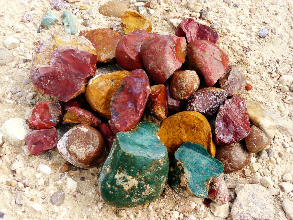 Same pile to right but look at unscrubbed pile of big rocks to left that was loaded with dirty 2 to 10+ pound rocks I omitted to search !:  This is Fernando's 200 acres. He had just had a bulldozer destroy the briar trees like mesquite, etc. Nice exposure to treasure rocks. 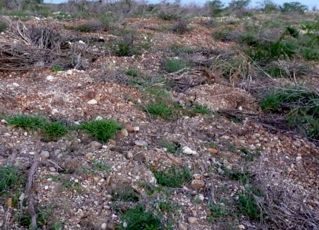  This view is off of Fernando's tallest hill toward Mexico. This was the tallest hill for several miles east and west. The knob shaped hills along Falcon Lake were old point bars when the Rio was flooded in ancient times and the water was several hundred feet deeper. The inside turns in the old river(point bars) were left behind as hills due to the high amount of rock deposited at these point bars prevented them being eroded away. Still standing with several hundred feet deep of agates ! The rock on these knob hills is also the rock that was transported from upstream lava fields of Mexico, Texas, New Mexico etc so rich in agates and pet woods. Hwy 83 underlayment is rich in agates. I hunted the agates spread out before paving Hwy 83 too, miles of underlayment I could never covered by walking. The giant quarry was north of town, that guy would not let me on his property, I begged. When I returned I took fellow RTH member Captain Bob but all the gravel pits had been shut down dang it. They were easy pickings.  Captain Bob high on the hill lol. He was angry, he only rented his room for a week, I had 10 more days left and he had to leave. He would have stayed another month I believe. I didn't tease him, promise.: 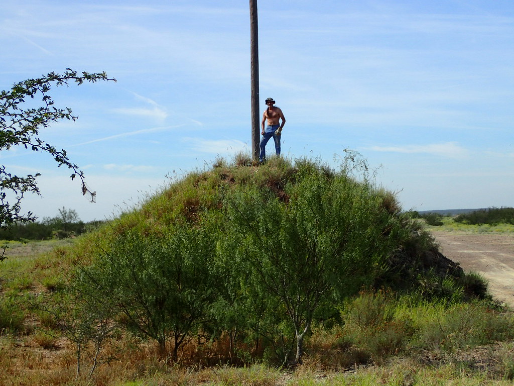 Not knowing wild horses I was told the big stallion in front of his mares was telling me to leave dodge or else, note cocked back ears. Thought he might let me pet him NOT. The wild horses often ran and played in the lake. They were impressive animals. 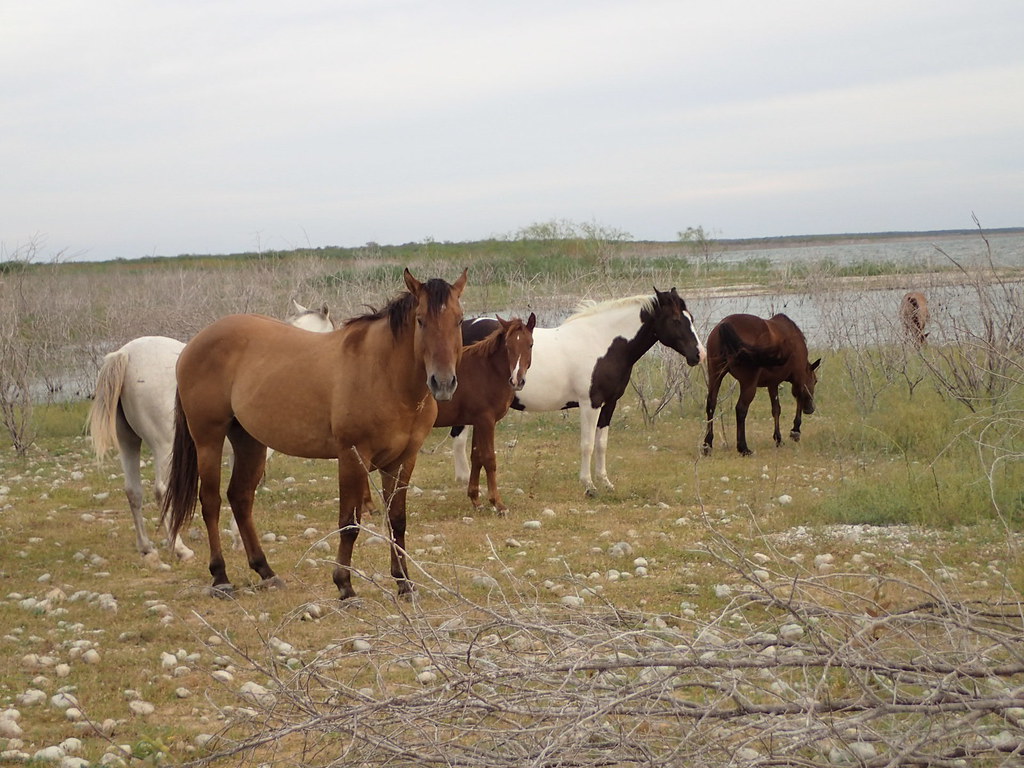 |
|
|
|
Post by jasoninsd on Jun 18, 2022 15:35:29 GMT -5
Jim, that first one has fortification banding...so it is automatically considered awesome! LOL orrum - Good to "see" you on here Bill!  Some of these might be for cabbing Jason. This is about the other half collected back in 2016. Just now looking/sawing them. Must be 700-800 pounds of them. Plenty of duds and plenty hotties. I only had permission to collect on a conglomerate of family ranches adding up to 4000 acres. Didn't touch a tenth of that land. What a gold mine. You gotta love the pockets of "gold" just sitting there on private property...especially when the landowners don't know or care anything about rocks!!  EDIT - I responded before I saw your post above about all of it. That ain't no "pocket"...that's just a sea of beautiful hounding!!  |
|
jamesp
Cave Dweller 
Member since October 2012
Posts: 36,607
|
Post by jamesp on Jun 19, 2022 6:36:02 GMT -5
Because it is a mass deposit over at least 100 miles of the Rio jasoninsd it was more efficient to drive up and down the river and take 'agate density' samples to find the caliche that yielded the most agates. Then your hard earned collecting energy was well spent. Studying the depositional science in this area was a big help. It became apparent that further than a half mile from river centerline was where the imported agates from upstream faded in density quickly. The density was thick at the river above and below Lake Falcon too but those narrow sections of the river were heavy with drug smuggling. It would take a pretty stupid smuggler to cross the wide lake with a load - not gonna happen. Way too much surveillance. Lake Falcon is safe and is just a rush to collect at due to the variety. Even the public lake shores where boats could legally access seemed just as rich in treasures as the private lands. |
|
|
|
Post by captbob on Jun 19, 2022 7:04:39 GMT -5
I didn't tease him, promise. *cough* so when we headed back? |
|
jamesp
Cave Dweller 
Member since October 2012
Posts: 36,607
|
Post by jamesp on Jun 19, 2022 7:46:33 GMT -5
I didn't tease him, promise. *cough* so when we headed back? I'm getting the itch. You still game ? |
|
jamesp
Cave Dweller 
Member since October 2012
Posts: 36,607
|
Post by jamesp on Jun 19, 2022 7:56:22 GMT -5
Rio/Zapata County geology notes of which I barely understand: Terrace deposits (Pleistocene and Holocene) at surface, covers 2 % of this area Terrace deposits: Gravel along the Rio Grande is sub-rounded clasts of locally derived limestone and chert and rounded clasts of basalt, volcanic porphyry, quartzite, milky quartz, and banded chalcedony derived from the west. Quaternary deposits: Sand, silt, clay, and gravel. locally indurated with calcium carbonate (caliche); includes point bar, natural levee, stream channel, sand dune, terrace, alluvial fan, landslide bolson and playa deposits. Goliad/Miocene: Clay, sandstone, marl, caliche, limestone, and conglomerate. Thickness 100-500 ft Uvalde Gravel Pliocene to Pleistocene: Caliche-cemented gravel well-rounded cobbles of chert, some cobbles of quartz, limestone, and igneous rock; present on topographic divides and high areas not associated with present drainage; Abundant, well-rounded pebbles and cobbles of chert, quartz, and limestone; minor igneous rock; some boulders. Caps drainage divides, upland flats, and rounded ridges 30-75 m above streams. Extensive upland deposits on high alluvial terraces along Rio Grande and in northern Nueces Plains. Thickness 1-6 m.  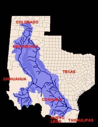 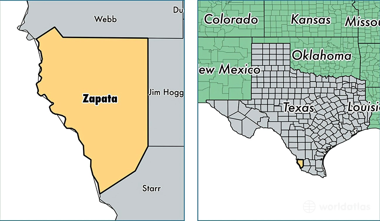  |
|