gemfeller
Cave Dweller 
Member since June 2011
Posts: 4,067 
|
Post by gemfeller on May 30, 2014 21:22:17 GMT -5
When I was younger I hunted points in east Idaho where I grew up. They were all relatively recent (several hundred years tops I'm guessing although people have inhabited the region for some 11,000 years). Many different tribes came there for the abundant game and fish in Snake River. The river got its name from the Snake Indians that lived near it, not from its twisty course as many mistakenly believe. Snake Indian is a collective name given to the Northern Paiutes, Bannocks and Shoshones. Sacajawea was a Shoshone and I was born not many miles from where she was.
Nearly all the points I've seen from that region were made from obsidian. Many were beautifully knapped and ranged in size from small bird points to large spear points. I've seen a few small "gem" points knapped from chalcedony and agate.
Many ancients were attracted to the Snake River to harvest food from the huge numbers of salmon that swam upstream from the Columbia to spawn. They were stopped by the river's Shoshone Falls barrier in the south-central part of the state. The falls tower 212 feet in height, 45 feet higher than Niagara. The fish diverted into the Snake's tributary streams such as the Salmon River.
One of the oldest examples of human remains in the U.S., Buhl Woman, was found in a quarry not very far from the Shoshone Falls. The skeleton has been dated at around 11,000 years, and those remains along with 9,000-year-old Kennewick Man on the Columbia, show that people have lived in the region for a very long time although not much archaeological evidence has survived (or at least hasn't yet been found). At least one buried cache of beautiful Clovis points was discovered further to the northwest and they date from about 13,000 years ago.
East Idaho was a crossroads for both Native Americans and European settlers. The Oregon Trail paralleled the Snake River to the current Oregon border. Fort Hall was established near Pocatello for the protection of emigrants and as a resupply point. There's a rockhound connection too. Succor Creek, the gem bonanza in east Oregon's Owyhees, was greatly-anticipated as a destination by the wagon trains. It was a green place with water where the weary travelers could find "succor" (relief from stress) for a few days before heading on into the miles of dry desert separating them from Oregon's Willamette Valley.
There's lots of history in the general region.
|
|
jamesp
Cave Dweller 
Member since October 2012
Posts: 36,618
|
Post by jamesp on May 31, 2014 8:08:16 GMT -5
Twenty miles from my house is a pricy community called Peachtree City. It is a golf community with 2 large dammed lakes at least 100 cares each on Flat Creek. It is a large basin shaped area and very sandy. Flat creek is a wide flat clear creek with lots of beaver ponds. The flattest lake(an ancient beaver pond) had a 3 acre peninsula with flat approach sticking into it. In clearing the spots for the 2 lakes and the numerous golf courses i was able to collect artifacts. The variety of material and point types were overwhelming. Never did archeologists come to the rescue. 2 sites, one on each lake were gold mines for points. The flat lake w/the user friendly peninsula was the most variable camp I ever collected. The upper and steeper banked lake was with a fork of 2 creeks. In the fork was a site that we picked up about a 100 local white quartz points. Crude and unidentifiable. However, the lower lake on the peninsula was full of classic points from Mississipian, woodland, and archaic aged points. Of mountain and coastal chert and flints that were imported from sources I am well aware of 100-200 miles away. Guilfords, big sandys, heavy duties, lost lakes, birdies, mississipi triangles, adenas and many classic point types. The site was never plowed and the points were being exposed by the wind as they took 2 years to dig the lake out deeper. As they moved closer to the peninsula they piled their dang dredgings on the peninsula and covered this valuable site over. Here is some of what I found. Note that white quartz is the only local material, all the rest are imports. And the best 12 are on another mount, one of them I traded for a semi truck load of scrap steel. 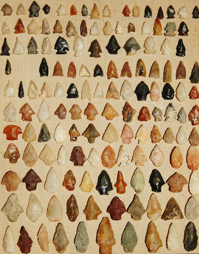 |
|
jamesp
Cave Dweller 
Member since October 2012
Posts: 36,618
|
Post by jamesp on May 31, 2014 8:57:48 GMT -5
What is metate Ed ? You mentioned grinding.
|
|
|
|
Post by rockpickerforever on May 31, 2014 9:26:35 GMT -5
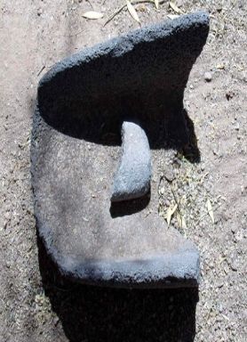 Metate, used for grinding corn, acorns or whatever to make meal. This one's got a lot of miles on it. Great pics, Ed, it looks like a really neat site. The stone box with the holes in it... Maybe they used it for people that misbthat Ihaved, put them out on display to keep others in line? Sort of like the Colonial Americans used stocks. Mohstly. |
|
|
|
Post by mohs on May 31, 2014 9:32:32 GMT -5
What a prolific collection of found points James ! You found them all ?! Geez! Its remarkable the trade network the Indians had. Stones traveled far and wide. From wikipedia en.wikipedia.org/wiki/Metate yeah grinding corn and other grains. In the early Phoenix settlement metates were found all over. It was a common rock bottom kitchen product. They must exit in your area? |
|
|
|
Post by mohs on May 31, 2014 9:40:16 GMT -5
One of the founding legends of the lost Dutchman Gold mine is that a massacre happened. Let say this happened sometime in the early 1800’s . The story goes that that a large party (200) of Mexican/Spaniards were mining gold in the Superstitions. The Apache Indian came upon the scene and were getting tired of the intrusion into their sacred mountains. Thunder God Gold! So they set a trap. When the miners were all loaded up w/satchels full of gold ore on their burro’s the Apache attacked! Slaughtered all! Actually two brother did survived the massacre. The Peralta’s ! If that hadn’t happened there would be no one to pass the tale on. That how legends start Well the gold ore was just left to lie wherever it fell. The Apache’s had no use for the yellow rock. The area where this massacre occurred is called Massacre Grounds Its on the western base of the Superstitions. A fairly easy area to access.. The point is: that this is foundation tale of the Lost Dutchman Gold Mine . Many a prospector have claimed to have found this gold ore lying around in weathered out leather satchels. But know ones as ever had any sample assayed. So its just talk. But there is another point I’m trying to make about the artifact/ arrowhead statement above. In my skeptic stance about the legend, I assume, if this massacre happened: then shouldn’t there be many arrowheads/points lying about this area? Does anyone know if the Little Big Horn area supports my theory? I just read that Lakota & Cheyenne were well armed with fire arm power. So it make my point is sort of mute. But the Apaches of 1840 wouldn’t have been as well armed. Assumedly they used more primitive weapons. Bow & arrow, spears, ect… I’ve asked many a Dutch hunter whom have scoured Massacre Grounds if arrowheads were abundant? Well were looking for gold. Not arrowheads! I’m told. If there were an abundance of arrowheads, then it may fortify the massacre legend and lend more credence to the lost gold legend. That’s how I think about it. For anyone who cares to read more www.desertusa.com/treasure/lost/gold-lost-base-old.html |
|
gemfeller
Cave Dweller 
Member since June 2011
Posts: 4,067 
|
Post by gemfeller on May 31, 2014 12:01:05 GMT -5
Re: metates. A dentist I know told me he practiced in a foreign area where similar grain-grinding methods were used (can't recall the location). He said so much hard rock from the metates was mixed with the ground meal that his patients' teeth had been worn down almost flat from chewing it.
There must have been a reason such porous rocks were chosen for metates but I'm not sure what. But it's an object lesson that stone is much harder than apatite, the mineral teeth are made from. (Now come old jokes about apatite and appetite).
Interesting posts James and Ed. That's an impressive collection of points and even more impressive is your ability to identify them and relate them to specific cultures, James.
Ed, I got hooked on learning about the "Old Ones" while a student at the U. of New Mexico. There were interesting relationships between the Hohokam and their neighbors: the Fremonts, Patayan, Mogollon and Anasazi. One of my books claims the Pima Alto and Papago Indians are living descendants of the Hohokam.
Ancient trade routes have been mentioned. The Hohokam had copper bells made by the lost wax casting method. Archaeologists believe they came from Mexico. The turquoise trade has always interested me. I ran across this doing a search for Cerillos (New Mexico) turquoise:
"The Anasazi and Hohokam mined turquoise throughout our Southwest. Absolute evidence exists that these prehistoric people mined turquoise at Cerillos and the Burro Mountains of New Mexico, Kingman and Morenci in Arizona and the Conejos areas of Colorado. Turquoise was a popular trade item. We know this because so much has been found in archeological sites. Many hundreds of miles away from its source. A prime example is the Cerillos, New Mexico, turquoise found with the Aztecs."
|
|
gemfeller
Cave Dweller 
Member since June 2011
Posts: 4,067 
|
Post by gemfeller on May 31, 2014 12:07:45 GMT -5
Not sure what the structure in the foreground was used for or its purpose? Maybe some one here does? Here's a guess Ed. The holes appear to me to be supports for poles of some type: maybe a drying rack for hides or maybe corn? Your image doesn't provide any scale so I can't really tell how large the structure is. If you look at the upper right of the picture there's a roof pole extending outside the building wall. That was a common type of construction in pueblos. Maybe it was for storage. |
|
jamesp
Cave Dweller 
Member since October 2012
Posts: 36,618
|
Post by jamesp on May 31, 2014 13:31:34 GMT -5
What a prolific collection of found points James ! You found them all ?! Geez! Its remarkable the trade network the Indians had. Stones traveled far and wide. From wikipedia en.wikipedia.org/wiki/Metate yeah grinding corn and other grains. In the early Phoenix settlement metates were found all over. It was a common rock bottom kitchen product. They must exit in your area? We just call them grinding stones. They ran all the natives off before we could get their descriptions! Many made out of soapstones and granite. Thanks for the def. And the illustrative example. Yes, points all in about 3 acres. Like southerners and their arsenals of guns, the natives must have had their weapons. |
|
|
|
Post by mohs on May 31, 2014 13:57:17 GMT -5
Once again I’m going to throw a rock into this discussion and change course.
Why didn’t the American Indians get in to metalworking?
Why didn’t they have their own bronze age?
Why didn’t they invent the wheel & cart?
a correction!
the original post is wrong.
The black rock is a piece of basalt mostly
and is very common to this area.
I just got back from stroll at Snake town
The black rock was everywhere
|
|
jamesp
Cave Dweller 
Member since October 2012
Posts: 36,618
|
Post by jamesp on May 31, 2014 14:39:51 GMT -5
some Georgia metates and mortars. Also of teeth grinding grainy stone. This one of soapstone from the well known soap stone hill in SW Atlanta. 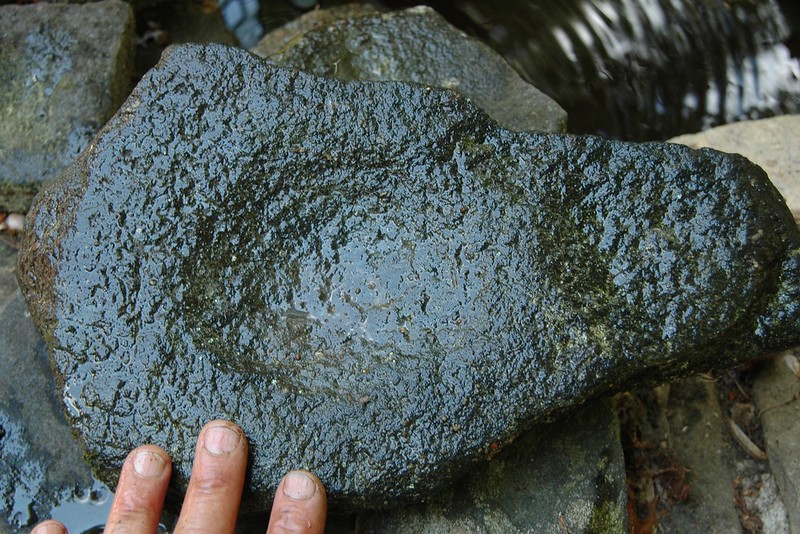 granite 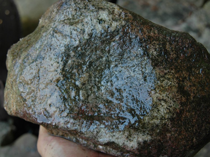 conglomerate 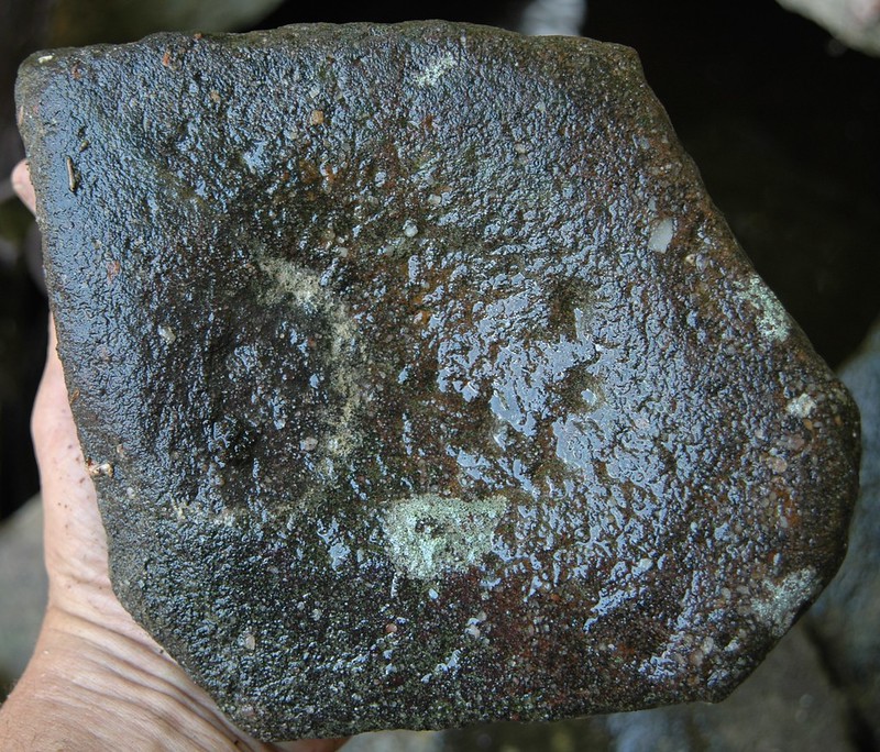 We rarely find pebbles. One on high ground is quickly suspect. You can see the weathered coating is ground off. Got a box of these. I am guessing they were used for acorns, nuts, berries and fruits. Aquatic plants a large part of diet too. And nutting stones, usually square and 4-6 inches square with a divot in center often both sides. 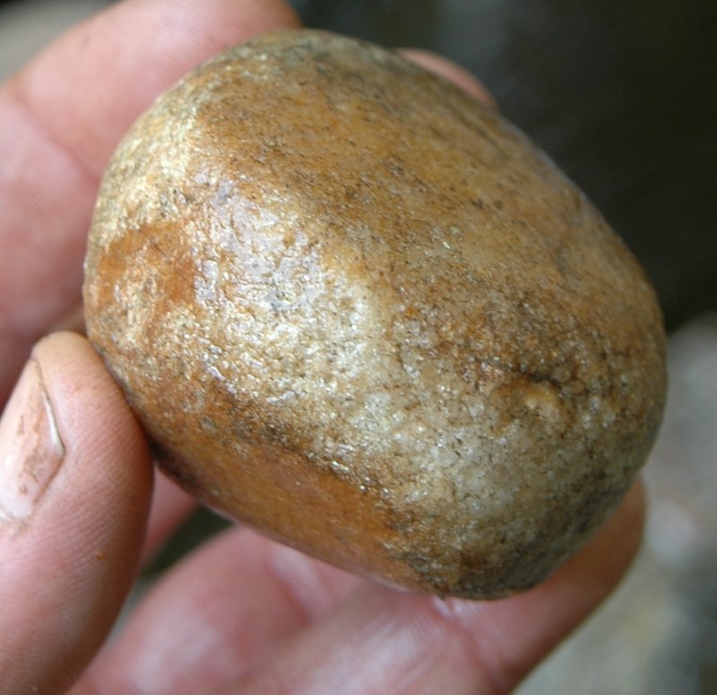 |
|
|
|
Post by mohs on May 31, 2014 19:41:43 GMT -5
those are some significant rocks Here’s a really lousy picture of wall map at Pueblo Grande Depicting trade routes. The circular spots are location of turquoise, black=obsidian, cream color=pottery and the other is shell 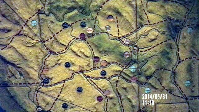 enjoy ed |
|
|
|
Post by mohs on Jun 1, 2014 12:02:28 GMT -5
Hi Rick I liked the Kensington rune rock link Here is another found marked stone that is full of mystery The Peralta Stones ! You’ve probably have heard about them? If not-a link www.desertusa.com/lost-dutchman/peralta-stones.htmlThis as to be the most famous rock heart in history  But I’m working on topping it…. mostly  Find the heart Find a treasure |
|
jamesp
Cave Dweller 
Member since October 2012
Posts: 36,618
|
Post by jamesp on Jun 1, 2014 20:45:25 GMT -5
You guys are fortunate to have so much recent activity. The trade route map is amazing.
In Florida, routes were chosen by connected 'islands'. Islands being stands of pine trees that were carpeted with pine straw.
The scrub was the alternative. I am thinking after about 10 miles in scrub you would die of dehydration. It is so impenetrable.
It is a danger to this day. People get lost and trek into the scrub, a miserable way to bite the bullet.
So the old trade routes were far from straight lines, dominated by the vegetation.
Native copper was used occasionally. Other than gold, that is about all of the metal work I have ever seen.
|
|
|
|
Post by mohs on Jun 1, 2014 21:05:11 GMT -5
I think the networking that was done on these routes were intense. Being a scout or trader had to be premium employment Of course merchandise was limited by how much could be carried But it had to be specialized field Native copper was used occasionally. Other than gold, that is about all of the metal work I have ever seen. any idea why James? That metal working didn’t become more industrious? Or were the Indian the wiser ones? Perhaps they foresaw that heavy metal working would alter their ways too much and just lead to warfare and strife? hhhmmmm… |
|
jamesp
Cave Dweller 
Member since October 2012
Posts: 36,618
|
Post by jamesp on Jun 2, 2014 20:32:20 GMT -5
I think they were w/hands full. Squaw did all the work and they sat around making arrowheads, fishing and hunting. just kidding(ladies).
I would guess the metal was a bit over their level of conception. And may not have been necessary.
|
|
|
|
Post by mohs on Jun 4, 2014 16:45:40 GMT -5
Thanks James too many mysteries here is another This is the explanations plaque on ball courts at Pueblo Grande 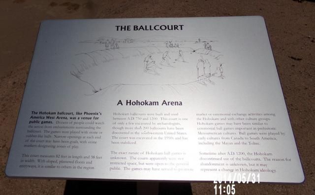 The last paragraph is a mystery Why would they quit building ball courts? & start building mounds? Strange. Because ball courts and mounds are opposites Maybe there were heavy rains for a couple decades causing the river to be uncontrollable ? Take to high ground ? But it certainly was drought that contributed to their disappearance. Not that it’s a big deal Who would worry if we disappeared? Mostly |
|
|
|
Post by mohs on Jun 6, 2014 11:00:11 GMT -5
Here are some stone playing balls on display at Pueblo Grande. 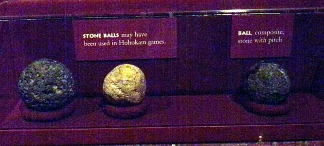 Who know how they shaped these playing ball sphere’s? What is interesting is the one ball on the right as cactus sap on it! Perhaps, to rubberize it? The ball courts and games originated with the Olmecs, in the rainy forest of eastern Mexico circa 1800 B.C. That area had rubber trees and the balls were made from that rubber. The ball courts & games became wildly popularized by the Mayans. The ball courts for the Mayans were highly significant and deeply religious activity. The Mayan dead, ‘the spirits’ resided under the ball court. It was the Mayan’s underworld. Perhaps this is why the ball in play couldn’t touch the ground? The game could get very brutal But for the poor Hohokams of the desert it could have only been only rougher. They only had rock! and sticky sap from a cactus? So that that where the popular phrase ‘playing hard ball’ originated. mostly |
|
gemfeller
Cave Dweller 
Member since June 2011
Posts: 4,067 
|
Post by gemfeller on Jun 6, 2014 12:22:50 GMT -5
Ed, the rock spheres were probably made the same way the giant spheres in Costa Rica were made: by pecking at them repeatedly with another rock. But I can't see them being used in the Hohokam ball games. I believe they must have had another purpose, but "hard balls" they definitely are! This link mentions that rubber balls, like the ones used in Mesoamerica, have been found at Hohokam sites: nativeamericannetroots.net/diary/1646And this link discusses the origins and political/religious overtones of the Mesoamerican ball game. I've seen the ball court at Wupatki and it's fascinating, just like the rest of those ruins. www.witzmountain.com/2012_Ballcourt3.html |
|
gemfeller
Cave Dweller 
Member since June 2011
Posts: 4,067 
|
Post by gemfeller on Jun 6, 2014 12:27:59 GMT -5
Just found this at another site:
At Pueblo Grande, two and possibly three ballcourts were constructed. Few Hohokam sites have more than two recorded ballcourts (the village of Villa Buena had five). One of the ballcourts at Pueblo Grande, located about 650 feet (198 m) northwest of the platform mound, was excavated in the 1950s. This relatively small ballcourt measures 82 feet (25 m) long and 38 feet (11.5 m) wide and is oriented north-south. It was constructed ca. A.D. 950, late when compared with the construction of many other Hohokam ballcourts. The court was large enough to accommodate only two to four players on the floor at any one time.
A stone ball was excavated from the fill of this court, although it is not known if this ball was one that was actually used in play at the ballcourt, or if it was deposited there after the court was abandoned. This is the only stone ball thus far excavated from a Hohokam ballcourt, although similar stone balls have been recovered from other cultural features (ie., trash mounds) at Pueblo Grande and other Hohokam sites. Accounts of Mesoamerican ball games suggest the predominant use of rubber balls during play, and a prehistoric rubber-like ball has been found at a Hohokam site in southern Arizona. This rubber-like ball was made from the resin of the native Sonoran Desert guayule plant.
|
|


 ... to the New Guys from The ChatBox V.2 Crew