|
|
Post by mohs on Jul 29, 2021 11:49:27 GMT -5
I'm on that canal path trying to stay of the ditch ...m  stly THEY ( the Cibolans) did an amazing job - as did the Pre-Bolivians and Pre-Incas. How was the knowledge passed on? Hi 1dave thought you'd enjoy this documentary on SRP, Roosevelt and early Phoenix morhz later.... |
|
|
|
Post by 1dave on Jul 29, 2021 13:59:26 GMT -5
|
|
|
|
Post by mohs on Jul 31, 2021 11:00:24 GMT -5
Moss on the Stones in the Supers 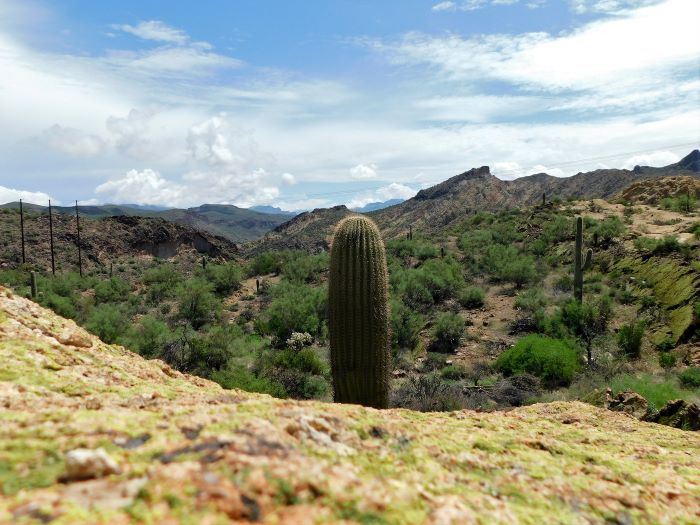 Not sure what it is about that area and the moss ? Seem like only that area is predominantly mossy I been going to it for decades. Others know its a bit unique of an area Cause there is major pull off from the road I've brought a few members to that area. Certainly I haven’t explored those mountains In any depth I would suggest many you tube vids. Yesterday I was so foolish. I just took off, no planning. and got pretty deep into the wilderness. Little water, and none, on what I thought was going to be just a short stroll. Must get a canteen. High humidity. Over perspiring! In the Supers by my lonesome. With a camera to record mohs last roll Ha |
|
|
|
Post by mohs on Aug 10, 2021 14:03:29 GMT -5
I paln on braving the Supers soon
cooler weather so that my help
anyway this video popped up
so its encouraging
hell of story
and some fab scenery
hope you enjoy
and go ahead and comment....
|
|
|
|
Post by mohs on Aug 11, 2021 17:30:55 GMT -5
this was taken a few weeks ago inside an old abandon railroad cut in Tempe 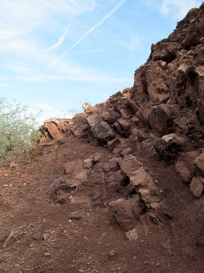 The photo perspective downplays the depth To the top is about 40 feet up. The cut is 30 feet wide and at 50 yards long Kind of spooky clausto walk through it. Plus at ground level, without much warning, you unknowingly walk right up to the edge. Yet somehow - the body knows there is approaching danger. Stiffens and proceeds cautiously On moonless night it would be a very bad stumble. Something of geological interests Is the strike and dip of those faulted rocks.
hhhhhmmmm... That railroad cut in Tempe shows a lot block rock that cut is about 40 feet deep hadn't contemplated that before  |
|
|
|
Post by mohs on Aug 13, 2021 16:01:59 GMT -5
just a short hike boys 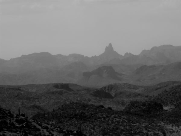 and we'll
find the heart ! |
|
|
|
Post by mohs on Aug 14, 2021 9:58:51 GMT -5
Post this for the scenery of the Salt/Verde/Tonto Basin
Best I know the lady turned out o.k.
Lost her footing and went under
This is comment I left
Glad your all right
Lucky lady !
Life jackets are not a bad idea
50 years ago I went under from undertow
middle of the river and fairly shallow
floundering death struggle
not sure how I got out of that jam
besides beer induced determination
no one around then- to help
only about 100 people on the whole river
times have changed
some better- some worse
Once again, floaties
are not a bad idea
|
|
|
|
Post by mohs on Aug 14, 2021 17:12:56 GMT -5
pareidolia alert ! Legends of Super @19:03-19:04 gohz by  fast
|
|
|
|
Post by mohs on Aug 14, 2021 19:48:30 GMT -5
Mr Augustine may be overconfidence in his semiotic interpretations!
The concentric circles on a treasure map that he interprets as
water falls may be a cognitive bias
Or is he just being sly...
DutchHunters are like that
Just try to get a straight scoop of gravel from them ha
Secretive bunch
I have an idea of what the concentric circles represents.
Except my theory is of human constructed artifacts.
Unfortunately these archaeological artifacts would deteriorates over time.
Due to flash floods… wind erosion ect...
Making it even more difficult to locate....
Nonetheless evidence would remain to the trained eye….
|
|
|
|
Post by mohs on Aug 15, 2021 19:54:40 GMT -5
the other side of the mountain 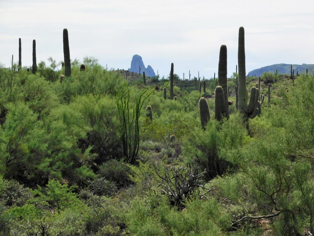 |
|
|
|
Post by mohs on Aug 16, 2021 20:49:05 GMT -5
|
|
|
|
Post by HankRocks on Aug 16, 2021 21:03:25 GMT -5
|
|
|
|
Post by mohs on Sept 1, 2021 17:00:06 GMT -5
Yo again  This shot is part of the Papago's that I clamber up in April of 2017  forum.rocktumblinghobby.com/thread/78462/pre-phoenix?page=2 forum.rocktumblinghobby.com/thread/78462/pre-phoenix?page=2The picture of the draw that I scrambled up was fairly easy then 5 years later it would be a considerable struggle The going up is easy. The coming down is the hard part. The picture was taken about 500 yards away from the north side of McDowell road on level ground ha |
|
|
|
Post by mohs on Sept 6, 2021 11:04:35 GMT -5
This chunk of a boulder is what the Pagago Buttes are composed of. 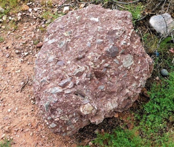 It’s a mystery how they formed. But geologist have good clues. Huge landslide from massive mountains that no longer exist is one of the explanations Mohs cursory look and quick analysis? Those clastics embedded in the matrix is a: basalt? . Mighty mounts of mafic magma slowly froze into a igneous mountain deep under a sea? * Somehow this massive mountain of basalt uplifted up or violently shattered free. Perhaps by super volcanic event? Then after eons another major event occurred causing this humongous mountain to collapse & shatter. Perhaps under its own gravitational weight? The subsequent landslide broke the basalts into a billion trillion sharp angled clastics? Leaving behind a huge heaping mound of scattered broken angled sharp stones. Then the event. The bonding matrix?! Some sort of massive inundation of oxidized Martian rich silica alluvial red bed flowed. Over the eons this thick gooey Mogillon red filled in, welded this mountainous field of clastics together? Subsequent tafoni erosion over the course of millions of years h ave rounded & pockmarked the Papago's into the Buttes they are today . I’m sure that not how it happened But a m o) h z can dream,,,m  stly *side note Have to inspect those clastic grains for composition type |
|
|
|
Post by 1dave on Sept 6, 2021 17:25:55 GMT -5
This chunk of a boulder is what the Pagago Buttes are composed of.  It’s a mystery how they formed. But geologist have good clues. Huge landslide from massive mountains that no longer exist is one of the explanations Mohs cursory look and quick analysis? Those clastics embedded in the matrix is a: basalt? . Mighty mounts of mafic magma slowly froze into a igneous mountain deep under a sea? * Somehow this massive mountain of basalt uplifted up or violently shattered free. Perhaps by super volcanic event? Then after eons another major event occurred causing this humongous mountain to collapse & shatter. Perhaps under its own gravitational weight? The subsequent landslide broke the basalts into a billion trillion sharp angled clastics? Leaving behind a huge heaping mound of scattered broken angled sharp stones. Then the event. The bonding matrix?! Some sort of massive inundation of oxidized Martian rich silica alluvial red bed flowed. Over the eons this thick gooey Mogillon red filled in, welded this mountainous field of clastics together? Subsequent tafoni erosion over the course of millions of years h ave rounded & pockmarked the Papago's into the Buttes they are today . I’m sure that not how it happened But a m o) h z can dream,,,m  stly *side note Have to inspect those clastic grains for composition type Not much black basalt there. I seem to recall it came from south mountain. What was it made of? I wish I could come look in person. |
|
|
|
Post by mohs on Sept 6, 2021 18:52:57 GMT -5
Hi Dave
So glad you chimed in
I really appreciate that !
You may very well be right
The clasts may not be of basaltic origin
That was just a quick appraisal on my part,
& hardly a real informed view
I did detect a fine grain aphanantic texture
sharp angled, greenish to blackish coloring
plus some feldparish platy sheen
But lets back up for a moment !
My logic tells me that the Papago clasts
is the original bedding.
Laid down or raised up long before the
Papago Buttes were formed
And the reddish matrix hence the Buttes
that those clasts
are therein embedded in ----
is of later origin?
That seems reasonable-- but may be deceptively wrong!
Geological history is very sneaky
Anyway, just trying to determine the origin,
of the majority,
of those sharp angled clasts.
I think they are igneous.
Perhaps from a heavy laying down of
pyroclastic super volcanic flow event?
Maybe they are mostly a meta- rhyolite?
Sort of rhyolite that as been intermediately meta-morphed?
Of course,
not all those clasts are going to be of the same type
and or
even origin.
More importantly of the same age group
Anyway Dave if you can’t come here
I may bring a healthy sample load to you!
I’d really like a second informed opinion….
Thanks!
|
|
|
|
Post by 1dave on Sept 7, 2021 20:19:42 GMT -5
You are right mohs! There was a lot of rhyolite lava flows in your area that was later compressed into meta-rhyolite. A lot of it tumbled down into Salt Creek Canyon, blocking it off. When water pressure finally became powerful enough to destroy the dam - that was the end of the Seven Cities of Gold. Those sharp edges prove the pieces didn't travel very far. |
|
|
|
Post by mohs on Sept 9, 2021 20:05:49 GMT -5
You are right mohs! There was a lot of rhyolite lava flows in your area that was later compressed into meta-rhyolite. A lot of it tumbled down into Salt Creek Canyon, blocking it off. When water pressure finally became powerful enough to destroy the dam - that was the end of the Seven Cities of Gold. Those sharp edges prove the pieces didn't travel very far. which bring up the question of what came first the Papago Buttes or The Salt River ? |
|
|
|
Post by mohs on Sept 9, 2021 20:11:30 GMT -5
this was taken a few weeks ago inside an old abandon railroad cut in Tempe  The photo perspective downplays the depth To the top is about 40 feet up. The cut is 30 feet wide and at 50 yards long Kind of spooky clausto walk through it. Plus at ground level, without much warning, you unknowingly walk right up to the edge. Yet somehow - the body knows there is approaching danger. Stiffens and proceeds cautiously On moonless night it would be a very bad stumble. Something of geological interests Is the strike and dip of those faulted rocks.
hhhhhmmmm... That railroad cut in Tempe shows a lot block rock that cut is about 40 feet deep hadn't contemplated that before  |
|
|
|
Post by mohs on Sept 13, 2021 21:13:04 GMT -5
hey dave this is to good to be only in the other thread |
|