|
|
Post by 150FromFundy on Feb 2, 2020 7:47:17 GMT -5
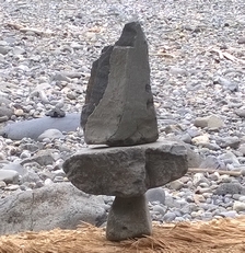
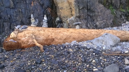
Weather balloon, HUH! Isn't that what they said about Roswell?
Nice finds.
|
|
|
|
Post by 150FromFundy on Oct 16, 2017 17:13:49 GMT -5
I spent a fee days passing through that area to scratch one item off the Bucket List last May. The area is amazing. I have to ask ... Did you brave the Moki Dugway highway near Mexican Hat? If you did, you will never forget it. If you didn't, check out the U-Tube videos and put it on your Bucket List. Some of the greatest excitement imaginable considering there is no admission price for the thrill. Sure they could use some guard rail, but that would lessen the excitement.
Darryl.
|
|
|
|
Post by 150FromFundy on Aug 8, 2017 20:11:23 GMT -5
Tommy:
I deleted my Photobucket images, closed the account, and told them what I thought. Unfortunately, my strategy will only work if several million other PhotoBucket users do the same. Shut the bastards down.
If I can find a site that will allow me to link to 3rd party sites, I may once again post on RTH, but I am a little leery to make the investment after losing over 8 years of posts.
As far as the old posts go, I don't believe they have much value without the photos. They can all be trashed as far as I'm concerned.
Darryl.
|
|
|
|
Post by 150FromFundy on Jul 31, 2017 19:27:28 GMT -5
I get it now ... flint knappers!
|
|
|
|
Post by 150FromFundy on Jul 31, 2017 19:26:07 GMT -5
Eat, be be eaten?
|
|
|
|
Post by 150FromFundy on Jul 10, 2017 17:06:36 GMT -5
Can I delete everything that I posted on PhotoBucket since 2009? If the images can't be viewed on RTH (or 3rd party sites), I see no reason why PhotoBucket should exist.
If you cant vote on the Board of Governors, vote with your consumer dollar and boycott them.
Darryl.
|
|
|
|
Post by 150FromFundy on Jun 23, 2017 19:33:02 GMT -5
Day 6 started with a drive through Capitol Reef National Park. Like so many other parks in Utah, this is another jaw dropper if you are into geology and imagining what the earth use to be like a few hundred million years ago. Capitol Reef National Park - Torrey, UtahThe main geologic feature of the park is the Waterpocket Fold. This “buckle” in the earth crust is about 100 miles long and was created when one side of the fold was uplifted by as much as 7,000 feet above the other side of the fold. Runoff from the high mesa cut through the exposed cliffs creating deep canyons. Although the rock layers in the fold range from as old as 270 million years to as young as 80 million years, the fold itself was believed to have been created 50 to 70 million years ago. Twin RocksAt the park entrance, we were greeted by two sentinels. (Caution – Rocks may be larger than they appear.)  Panorama Point Panorama PointThe next feature just down the road was Panorama Point where the three characteristic layers of bedrock are visible. The top layer is Wingate Sandstone (200 MY) that formed from windblown sandstone when a desert larger than the Sahara existed here. The middle layer is the Chinle Formation (225 MY) that formed when volcanic ash covered a swampy floodplain. The bottom layer is the Moenkopi Formation (245 MY) formed when sediments were deposited in a subtropical tidal delta.  Goosenecks Overlook Goosenecks OverlookThe next feature just down the road is known as the Goosenecks Overlook where Sulphur Creek has cut through the sedimentary rock layers. It’s hard to believe this creek this little creek did all that, but it’s not monsoon season.  Fruita is for Turkeys Fruita is for TurkeysFruita is irrigated by the Freemont River, making it an ideal location for orchards which have existed here since the early pioneers settled the valley. These turkeys were a few that got on the wrong side of the orchard fence and were separated from the rest of the flock. They do not appear to be the most intelligent birds and we were tempted to simply pick them us and toss them over the fence.  [/URL] PetroglyphsThe early pioneers that established the orchards were not the first ones here. There is evidence of the early Freemont people, or was it Ancient Aliens?  Rockfall Hazard Area Rockfall Hazard AreaEvery once in a while a particular trail stands out above the other trails. We took this one. Any questions?  Waterpockets WaterpocketsAlthough we were not blessed with any rockfalls, we did get up close and personal with the waterpockets that give the fold its name. These are a characteristic erosion patterns that form from seepage and freeze/thaw cycles. The area is covered with black basalt boulders that look out of place with the sedimentary rock. Obviously, someone was shooting hoops with this one.  Boulders BouldersHere are a few more of those black basalt boulders that litter the surface of the sedimentary rock.  Rock Squirrel Rock SquirrelRock squirrels are common here. I think they may like the rocks. I never realized how disproportionately long their fingers and toes are.  Side-Blotched Lizard Side-Blotched LizardThese lizards are also common here. They scurry beneath your feet staying just ahead of your footsteps. The ID is not positive, but I think this is the side-blotched based on the blue tones on the underside. How do you tell a tourist from a local? The tourist is the one chasing after the lizard trying to convince it to stay still for a photo op.  Pricklypear Cactus Pricklypear CactusThere were plenty of wildflowers along the trail, but the vibrant colours of the cactus flowers stole the show.  The Scenic Drive The Scenic DriveAfter a few hours of climbing up and down a desert trail, we were in need of a nice cool drive and a face full of AC. Perfect for the Scenic Drive which follows the Waterpocket Fold for several miles.  The Scenic Drive The Scenic Drive Hot Rocks Hot RocksIt says we are good for a day, but we only spent about an hour in this area. I guess that makes me a chicken and not a turkey. Signs like this definitely heighten the adventure.  Unbelievable UnbelievableThe thin band of yellow-grey rock is the Shinarump member of the Chinle Formation. This layer of river-deposited sandstone contains trace amounts of uranium. Early prospecting began here in 1904 when uranium was believed to cure rheumatism and just about anything else that ailed you. Ore from these deposits was crushed and worn in pouches and consumed directly as tonics.  Further mining occurred in the 1950’s when the AEC encouraged uranium mining throughout the Colorado plateau. Even National Park lands were not protected during the greatest demand period for uranium.  Darryl. |
|
|
|
Post by 150FromFundy on Jun 16, 2017 15:57:26 GMT -5
Tadpoles are a protected species around here. We leave them in the ponds. Actually, anything that feeds on the annual plague of mosquitoes around here is a protected species.
On the other hand, I saw the movie FROGS as a young child. You could be on the right track.
Darryl.
|
|
|
|
Post by 150FromFundy on Jun 16, 2017 15:51:25 GMT -5
I find that torture. Especially those pocket sized pieces. Fortunately, Springdale has a few shops were you can collect for a fee.
Darryl.
|
|
|
|
Post by 150FromFundy on Jun 16, 2017 15:46:02 GMT -5
I like the photo of Delft. Rush hour traffic does not appear to be an issue here. Then again, maybe the canals gridlock at 5:00 PM.
Darryl.
|
|
|
|
Post by 150FromFundy on Jun 16, 2017 15:39:47 GMT -5
rockpickerforever - Thanks for the follow-up information. Laura and I could have used you as an interpreter along the trails. We saw lots of nature along the way and took pictures of most of it as it was all new to us. - Darryl
|
|
|
|
Post by 150FromFundy on Jun 16, 2017 15:22:02 GMT -5
rockjunquie - Thanks for the compliment, but no. These photos were shot with a Fuji Finepix "point and shoot" camera with a few SLR-like capabilities. It does a nice job in macro mode if you don't drink too much coffee. Truth be told, we were in the parks which are protected for their magnificent beauty. You can take a picture in any direction and it will likely be amazing.
zarguy - If I lived in your part of the planet, I would have an annual National Park Pass and spend as much time park hopping as possible. But then again you may be too busy collecting on BLM lands to have time for the parks. We really enjoyed our night in Springdale and our day in Zion. We visited the DeZion Gallery (and a few others) and probably saw your work, but didn't connect the dots. I will check out the musical reference. You and Tommy have me curious now.
Tommy - Hopefully not a once in a lifetime experience. I know I want to go back while I can still haul my rocks up that switchback trail.
Darryl.
|
|
|
|
Post by 150FromFundy on Jun 16, 2017 15:03:32 GMT -5
coloradocliff - Thanks for the ID on the cactus. As for the buzzard cooling itself, that's a good possibility too. I know sweaty arms raised into the breeze cools me. Hopefully a few more opinions will be offered.
Darryl.
|
|
|
|
Post by 150FromFundy on Jun 15, 2017 21:27:32 GMT -5
It’s Day 5 and we are continuing on Scenic Byway 12 from Bryce Canyon City to Torrey. This drive passes through parts of the Dixie national Forest and the Grand Staircase – Escalante National Monument. There were a few interesting stops along the way. One was a 2 hour diversion down the Burr Trail. The Burr Trail – Boulder UtahInto the CanyonThe first 30 miles of the Burr Trail is paved. It is passable by car when dry, but comes with warnings even for 4x4’s when wet. The road descends into and winds through a deep slickrock canyon and rolling desert.  Bird on a Wire? Bird on a Wire?This interesting silhouette caught our eye and warranted a closer look.  And Then I Saw Her Face And Then I Saw Her FaceWhile majestic when soaring in the air, these critters have a face only a mother could love. It looks like they fell out of the ugly tree and hit every branch on the way down. We aren’t sure whether this bird was warming up, drying out, or trying to impress the ladies. It vogued for several minutes before eventually moving on.  There were lots of opportunities for photos on our hike along a dry wash. If you are uncertain of what you are looking at, the next photo may make sense of it.  Cottonwoods in the Wash Cottonwoods in the WashDid you figure it out before scrolling down? These large cottonwoods find enough water on the floor of the wash to support their needs. Their thick bark protects them from forest fires due to lightning strikes, which there was lots of evidence of. While we were there, the cottonwoods were shedding their fluff. Snow in May.  Here’s another neat one. It reminds me or worm eaten wood.  But it’s not! This is an interesting erosion pattern from water seepage and many freeze/thaw cycles that appeared throughout the canyon.  One more. It reminds me of wood grain.  But all is not what it appears to be. The desert varnish (iron and manganese staining) is particularly pronounced on these cliffs.  This canyon also offers a very accessible (but small) slot canyon that was an amazing introduction to what would come in a few days. This slot canyon is only a few hundred feet off the road shoulder and only about another hundred feet in. It’s a nice cool spot on an otherwise hot day.  Human for Scale Human for Scale  Inside the Slot Inside the Slot  No Place to Be on a Rainy Day No Place to Be on a Rainy DayWe read and heard many warnings about hiking in the canyons. This wash had many pinch points that would not be the place to be if you needed a sudden vertical escape. Fortunately for us, the only water in the wash was in our bottles. 
Claret Cup(?) Cactus
I thought these were all pricklypear cactus, but apparently there’s more to it than that.

Darryl.
|
|
|
|
Post by 150FromFundy on Jun 9, 2017 17:05:12 GMT -5
Day 3 was a little busy, so Day 4 allowed us a little leisure time for a morning hike in Bryce Canyon National Park. The Navajo Loop Trail starts at Sunset Point and descends into the amphitheatre. This was probably one of the most amazing hikes that I have experienced. Navajo Loop Trail – Sunset Point, Bryce Canyon National ParkSunset Point – Navajo Loop TrailheadStart here and get down there. Seams simple enough.  Navajo Loop Trail – Into the Canyon Navajo Loop Trail – Into the CanyonThe camera doesn’t capture the size of the rock formations, but every once in a while you get a few humans in the picture for scale.  Navajo Loop Trail – Start Out Simple Navajo Loop Trail – Start Out SimpleThe trail starts out simple enough although the outside edge is not the place for you if you don’t enjoy a scenic overlook.  Navajo Loop Trail – Decision Time Navajo Loop Trail – Decision TimeThe trail offers a number of overlooks where you can catch your breath (8,500 feet elevation) and assess whether it is time to turn around, or not.  Navajo Loop Trail – Heart Attack Ridge Navajo Loop Trail – Heart Attack RidgeThe last photo overlooked this photo. One of us stayed and one of us ventured on. This is an amazing cascade of switchbacks. Easy to get down. Not so easy to get back up.  Navajo Loop Trail Navajo Loop TrailThe scenery changes as you reach the bottom of the canyon. The hoodoos appear a lot taller when you are looking up at them.  Navajo Loop Trail Navajo Loop Trail  Navajo Loop Trail - Critter Navajo Loop Trail - Critter  Navajo Loop Trail – Lightning Tree Navajo Loop Trail – Lightning TreeA number of the trees are burned, yet there was no widespread forest fire as neighbouring trees remain untouched. This results from lightning strikes that smoulder an individual tree.  Earth Discovery Center – Bryce Canyon CityEarth Discovery Center – Bryce Canyon City Earth Discovery Center – Bryce Canyon CityEarth Discovery Center – Bryce Canyon CityBryce Canyon City offers up a good sized rock shop with friendly and knowledgeable staff. If weight restrictions on airlines were not an issue, there was plenty of rock to choose from.  Earth Discovery Center – Waiting Area Earth Discovery Center – Waiting AreaI have been dragged to many stores that offer a park bench outside so the men can take refuge while the women shop inside. Here’s a little twist on that concept.  Earth Discovery Center – Fireside Stool Earth Discovery Center – Fireside StoolThere were a number of these really nice fireside stools available. They don’t lock them up which is an indication of their weight.  Earth Discovery Center – Fireside Stool Earth Discovery Center – Fireside StoolThere was a wide range of prices on these fireside stools depending on the size and colour. Entry level was $2,500 and you could pay up to $5,000 for a particularly nice one. I’m not sure how many they sell.  Earth Discovery Center – Fireside Stool Earth Discovery Center – Fireside Stool  Earth Discovery Center – Fireside Stool Earth Discovery Center – Fireside Stool  Darryl. |
|
|
|
Post by 150FromFundy on Jun 5, 2017 17:15:58 GMT -5
coloradocliff - The brochure that I borrowed my knowledge from is online on the NPS website. There is a geology tab with information on the formation of the hoodoos. The brochure mentions weak carbolic acid and not weak sulfuric acid, so I jumped the gun when I said acid rain, which is a problem for us on the east coast.
As far as future trips, Colorado is also on the bucket list. This first trip was a bit of an awakening for us.
Darryl.
|
|
|
|
Post by 150FromFundy on Jun 2, 2017 17:37:27 GMT -5
Day 3 of our road trip ended up with a drive to Bryce Canyon National Park. We arrived mid-afternoon, so the crowds were diminishing and we were able to find parking at all the viewpoints. Bryce Canyon National Park, UtahFor starters, Bryce Canyon is not actually a canyon at all. Bryce Canyon is actually an amphitheatre. Technically, to be a canyon a river should be present and responsible for cutting the canyon down. There is no river in Bryce canyon and the erosion features are the result of water seepage, over 200 freeze/thaw cycles per year, chemical attack, wind and blowing sand. Bryce PointThe rock is from the Caron formation. The softer rock is mudstone and siltstone. The harder rock is limestone. In geological terms, this rock is fairly young at only 40 million years.  Bryce Point Bryce Point  Agua Canyon Agua CanyonEven during the second week of May, there was still a little snow lingering due to elevation at 8,800 feet.  Agua Canyon Agua Canyon  Natural Bridge Natural Bridge  Natural Bridge Natural Bridge  Rainbow Point Rainbow PointBeing from the east coast, we get excited when we can see for a few miles before the fog rolls in. Due to the elevation above the smog layer, we could see the distant Paunsaugunt Plateau (30 miles) and Navajo Mountain (out of frame) that was about 80 miles away.  Rainbow Point Rainbow Point  Sunset Point Sunset PointBryce Canyon claims to have the largest collection of hoodoos in the world! I lost count after a while. Probably the thin air.  Sunset Point Sunset PointIn general, harder layers of rock resist erosion and for shear vertical cliffs. Softer layers of rock erode more easily and form steep slopes.  Sunset Point Sunset PointWhen water freezes, it expands by about 10%. When water seeps into cracks in the rock, it freezes, expands and over time pops out rock forming a pothole. Bryce Canyon may experience 200 freeze thaw cycles each year, so “frost wedging” is the primary erosion force.  Sunset Point Sunset PointAcid rain will slowly dissolve even the hardest limestone. Acid rain tends to carve and sculpt the limestone caps on may of the hoodoos.  Darryl. |
|
|
|
Post by 150FromFundy on May 26, 2017 19:39:43 GMT -5
|
|
|
|
Post by 150FromFundy on May 25, 2017 16:35:22 GMT -5
After cooling off from the Coral Sand Dunes, we came upon Orderville, Utah. Approaching from the southwest, we were greeted by the site of five stores. One was a Family Dollar, and the other four were rock shops. I got that warm, fuzzy feeling that this was going to be a good day. Four out of five isn’t bad. Orderville, UtahAlthough we visited all four of the shops, two stood out. One was arguably a roadside attraction. The Rock Stop  Flintstones, Meet the Flintstones Flintstones, Meet the Flintstones  Pseudo-Saurus Pseudo-Saurus  Couldn’t Stand the Weather, so we waited a few minutes. Couldn’t Stand the Weather, so we waited a few minutes.  The Orderville Mine Rock Shop The Orderville Mine Rock Shop  Joe’s Rock Shop – We had an opportunity to chat with Ken Caruso of Joe’s Rock Shop. This store specializes in Septarian Nodules that are mined near Mount Carmel. I didn’t realize that Septarian Nodules form around a fossil that is often missed when the nodule is cut, or broken. We had an opportunity to view a few fossil-containing Septarian Nodules that were collected by Ken and his wife. This was a nice stop along the way, but we still have to get through the Dixie National Forest. Darryl. |
|
|
|
Post by 150FromFundy on May 24, 2017 19:25:59 GMT -5
Day 3 was a busy day with three stops along the way before we made it to Bryce Canyon National Park. The first stop was a different kind of desert. Coral Pink Sand Dunes State ParkThe small desert looks a little more like the TV deserts where caravans of camels cross over drifting sand dunes. In order for this type of desert to form, you need wind, sand and some form of disruptor to the wind.  A Long and Winding Road A Long and Winding RoadThis desert is at elevation 6,000 feet and is nestled between two mountain ranges. A notch between the mountains creates a natural Venturi effect. When wind is compressed in the notch between the mountains, the velocity accelerates enough to transport sand. When the wind expands in the valley, the velocity slows enough to deposits the sand.  In the Pink In the PinkThe source of the coral pink sand is Navajo sandstone. The source of the color in the Navajo sandstone is various forms of iron oxide. The Navajo sandstone dates back to the middle Jurassic period, but this desert is only believed to be between 10,000 and 15,000 years old.  Hanging On Hanging OnThe diversity of life in the dunes is greatly less than that in other areas where life flourishes in the desert. In spite of that, a few plants attempt to anchor the drifting sands in place.  It Keeps You Running It Keeps You RunningIn areas where there is no plant life to anchor the dunes, the dunes may drift up to fifty feet each year.  I Can See for Miles and Miles I Can See for Miles and MilesAt mid-morning, it was already starting to go from warm to hot. Distances are a little tough to judge and you sometimes wonder if hiking up to the next ridge is really worth it.  Taking Advice Taking AdviceI was advised that hiking up to the next ridge was really worth it. To be honest with you, the next ridge looks a whole lot like the previous ridge. You simply have more sand in your boots for the walk back.  Ants in Your Pants Ants in Your PantsWe didn’t see a lot of critters in the heat of the day. However, I did seem to park myself in close proximity to a number of ant colonies along the way.  Darryl. |
|


 Al Falfa